Hills of Britain and Ireland
OS Map of Ulgraves


Ulgraves - Staveley circular car ramble
From left - Andrew, Ian, Paul S, Phil, Louise, Carole, Liz.
26-Oct-24 • Jackie & Dennis • flickr
carramble staveley shdrc 54202286348

Tree growing in the cleft of a glacial erratic
I tried a few different shots.
26-Oct-24 • Jackie & Dennis • flickr
carramble staveley shdrc 54201142837

Gurnal Dubs and boat house.
We had lunch here. www.f22.org.uk/lakes/Gurnal_Dubs/index.htm" rel="noreferrer nofollow www.f22.org.uk/lakes/Gurnal_Dubs/index.htm Gurnal Dubs was created by erecting a dam to enclose three smaller natural ponds (or "dubs") to make one larger lake. The boathouse was erected by the Fothergill family.
26-Oct-24 • Jackie & Dennis • flickr
carramble shdrc staveley 54203042817

Green Lane
Cumbria
24-Jul-24 • stephen dutch • flickr
greenlane potterfell stricklandrogercp countryside cumbria lane track footpath outdoor lakedistrict walk leaves tree 53882684153

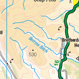
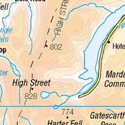
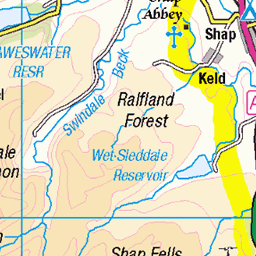
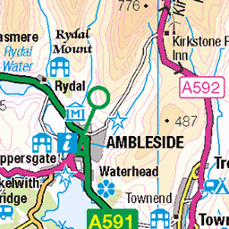
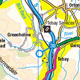
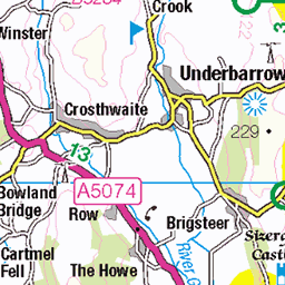
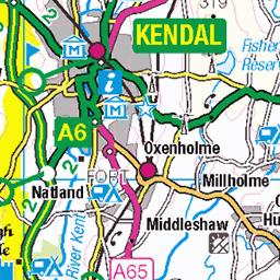
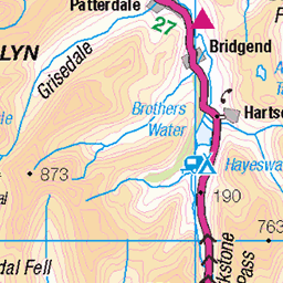
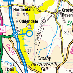
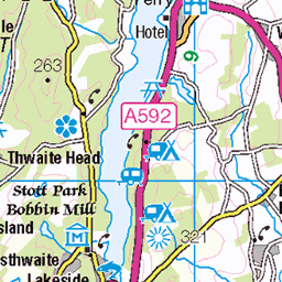
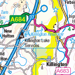
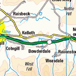
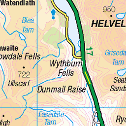
OS Map
This is OS mapping. In some areas, OpenStreetMap shows more footpaths
Spatial NI has online OSNI mapping. Click "Basemap Gallery" (4 squares icon at the top).
Now would be a good time for a cup of tea.

GPX Editor
Record map clicks
Reload map
Photos
Please tag your photos and upload them to the British and Irish Mountains group on Flickr
The other photos have been geo-tagged as on or around the summit. For less busy mountains, it can be a little hit and miss.
Ulgraves - Staveley circular car ramble
From left - Andrew, Ian, Paul S, Phil, Louise, Carole, Liz.
26-Oct-24 • Jackie & Dennis • flickr
carramble staveley shdrc 54202286348
Tree growing in the cleft of a glacial erratic
I tried a few different shots.
26-Oct-24 • Jackie & Dennis • flickr
carramble staveley shdrc 54201142837
Gurnal Dubs and boat house.
We had lunch here. www.f22.org.uk/lakes/Gurnal_Dubs/index.htm" rel="noreferrer nofollow www.f22.org.uk/lakes/Gurnal_Dubs/index.htm Gurnal Dubs was created by erecting a dam to enclose three smaller natural ponds (or "dubs") to make one larger lake. The boathouse was erected by the Fothergill family.
26-Oct-24 • Jackie & Dennis • flickr
carramble shdrc staveley 54203042817
Green Lane
Cumbria
24-Jul-24 • stephen dutch • flickr
greenlane potterfell stricklandrogercp countryside cumbria lane track footpath outdoor lakedistrict walk leaves tree 53882684153


Videos
A walk up Green Quarter Fell an outlying fell. A quiet day in the Far Eastern Fells on a Bank Holiday Music from ...
A 14km walk over some Outlying Wainwrights near Staveley.
Notes
- Data: Database of British and Irish Hills v18.2
- Maps: We use OS mapping for England, Scotland, Wales, and the Isle of Man. Sadly, Channel Islands, Northern (OSNI) and Southern Ireland (OSI) mapping isn't available online, so we use Openstreetmap.