Hills of Britain and Ireland
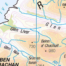
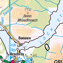
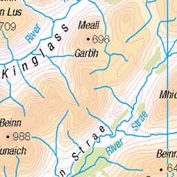
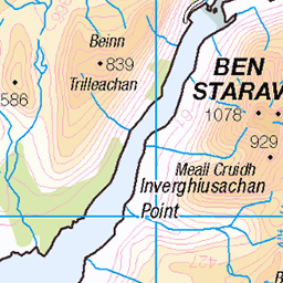
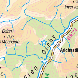
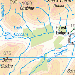
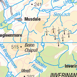
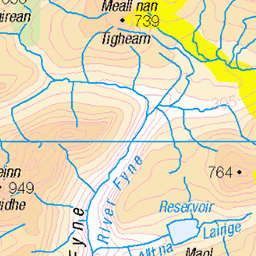
OS Map of Beinn a' Bhuiridh

Containment
02-Aug-23 • younus.karim35 • flickr
dalmally scotland unitedkingdom psgf landscape outdoor nature 53102894939

Lights On
02-Aug-23 • younus.karim35 • flickr
dalmally scotland unitedkingdom fujifilm xpro3 35mm xf23mmf2 diffusion hazy dreamy atmosphere 53111676090

Distant Peaks
02-Aug-23 • younus.karim35 • flickr
dalmally scotland unitedkingdom landscape outdoor nature 53126864942

West Face
02-Aug-23 • younus.karim35 • flickr
dalmally scotland unitedkingdom landscape outdoor nature 53116175451


Leadmill Beck at Fox Covert Nature Reserve, Catterick (1)
catterick foxcovert leadmillbeck birdhide england 50827852337
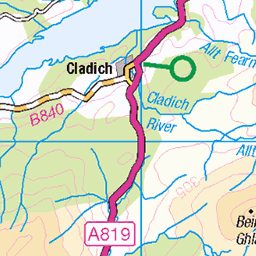
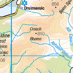
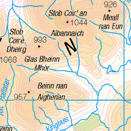
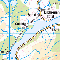
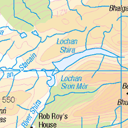
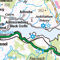
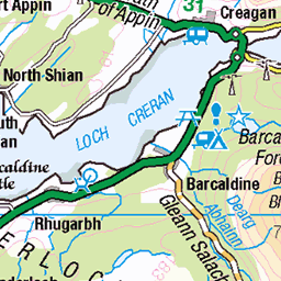
OS Map
This is OS mapping. In some areas, OpenStreetMap shows more footpaths
Spatial NI has online OSNI mapping. Click "Basemap Gallery" (4 squares icon at the top).
Now would be a good time for a cup of tea.
GPX Editor
Record map clicks
Reload map
Photos
Please tag your photos and upload them to the British and Irish Mountains group on Flickr
The other photos have been geo-tagged as on or around the summit. For less busy mountains, it can be a little hit and miss.
Containment
02-Aug-23 • younus.karim35 • flickr
dalmally scotland unitedkingdom psgf landscape outdoor nature 53102894939
Lights On
02-Aug-23 • younus.karim35 • flickr
dalmally scotland unitedkingdom fujifilm xpro3 35mm xf23mmf2 diffusion hazy dreamy atmosphere 53111676090
Distant Peaks
02-Aug-23 • younus.karim35 • flickr
dalmally scotland unitedkingdom landscape outdoor nature 53126864942
West Face
02-Aug-23 • younus.karim35 • flickr
dalmally scotland unitedkingdom landscape outdoor nature 53116175451
Leadmill Beck at Fox Covert Nature Reserve, Catterick (1)
catterick foxcovert leadmillbeck birdhide england 50827852337


Videos
Panoramic shot from the top of Beinn a' Bhuiridh.
The Dalmally horseshoe involves the Corbett Beinn a' Bhuiridh and the Munro Stob Daimh which is one of two Munro's on the ...
It's the first Munro of 2022 and what a fantastic feeling to be back on the hills. This time I decided to stay a little closer to home.
Notes
- Data: Database of British and Irish Hills v18.2
- Maps: We use OS mapping for England, Scotland, Wales, and the Isle of Man. Sadly, Channel Islands, Northern (OSNI) and Southern Ireland (OSI) mapping isn't available online, so we use Openstreetmap.