Hills of Britain and Ireland
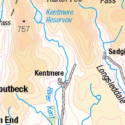
OS Map of Harper Hills


The Embrace
18-Oct-24 • hdr.photography • flickr
autumn bracken lakedistrict landscape landscapes trees valley 54103863544

Autumn 2024_1
Autumn in a temperate rainforest on the outskirts of the Lake District
18-Oct-24 • hdr.photography • flickr
autumn lakedistrict landscape landscapes light tree trees valley 54077051830

Autumn Birches
18-Oct-24 • hdr.photography • flickr
autumn lakedistrict landscape landscapes tree trees 54090265882

Autumn 2924_2
18-Oct-24 • hdr.photography • flickr
autumn lakedistrict landscape landscapes tree trees bracken leaves 54082477171

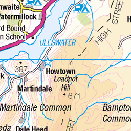
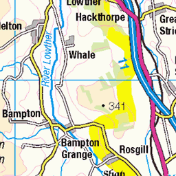
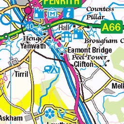
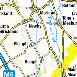
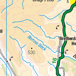
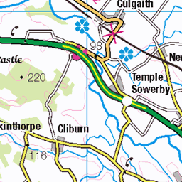
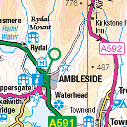
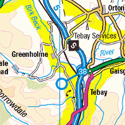
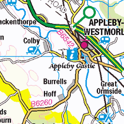
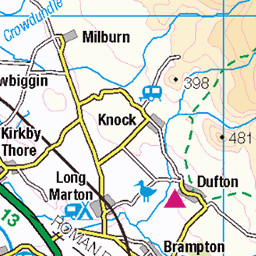
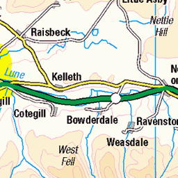
OS Map
This is OS mapping. In some areas, OpenStreetMap shows more footpaths
Spatial NI has online OSNI mapping. Click "Basemap Gallery" (4 squares icon at the top).
Now would be a good time for a cup of tea.


GPX Editor
Record map clicks
Reload map
Photos
Please tag your photos and upload them to the British and Irish Mountains group on Flickr
The other photos have been geo-tagged as on or around the summit. For less busy mountains, it can be a little hit and miss.
The Embrace
18-Oct-24 • hdr.photography • flickr
autumn bracken lakedistrict landscape landscapes trees valley 54103863544
Autumn 2024_1
Autumn in a temperate rainforest on the outskirts of the Lake District
18-Oct-24 • hdr.photography • flickr
autumn lakedistrict landscape landscapes light tree trees valley 54077051830
Autumn Birches
18-Oct-24 • hdr.photography • flickr
autumn lakedistrict landscape landscapes tree trees 54090265882
Autumn 2924_2
18-Oct-24 • hdr.photography • flickr
autumn lakedistrict landscape landscapes tree trees bracken leaves 54082477171


Videos
None found
Notes
- Data: Database of British and Irish Hills v18.2
- Maps: We use OS mapping for England, Scotland, Wales, and the Isle of Man. Sadly, Channel Islands, Northern (OSNI) and Southern Ireland (OSI) mapping isn't available online, so we use Openstreetmap.