Hills of Britain and Ireland
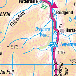
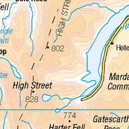
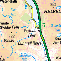
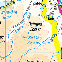
OS Map of Steel Knotts (Pikeawassa - Steel Knotts)
Height: 432m / 1417ft • Prominence: 51m / 167ft • Summit : rock outcrop • Trip reports (hill-bagging)

Panorama of Hallin Fell and Ullswater from Beda Fell.
28-Mar-25 • colin9007 • flickr
lake district cumbria hallin fell ullswater beda 54418104555


Hallin Fell and Ullswater from Beda Fell.
28-Mar-25 • colin9007 • flickr
lake district cumbria hallin fell ullswater beda 54416850747

Howegrain Beck, Martindale, Cumbria.
28-Mar-25 • colin9007 • flickr
lake district cumbria martindale 54417909744

The 16th century St Martin's Church, Martindale, Cumbria.
28-Mar-25 • colin9007 • flickr
lake district cumbria st martins church martindale 54417909704

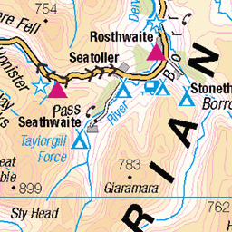
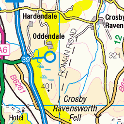
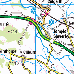
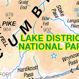
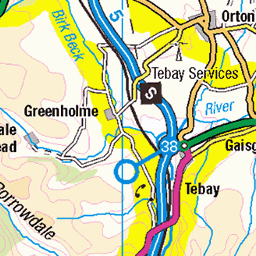
OS Map
This is OS mapping. In some areas, OpenStreetMap shows more footpaths
Spatial NI has online OSNI mapping. Click "Basemap Gallery" (4 squares icon at the top).
Now would be a good time for a cup of tea.


GPX Editor
Record map clicks
Reload map
Photos
Please tag your photos and upload them to the British and Irish Mountains group on Flickr
The other photos have been geo-tagged as on or around the summit. For less busy mountains, it can be a little hit and miss.
Panorama of Hallin Fell and Ullswater from Beda Fell.
28-Mar-25 • colin9007 • flickr
lake district cumbria hallin fell ullswater beda 54418104555
Hallin Fell and Ullswater from Beda Fell.
28-Mar-25 • colin9007 • flickr
lake district cumbria hallin fell ullswater beda 54416850747
Howegrain Beck, Martindale, Cumbria.
28-Mar-25 • colin9007 • flickr
lake district cumbria martindale 54417909744
The 16th century St Martin's Church, Martindale, Cumbria.
28-Mar-25 • colin9007 • flickr
lake district cumbria st martins church martindale 54417909704

photo
25-Nov-24 • Marie-Laure Even • flickr
shadow hike landscape winter lakedistrict olympusem5markii skiddaw cumbria lake blencathra steelknottshike martindale field countryside wilderness wild marielaureeven tree travel cloud ullswater 2024 lakedistrictnationalpark nature england europe uk mountain arbre campagne champ fjall hiver lac montagne nuage ombre paysage royaumeuni unitedkingdom voyage гора природа 54274932473

photo
25-Nov-24 • Marie-Laure Even • flickr
hike england winter lakedistrict olympusem5markii cumbria stonewall howegrainvalley martindale countryside wilderness wild marielaureeven tree travel steelknottshike mountain 2024 lakedistrictnationalpark nature landscape europe uk field arbre campagne champ fjall hiver montagne murenpierre paysage royaumeuni unitedkingdom voyage гора природа 54396103200

Martindale.
25-Nov-24 • Marie-Laure Even • flickr
hike england winter lakedistrict olympusem5markii highdodd cumbria wintercrag stonewall nature howegrainvalley steelknottshike martindale countryside wilderness wild marielaureeven tree travel cloud mountain 2024 lakedistrictnationalpark green landscape europe uk field arbre campagne champ fjall hiver montagne murenpierre nuage paysage royaumeuni unitedkingdom vert voyage гора природа 54256930058

2024-1642K Swarth Fell and Ullswater, English Lake District.
02-Oct-24 • johncheckley • flickr
54258623357

2615 Steel Knotts
17-Aug-14 • Dugswell2 • flickr
steelknotts p51 tump wainwright synge birkett fellranger pikeawassa 33835951036
Videos
This is the hike around the Fusedale Round with the fell walkiing club in the Lake District, which is also Christine's guided tour.
A circular hike up Steel Knotts and Loadpot Hill in Fusedale, a picturesque valley in the Lake District National Park in the UK.
A good walk with great views of Ullswater, the Eastern Fells and over to the Pennines.
Heading up to Steel Knotts in the Lake District national park to bag another wainwright. *Just a side note on mountain safety.
Notes
- Data: Database of British and Irish Hills v18.2
- Maps: We use OS mapping for England, Scotland, Wales, and the Isle of Man. Sadly, Channel Islands, Northern (OSNI) and Southern Ireland (OSI) mapping isn't available online, so we use Openstreetmap.