Hills of Britain and Ireland
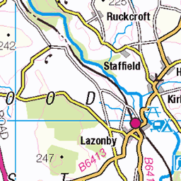
OS Map of Stone Arthur

Helvellyn, Striding Edge and Fairfield
Helvellyn is on the left, Striding Edge in the middle, and a bit of Fairfield is to the right. The photo was taken on Great Rigg.
06-Feb-25 • Paul Austin Murphy • flickr
54312808310

View of the Southern Half of the Fairfield Horseshoe
Photo taken near Heron Pike.
06-Feb-25 • Paul Austin Murphy • flickr
54312418126


Video: View West and North-West From Heron Pike.
06-Feb-25 • Paul Austin Murphy • flickr
54312607619

That Tree
Those that know, know where
18-Jan-25 • RoystonVasey • flickr
apple iphone se cumbria lake district ldnp grasmere january winter fog mist grim 54273151371
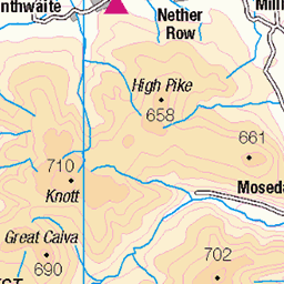
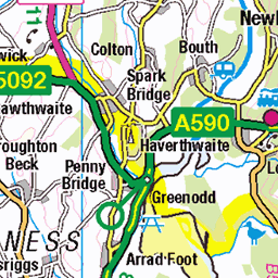
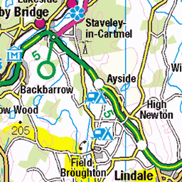
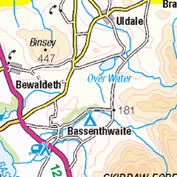
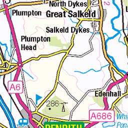
OS Map
This is OS mapping. In some areas, OpenStreetMap shows more footpaths
Spatial NI has online OSNI mapping. Click "Basemap Gallery" (4 squares icon at the top).
Now would be a good time for a cup of tea.


GPX Editor
Record map clicks
Reload map
Photos
Please tag your photos and upload them to the British and Irish Mountains group on Flickr
The other photos have been geo-tagged as on or around the summit. For less busy mountains, it can be a little hit and miss.
Helvellyn, Striding Edge and Fairfield
Helvellyn is on the left, Striding Edge in the middle, and a bit of Fairfield is to the right. The photo was taken on Great Rigg.
06-Feb-25 • Paul Austin Murphy • flickr
54312808310
View of the Southern Half of the Fairfield Horseshoe
Photo taken near Heron Pike.
06-Feb-25 • Paul Austin Murphy • flickr
54312418126
Video: View West and North-West From Heron Pike.
06-Feb-25 • Paul Austin Murphy • flickr
54312607619
That Tree
Those that know, know where
18-Jan-25 • RoystonVasey • flickr
apple iphone se cumbria lake district ldnp grasmere january winter fog mist grim 54273151371


Videos
JD bags Stone Arthur. Short but steep walk from the Swan Hotel Grasmere. Start/return point is the Swan Hotel. I'm using the ...
A glorious day in the Lake District climbing Stone Arthur for the very first time. Perfect weather, allowed superb views over ...
This time we were privileged to experience some absolutely stunning conditions for our hike in the Lake District. Setting out from ...
A short walk up Stone Arthur from Grasmere Village. https://jimearl6.com/a-walk-up-stone-arthur/#more-4849 Stone Arthur is one ...
PRE-ORDER MY 2025 CALENDAR! https://geni.us/2025CalendarYT MASTER Composition with my eBook ...
Notes
- Data: Database of British and Irish Hills v18.2
- Maps: We use OS mapping for England, Scotland, Wales, and the Isle of Man. Sadly, Channel Islands, Northern (OSNI) and Southern Ireland (OSI) mapping isn't available online, so we use Openstreetmap.