Hills of Britain and Ireland
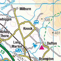
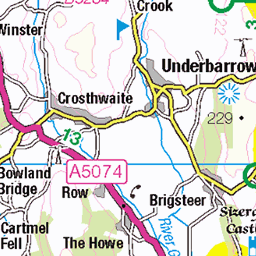
OS Map of Sleddale Pike
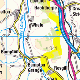
Height: 506m / 1660ft • Prominence: 6m / 20ft • Summit : small mound 20m S of pile of stones • Trip reports (hill-bagging)


P46 Wet Sleddale reservoir
Just to the west of Shap is the valley of Wet Sleddale with a reservoir at its entrance.
15-Sep-14 • Grahamtravels • flickr
15380427832

P49 High Wether Howe
At the head of Sleddale sits the top of High Wether Howe.
15-Sep-14 • Grahamtravels • flickr
15194245817

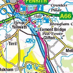
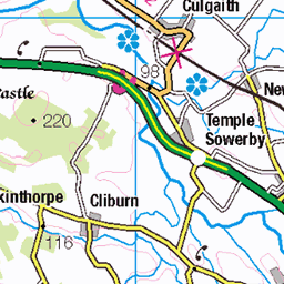
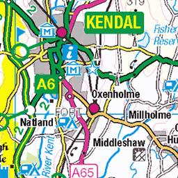
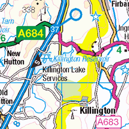
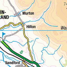
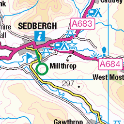
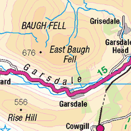
OS Map
This is OS mapping. In some areas, OpenStreetMap shows more footpaths
Spatial NI has online OSNI mapping. Click "Basemap Gallery" (4 squares icon at the top).
Now would be a good time for a cup of tea.


GPX Editor
Record map clicks
Reload map
Photos
Please tag your photos and upload them to the British and Irish Mountains group on Flickr
The other photos have been geo-tagged as on or around the summit. For less busy mountains, it can be a little hit and miss.
P46 Wet Sleddale reservoir
Just to the west of Shap is the valley of Wet Sleddale with a reservoir at its entrance.
15-Sep-14 • Grahamtravels • flickr
15380427832
P49 High Wether Howe
At the head of Sleddale sits the top of High Wether Howe.
15-Sep-14 • Grahamtravels • flickr
15194245817

Michaela Jordan Made It
That's alright then. One of many remarks written on the boarding at Sleddale Hall (Crow Top), Wetsleddale.
12-Sep-09 • Lune Rambler • flickr
door film cumbria graffitti pilgrimage richardegrant withnaili wetsleddale sleddalehall paulmccann 3920829090
Videos
Starting in Sadgill on the river Sprint the route ascends to the top of Wray Cragg and Shipman Knotts in the dark with some of the ...
Parking at Mardale Head, next to Haweswater Reservoir, I meet up again with fellow Youtuber Alan from @54DegreesNorth and ...
Branstree Selside Pike Tarn Crag (Sleddale) Grey Crag (Sleddale Fell)
A fine walk on grassy paths with views over the Far Eastern Fells https://jimearl6.com/a-harter-fell-round-from-sadgill/#more-6671 ...
A walk up Green Quarter Fell an outlying fell. A quiet day in the Far Eastern Fells on a Bank Holiday Music from ...
Notes
- Data: Database of British and Irish Hills v18.2
- Maps: We use OS mapping for England, Scotland, Wales, and the Isle of Man. Sadly, Channel Islands, Northern (OSNI) and Southern Ireland (OSI) mapping isn't available online, so we use Openstreetmap.