Hills of Britain and Ireland
OS Map of Arthur's Pike


where in the world 841 - rapids in cumbria
photo shot by KHWD
16-Oct-24 • keefhwebdesigns • flickr
keefhwebdesigns khwd keefh travelphotography travel topdesignideasviapix water web panorama woodland green canon flickrtravelaward flickrunitedaward newflickrgroup iamflickr cumbria ngc 53571056333

The Distant Northern Fells
Popping their heads over the smaller fells on the side of Ullswater.
06-Aug-24 • Paul Austin Murphy • flickr
53911032657


OS Map
This is OS mapping. In some areas, OpenStreetMap shows more footpaths
Spatial NI has online OSNI mapping. Click "Basemap Gallery" (4 squares icon at the top).
Now would be a good time for a cup of tea.
GPX Editor
Record map clicks
Reload map
Photos
Please tag your photos and upload them to the British and Irish Mountains group on Flickr
The other photos have been geo-tagged as on or around the summit. For less busy mountains, it can be a little hit and miss.
where in the world 841 - rapids in cumbria
photo shot by KHWD
16-Oct-24 • keefhwebdesigns • flickr
keefhwebdesigns khwd keefh travelphotography travel topdesignideasviapix water web panorama woodland green canon flickrtravelaward flickrunitedaward newflickrgroup iamflickr cumbria ngc 53571056333
The Distant Northern Fells
Popping their heads over the smaller fells on the side of Ullswater.
06-Aug-24 • Paul Austin Murphy • flickr
53911032657


where in the world 934, cumbria to scotland
shot by KHWD , i think it was a small road in the Cairngorms, certainly treacherous in a motorhome Cairngorms National Park (Scottish Gaelic: Pàirc Nàiseanta a' Mhonaidh Ruaidh) is a national park in northeast Scotland, established in 2003. It was the second of two national parks established by the Scottish Parliament, after Loch Lomond and The Trossachs National Park, which was set up in 2002. The park covers the Cairngorms range of mountains, and surrounding hills. Already the largest national park in the United Kingdom, in 2010 it was expanded into Perth and Kinross. Roughly 18,000 people reside within the 4,528 square kilometre national park. The largest communities are Aviemore, Ballater, Braemar, Grantown-on-Spey, Kingussie, Newtonmore, and Tomintoul. Like all other national parks in the UK, the park is IUCN designated Category V however it contains within its boundaries several national nature reserves that have IUCN Category II (national park) statuses, such as Abernethy Forest and Mar Lodge Estate. In 2018, 1.9 million tourism visits were recorded. The majority of visitors are domestic, with 25 per cent coming from elsewhere in the UK, and 21 per cent being from other countries. Tourism makes up about 80% of the economy of the national park. PS Love the Cairngorms
27-Oct-23 • keefhwebdesigns • flickr
snow white scotland bridgeorroadperspective motorhometravelpix motorhomes motorhomesandcaravans motorhometravelsblog keefhwebdesigns khwd keefh sky openroad cairngorms 53730950343

2584 Arthur's Pike
17-Jan-22 • Dugswell2 • flickr
lakedistrict cairn arthurspike p4 wainwright birkett synge fellranger 51835834473

2584 Arthur's Pike a
Parked by outdoor pool in Askham then upward to White Knott, Arthur's Pike, Bonscale Pike, Swarth Fell (Ullswater) then down to Knotts then minor road to Helton & back to Askham bagging benchmarks en route. Name:Arthur's Pike Hill number:2584 Height:533m / 1749ft Parent (Ma):2528 High Street RHB Section:34C: Lake District - Eastern Fells Nuttall/Wainwright area:Lake District - Far Eastern Fells County/UA:Cumbria (CoU) Catchment:Eden (Carlisle) Class:Wainwright, Birkett, Synge, Fellranger Grid ref:NY 46074 20677 Summit feature:cairn Drop:4m Col:529m NY461204 Observations:probably Wainwright/Birkett summit; also cairn 190m SSE at NY 46165 20510 and knoll 50m S at NY 46056 20627 may be as high
17-Jan-22 • Dugswell2 • flickr
lakedistrict cairn arthurspike p4 wainwright birkett synge fellranger 51835723311

2584 Arthur's Pike b
17-Jan-22 • Dugswell2 • flickr
lakedistrict cairn arthurspike p4 wainwright birkett synge fellranger 51835724056

2584 Arthur's Pike c
17-Jan-22 • Dugswell2 • flickr
lakedistrict cairn arthurspike p4 wainwright birkett synge fellranger 51835836318
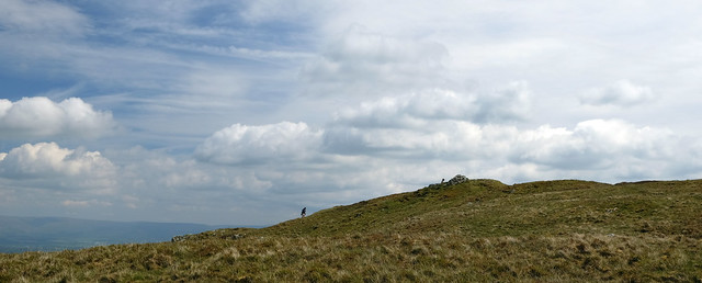
Arthur's Pike - getting there.
23-May-19 • greengrocer48 • flickr
arthurspike cumbria england lakedistrict ullswater 53537491099

Arthur's Pike: The Summit
16-Sep-10 • johnabutler2 • flickr
england mountain english hill lakedistrict wainwright summit ullswater arthurspike hill2584 4996962410
Videos
This is the hike around the Fusedale Round with the fell walkiing club in the Lake District, which is also Christine's guided tour.
Hiking.
Reaching the top of Arthur's Pike, I capture stunning views of Ullswater and the surrounding fells. Enjoy the breathtaking scenery ...
Still in the Lake District camping in our self built campervan at Waterside House Farm Campsite. And we stupidly decided to take ...
Welcome back to another video, this time from the stunning Ullswater in the Lake District National Park! Today we get out for a Fell ...
Notes
- Data: Database of British and Irish Hills v18.2
- Maps: We use OS mapping for England, Scotland, Wales, and the Isle of Man. Sadly, Channel Islands, Northern (OSNI) and Southern Ireland (OSI) mapping isn't available online, so we use Openstreetmap.