Hills of Britain and Ireland
OS Map of Hartsop Above How (Gill Crag - Hartsop Above How)


Hart Crag, Fairfield and St Sunday Crag Walk. The Lake District UK.
Hart Crag, Fairfield & St Sunday Crag Distance: 8½ miles (13½km) Ascent: 3,300 ft (1,000m) A horseshoe walk that takes in the long ridge of Hartsop-above-How and the summits of Hart Crag, Fairfield and St Sunday Crag.
12-Oct-23 • James Holme • flickr
hfholidays lakedistrict walkingholiday nationalpark cumbria 53257748886

Hart Crag, Fairfield and St Sunday Crag Walk. The Lake District UK.
Hart Crag, Fairfield & St Sunday Crag Distance: 8½ miles (13½km) Ascent: 3,300 ft (1,000m) A horseshoe walk that takes in the long ridge of Hartsop-above-How and the summits of Hart Crag, Fairfield and St Sunday Crag.
12-Oct-23 • James Holme • flickr
hfholidays lakedistrict walkingholiday nationalpark cumbria 53277620563

photo
Hike to High Hartsop Dodd
27-Aug-23 • Steve Hodgson Photos • flickr
cumbria lakedistrict 53147178561

photo
High Hartsop Dodd
27-Aug-23 • Steve Hodgson Photos • flickr
barn highhartsopdodd lakedistrict cumbria 53147387784

photo
Hike up High Hartsop Dodd and Little Hart crag
27-Aug-23 • Steve Hodgson Photos • flickr
mountains highhartsopdodd lakedistrict cumbria tree 53147606080
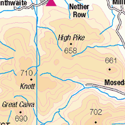
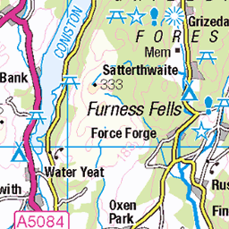
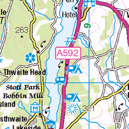
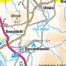
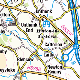
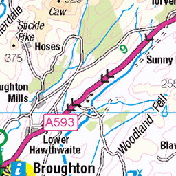
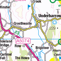
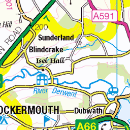
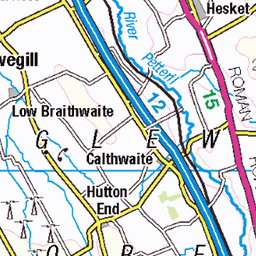
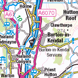
OS Map
This is OS mapping. In some areas, OpenStreetMap shows more footpaths
Spatial NI has online OSNI mapping. Click "Basemap Gallery" (4 squares icon at the top).
Now would be a good time for a cup of tea.


GPX Editor
Record map clicks
Reload map
Photos
Please tag your photos and upload them to the British and Irish Mountains group on Flickr
The other photos have been geo-tagged as on or around the summit. For less busy mountains, it can be a little hit and miss.
Hart Crag, Fairfield and St Sunday Crag Walk. The Lake District UK.
Hart Crag, Fairfield & St Sunday Crag Distance: 8½ miles (13½km) Ascent: 3,300 ft (1,000m) A horseshoe walk that takes in the long ridge of Hartsop-above-How and the summits of Hart Crag, Fairfield and St Sunday Crag.
12-Oct-23 • James Holme • flickr
hfholidays lakedistrict walkingholiday nationalpark cumbria 53257748886
Hart Crag, Fairfield and St Sunday Crag Walk. The Lake District UK.
Hart Crag, Fairfield & St Sunday Crag Distance: 8½ miles (13½km) Ascent: 3,300 ft (1,000m) A horseshoe walk that takes in the long ridge of Hartsop-above-How and the summits of Hart Crag, Fairfield and St Sunday Crag.
12-Oct-23 • James Holme • flickr
hfholidays lakedistrict walkingholiday nationalpark cumbria 53277620563
photo
Hike to High Hartsop Dodd
27-Aug-23 • Steve Hodgson Photos • flickr
cumbria lakedistrict 53147178561
photo
High Hartsop Dodd
27-Aug-23 • Steve Hodgson Photos • flickr
barn highhartsopdodd lakedistrict cumbria 53147387784
photo
Hike up High Hartsop Dodd and Little Hart crag
27-Aug-23 • Steve Hodgson Photos • flickr
mountains highhartsopdodd lakedistrict cumbria tree 53147606080

photo
View from High Hartsop Dodd.
27-Aug-23 • Steve Hodgson Photos • flickr
stile fence highhartsopdodd lakedistrict cumbria brotherswater 53147605665

Deepdale, Lake District National Park, Cumbria, UK
Seen from halfway up Deepdale (below Letterhaw Crag?), the background is rather dominated by Hart Crag and the cloud factory of Link Cove. Hart Crag's 822 m summit is on the left, hidden by, yes, cloud; the peak in the sunbeam is The Step, above Erne Nest Crag. Link Hause extends rightwards from there, to Fairfield (873 m). That's in cloud too, but Cofa Pike is to the right. Hartsop above How forms the left of the main valley, with St Sunday Crag to the right of this view.
deepdale patterdale lakedistrict nationalpark cumbria uk thestep hartcrag ernenestcrag lakeland fell cloud bracken rock sunbeam snow 53648745569

Hartsop Dodd and Hart Crag from Brothers Water, Lake District, UK
01-Jun-20 • SheffieldRambler • flickr
brotherswater patterdale lakedistrict 53309633167

Dovedale.
Dovecrag with Hart Crag behind.
07-Feb-20 • greengrocer48 • flickr
cumbria england lakedistrict dovecrag dovedale hartcrag 53922998513
Videos
GPX Download Of Route... https://drive.google.com/file/d/16Tj9_OV0CR2PCGoRamkyky_jTko2qmAo/view?usp=drivesdk Dove ...
GPX Download Of Route... https://drive.google.com/file/d/1qntOhDDCG2gIgglXMXMHbmdO_JDSdsXB/view?usp=drivesdk The ...
A walk taking in Hartsop above How, the priests hole cave and Dove falls.
A walk taking in Hartsop above How, the priests hole cave and Dove falls.
Beautiful sunny day out on the fells around Dovedale and Patterdale. OS maps routes can be found here ...
Notes
- Data: Database of British and Irish Hills v18.2
- Maps: We use OS mapping for England, Scotland, Wales, and the Isle of Man. Sadly, Channel Islands, Northern (OSNI) and Southern Ireland (OSI) mapping isn't available online, so we use Openstreetmap.