Hills of Britain and Ireland
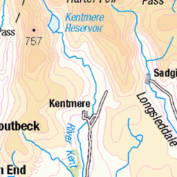
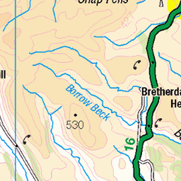
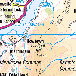
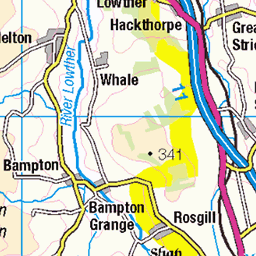
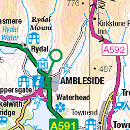
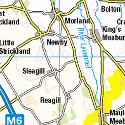
OS Map of Branstree
Height: 712m / 2334ft • Prominence: 137m / 449ft • Summit : ground 80m NW of end of wall • Trip reports (hill-bagging)


31st August 2024. The Rigg Plantation and Haweswater, Cumbria
31-Aug-24 • Barnsley Victor • flickr
54013697833

31st August 2024. Car Park. Riggindale Crag and Haweswater, Cumbria.
31-Aug-24 • Barnsley Victor • flickr
54013799549

31st August 2024. Footpath. Riggindale Crag and Haweswater, Cumbria.
31-Aug-24 • Barnsley Victor • flickr
54014246272

OS Map
This is OS mapping. In some areas, OpenStreetMap shows more footpaths
Spatial NI has online OSNI mapping. Click "Basemap Gallery" (4 squares icon at the top).
Now would be a good time for a cup of tea.


GPX Editor
Record map clicks
Reload map
Photos
Please tag your photos and upload them to the British and Irish Mountains group on Flickr
The other photos have been geo-tagged as on or around the summit. For less busy mountains, it can be a little hit and miss.
31st August 2024. The Rigg Plantation and Haweswater, Cumbria
31-Aug-24 • Barnsley Victor • flickr
54013697833
31st August 2024. Car Park. Riggindale Crag and Haweswater, Cumbria.
31-Aug-24 • Barnsley Victor • flickr
54013799549
31st August 2024. Footpath. Riggindale Crag and Haweswater, Cumbria.
31-Aug-24 • Barnsley Victor • flickr
54014246272


Bound to get better...
A walk in a downpour around the the head of Hawsewater. It didn't.
21-Jul-17 • greengrocer48 • flickr
cumbria england lakedistrict haweswater 54401216480

Haweswater - the Southern end of the lake
19-Apr-16 • greengrocer48 • flickr
haweswater cumbria england lakedistrict 54295636380

2550 Branstree
Lovely sunny day from Haweswater after Selside Pike. Name:Branstree Hill number:2550 Height:713m / 2339ft Parent (Ma):2528 High Street RHB Section:34C: Lake District - Eastern Fells Nuttall/Wainwright area:Lake District - Far Eastern Fells County/UA:Cumbria (CoU) Catchment:Catchment Boundaries, Eden (Carlisle), Kent Watershed:Morecambe Bay, St Bees Head to Ravenscar, Solway Firth Class:Hump, Simm, Hewitt, Nuttall, Wainwright, Birkett, Synge, Fellranger, Buxton & Lewis, Bridge, Clem Grid ref:NY 47802 09971 Summit feature:small pile of stones by trig station Drop:137m Col:576m NY474093 OS map sheet(s):(1:50k) 90 (1:25k) OL5S OL7N Observations:ground 40m NW at NY 47776 10002 and at NY 47754 09997 is about as high Survey:Abney level
08-Sep-07 • Dugswell2 • flickr
concretering selsidebrowconcretering branstree p137 hump tump simm hewitt nuttall wainwright birkett synge fellranger buxtonlewis bridge clem 48904945326

2550 Branstree a
08-Sep-07 • Dugswell2 • flickr
concretering selsidebrowconcretering branstree p137 hump tump simm hewitt nuttall wainwright birkett synge fellranger buxtonlewis bridge clem 48904425093

2550 Branstree b
08-Sep-07 • Dugswell2 • flickr
concretering selsidebrowconcretering branstree p137 hump tump simm hewitt nuttall wainwright birkett synge fellranger buxtonlewis bridge clem 48904426258
Videos
Join me to take a hike up to Branstree and Selside Pike from the Haweswater Reservoir in the Lake District National Park in the ...
A walk of almost 13 mile, the route starts at Mardale Head, Haweswater Reservoir. The route first heads around towards The Rigg ...
Grassy tops and views of the Pennines from the Far Eastern Fells. https://jimearl6.com/__trashed/#more-6161 This walk takes in ...
Lakeland Fell Walk.
Walking from Mardale Head up Gatescarth Pass. Then up along the fence to Branstree, before heading over to Selside Pike.
Notes
- Data: Database of British and Irish Hills v18.2
- Maps: We use OS mapping for England, Scotland, Wales, and the Isle of Man. Sadly, Channel Islands, Northern (OSNI) and Southern Ireland (OSI) mapping isn't available online, so we use Openstreetmap.