Hills of Britain and Ireland
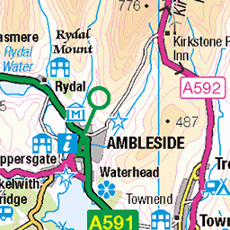
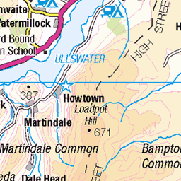
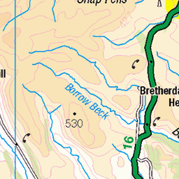
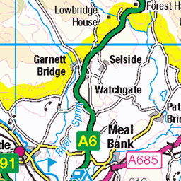
OS Map of Great Rigg
Height: 766m / 2514ft • Prominence: 31m / 102ft • Summit : rock 15m NE of cairn • Trip reports (hill-bagging)

The Fairfield Horseshoe
Photo taken at Hart Crag.
06-Feb-25 • Paul Austin Murphy • flickr
54319117469


Helvellyn, Striding Edge and Fairfield
Helvellyn is on the left, Striding Edge in the middle, and a bit of Fairfield is to the right. The photo was taken on Great Rigg.
06-Feb-25 • Paul Austin Murphy • flickr
54312808310

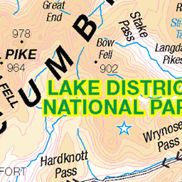
OS Map
This is OS mapping. In some areas, OpenStreetMap shows more footpaths
Spatial NI has online OSNI mapping. Click "Basemap Gallery" (4 squares icon at the top).
Now would be a good time for a cup of tea.


GPX Editor
Record map clicks
Reload map
Photos
Please tag your photos and upload them to the British and Irish Mountains group on Flickr
The other photos have been geo-tagged as on or around the summit. For less busy mountains, it can be a little hit and miss.
The Fairfield Horseshoe
Photo taken at Hart Crag.
06-Feb-25 • Paul Austin Murphy • flickr
54319117469
Helvellyn, Striding Edge and Fairfield
Helvellyn is on the left, Striding Edge in the middle, and a bit of Fairfield is to the right. The photo was taken on Great Rigg.
06-Feb-25 • Paul Austin Murphy • flickr
54312808310

View of the Southern Half of the Fairfield Horseshoe
Photo taken near Heron Pike.
06-Feb-25 • Paul Austin Murphy • flickr
54312418126


Videos
A circular walk over 4 Wainwrights from Greenhead Gill, visiting Alcock Tarn en route to Nab Scar, Heron Pike, Great Rigg and ...
A walk from Grasmere taking in four Wainwright's and returning via Alcock Tarn.
Another great day! This flight was well over an hour in the end, too long for YouTube, but here are the first few minutes. Slightly ...
A walk from Grasmere taking in four Wainwright's and returning via Alcock Tarn.
A fantastic Lake District ridge walk taking in the summits of 4 Wainwright's, Nab Scar, Heron Pike, Great Rigg and Stone Arthur.
Notes
- Data: Database of British and Irish Hills v18.2
- Maps: We use OS mapping for England, Scotland, Wales, and the Isle of Man. Sadly, Channel Islands, Northern (OSNI) and Southern Ireland (OSI) mapping isn't available online, so we use Openstreetmap.