Hills of Britain and Ireland
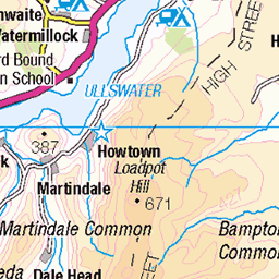
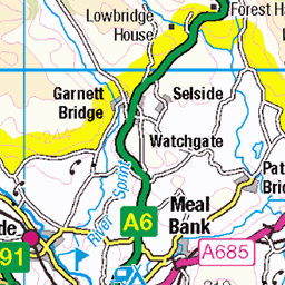
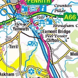
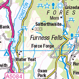
OS Map of Harter Fell (Mardale)

Kentmere Reservoir
Wet and windy and a river crossing to attend to. The Great Outdoors. From Smallthwaite Knott.
21-Feb-25 • stephen.mulvaneym • flickr
54345139439


Approaching the top of Mardale Ill Belle
kentmere cumbria lakedistrictjuly2024day2 lakedistrictjuly2024 kentmereround mardaleillbelle kentmerehorseshoe lakedistrictnationalpark 54156246960

The view at the top of Mardale Ill Belle
kentmere yoke cumbria lakedistrictjuly2024day2 illbelle lakedistrictjuly2024 kentmereround mardaleillbelle kentmerehorseshoe lakedistrictnationalpark froswick 54156110729

Haweswater and Blea Water
Seen from Mardale Ill Belle
kentmere kentmerehorseshoe lakedistrictjuly2024day2 cumbria lakedistrictnationalpark mardaleillbelle kentmereround haweswaterreservoir bleawater lakedistrictjuly2024 haweswater 54156110744

Follow the fence from Harter Fell to Kentmere Pike
Easy navigation.
lakedistrictjuly2024day2 cumbria kentmere harterfell lakedistrictjuly2024 kentmerehorseshoe lakedistrictnationalpark kentmereround 54156281200
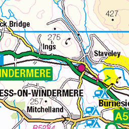
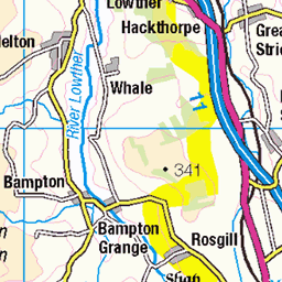
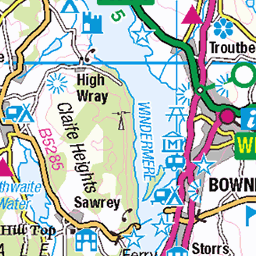
OS Map
This is OS mapping. In some areas, OpenStreetMap shows more footpaths
Spatial NI has online OSNI mapping. Click "Basemap Gallery" (4 squares icon at the top).
Now would be a good time for a cup of tea.


GPX Editor
Record map clicks
Reload map
Photos
Please tag your photos and upload them to the British and Irish Mountains group on Flickr
The other photos have been geo-tagged as on or around the summit. For less busy mountains, it can be a little hit and miss.
Kentmere Reservoir
Wet and windy and a river crossing to attend to. The Great Outdoors. From Smallthwaite Knott.
21-Feb-25 • stephen.mulvaneym • flickr
54345139439
Approaching the top of Mardale Ill Belle
kentmere cumbria lakedistrictjuly2024day2 lakedistrictjuly2024 kentmereround mardaleillbelle kentmerehorseshoe lakedistrictnationalpark 54156246960
The view at the top of Mardale Ill Belle
kentmere yoke cumbria lakedistrictjuly2024day2 illbelle lakedistrictjuly2024 kentmereround mardaleillbelle kentmerehorseshoe lakedistrictnationalpark froswick 54156110729
Haweswater and Blea Water
Seen from Mardale Ill Belle
kentmere kentmerehorseshoe lakedistrictjuly2024day2 cumbria lakedistrictnationalpark mardaleillbelle kentmereround haweswaterreservoir bleawater lakedistrictjuly2024 haweswater 54156110744
Follow the fence from Harter Fell to Kentmere Pike
Easy navigation.
lakedistrictjuly2024day2 cumbria kentmere harterfell lakedistrictjuly2024 kentmerehorseshoe lakedistrictnationalpark kentmereround 54156281200

A straightforward path to Kentmere Pike
lakedistrictjuly2024day2 cumbria kentmere harterfell lakedistrictjuly2024 kentmerehorseshoe lakedistrictnationalpark kentmereround kentmerepike 54154962222

Ooh, a drystone wall and some mud for a change
lakedistrictjuly2024day2 cumbria kentmere lakedistrictjuly2024 kentmerehorseshoe lakedistrictnationalpark kentmereround kentmerepike 54155819346

Follow the curving path to Kentmere Pike
lakedistrictjuly2024day2 cumbria kentmere lakedistrictjuly2024 kentmerehorseshoe lakedistrictnationalpark kentmereround kentmerepike 54156281100

Looking back towards Harter Fell
It sure is grassy up here
lakedistrictjuly2024day2 cumbria kentmere harterfell lakedistrictjuly2024 kentmerehorseshoe lakedistrictnationalpark kentmereround kentmerepike 54156103243
Videos
A slow 360 degree panorama from the summit of Harter Fell, in the Far Eastern Fells region of the English Lake District. All main ...
Parking at Mardale Head, next to Haweswater Reservoir, I meet up again with fellow Youtuber Alan from @54DegreesNorth and ...
lakedistrict #wainwrights #mardale #walkingthewainwrights #wainwrightwalks Another film by Andy Beck, the artist behind the ...
Starting in Sadgill on the river Sprint the route ascends to the top of Wray Cragg and Shipman Knotts in the dark with some of the ...
lakedistrict #mavicair2 #4k.
Notes
- Data: Database of British and Irish Hills v18.2
- Maps: We use OS mapping for England, Scotland, Wales, and the Isle of Man. Sadly, Channel Islands, Northern (OSNI) and Southern Ireland (OSI) mapping isn't available online, so we use Openstreetmap.