Hills of Britain and Ireland
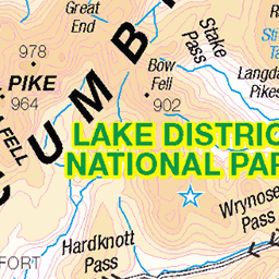
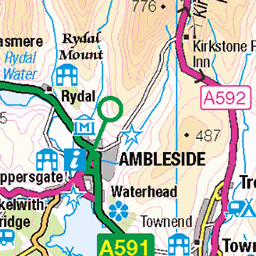
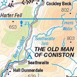
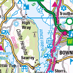
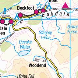
OS Map of Gibson Knott
Height: 420m / 1378ft • Prominence: 9m / 30ft • Summit : cairn on rocky outcrop • Trip reports (hill-bagging)


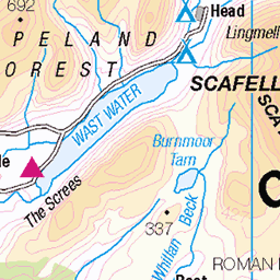
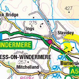
OS Map
This is OS mapping. In some areas, OpenStreetMap shows more footpaths
Spatial NI has online OSNI mapping. Click "Basemap Gallery" (4 squares icon at the top).
Now would be a good time for a cup of tea.


GPX Editor
Record map clicks
Reload map
Photos
Please tag your photos and upload them to the British and Irish Mountains group on Flickr
The other photos have been geo-tagged as on or around the summit. For less busy mountains, it can be a little hit and miss.

Sourmilk Gill Falls 1
22-Sep-24 • Bill Cumming • flickr
cumbria grasmere easedale waterfall 54032736522

Sourmilk Gill Falls 3
22-Sep-24 • Bill Cumming • flickr
cumbria grasmere easedale waterfall 54034058735


Lake District Mist
27-Oct-22 • Matthew Margot • flickr
unitedkingdom england europe lakedistrict ambleside fav10 54248944563

2494 Gibson Knott Wainwright Summit
Wainwright summit; cairn 200m SE at NY 31855 09924 is about 2m higher Survey:Abney level
09-Oct-15 • Dugswell2 • flickr
wainwright p12 gibsonknott 24236941782

2494 Gibson Knott
Helm Crag, Gibson Knott, Calf Crag, Steel Fell and Butharlyp Howe with Smudge on a warmish grey day. Name: Gibson Knott Hill number: 2494 Height:420m / 1378ft Parent (Ma): 2396 High Raise [High Raise (High White Stones)] Section:34B: Lake District - Central & Western Fells Area: Lake District - Central Fells County/UA:Cumbria (CoU) Class: Wainwright, Birkett, Synge, Fellranger (W,B,Sy,Fel) Grid ref:NY 31690 10036 Summit feature: cairn on rocky outcrop Drop: 10m Col:410m NY315101 Observations:Wainwright summit; cairn 200m SE at NY 31855 09924 is about 2m higher Survey: Abney level
09-Oct-15 • Dugswell2 • flickr
synge p10 birkett gibsonknott 24262674791
Videos
An ugly - but successful - top landing on the ridge of Gibson Knott, Grasmere. The coll between Gibson Knott and Helm Crag is ...
A fantastic GRASMERE walk in THE LAKE DISTRICT See more FAMILY WALKS ...
A nice gentle 7 mile circular hike around Greenburn Bottom, Grasmere in The Lake District. Not going up Helm Crag but ...
A slow 360 degrees panoramic from the summit of Gibson Knott, in the central fells region of the English Lake District. All main ...
In October 2019 Neil and special guest Stuart undertook the Steel Fell to Helm Crag horseshoe in the English Lake District - Steel ...
Notes
- Data: Database of British and Irish Hills v18.2
- Maps: We use OS mapping for England, Scotland, Wales, and the Isle of Man. Sadly, Channel Islands, Northern (OSNI) and Southern Ireland (OSI) mapping isn't available online, so we use Openstreetmap.