Hills of Britain and Ireland
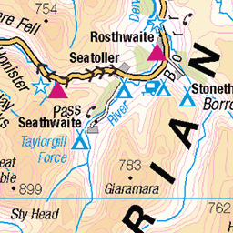
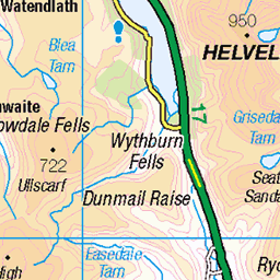
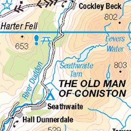
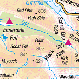
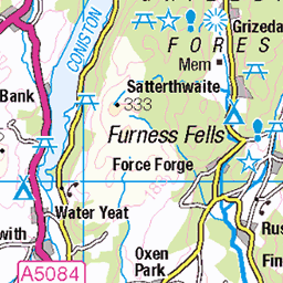
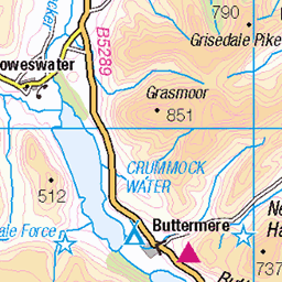
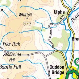
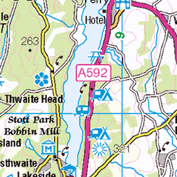
OS Map of Crinkle Crags - Long Top (Second Crinkle)


Walney Wind Farm on the Irish Sea (5)
21-Nov-23 • Paul Austin Murphy • flickr
walneywindfarm windturbines windfarm windfarms windturbine 53356518231
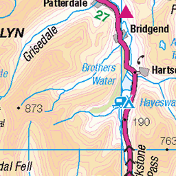
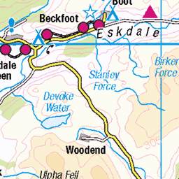
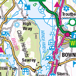
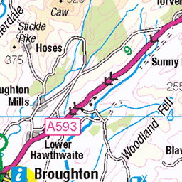
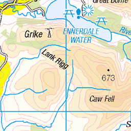
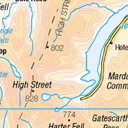
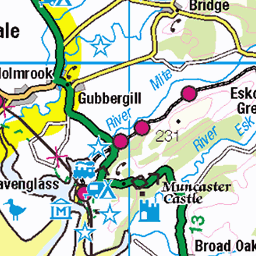
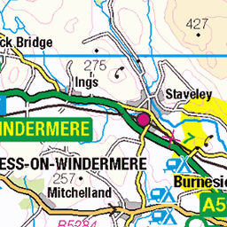
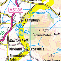
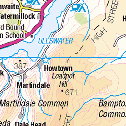
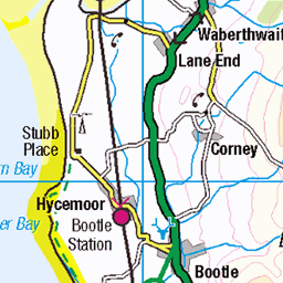
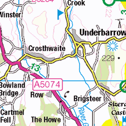
OS Map
This is OS mapping. In some areas, OpenStreetMap shows more footpaths
Spatial NI has online OSNI mapping. Click "Basemap Gallery" (4 squares icon at the top).
Now would be a good time for a cup of tea.


GPX Editor
Record map clicks
Reload map
Photos
Please tag your photos and upload them to the British and Irish Mountains group on Flickr
The other photos have been geo-tagged as on or around the summit. For less busy mountains, it can be a little hit and miss.
Walney Wind Farm on the Irish Sea (5)
21-Nov-23 • Paul Austin Murphy • flickr
walneywindfarm windturbines windfarm windfarms windturbine 53356518231

Lingcove Beck and River Esk
View down to Lingcove Beck from Pianet Knott at the end of the north ridge of Esk Pike. River Esk flows towards the transition to green fields below.
09-Nov-23 • a.hill-psalm145 • flickr
valley stream fells hills lingcove esk river eskdale lake district cumbria beck 53504343126

Passing shower, upper Eskdale
View over Lingcove Beck and Eskdale from Pianet Knott, southern ridge of Esk Pike.
09-Nov-23 • a.hill-psalm145 • flickr
monochrome esk eskdale lingcove pianet pike lake district cumbria shower weather cloud 53421878225

Lingcove Beck
Looking down a small section of this lovely mountain stream.
09-Nov-23 • a.hill-psalm145 • flickr
lingcove beck stream water mountain lake district eskdale cumbria 53370079243

Videos
A walk up to two Wainwright fells in the Lake District, Cold Pike (701m) & Crinkle Crags (859m) The walk starts from the top of the ...
My current favourite stroll along the ridge from Three Shires Stone to Bow Fell and back taking in Climbers Traverse and Great ...
A hike to Crinkle Crags and Cold Pike from Wrynose Pass A beautiful day with fantastic views. Thanks for watching Cheers ...
The Great Langdale valley in England's Lake District is a great starting point for some classic Lakeland walks. Previously, we have ...
GPX Download Of Route... https://drive.google.com/file/d/1KIUIgF_g2wqKMrDYcATqr396QMzrzRm5/view?usp=drivesdk Link to ...
Notes
- Data: Database of British and Irish Hills v18.2
- Maps: We use OS mapping for England, Scotland, Wales, and the Isle of Man. Sadly, Channel Islands, Northern (OSNI) and Southern Ireland (OSI) mapping isn't available online, so we use Openstreetmap.