Hills of Britain and Ireland
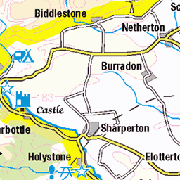
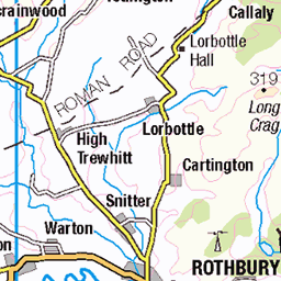
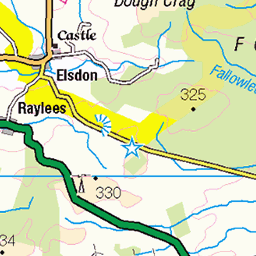
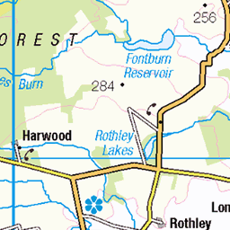
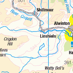
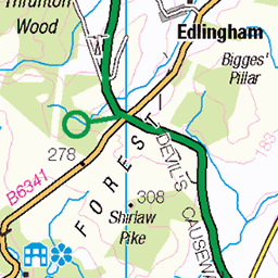
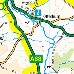
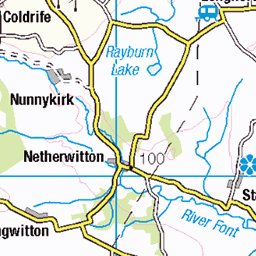
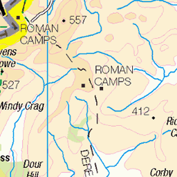
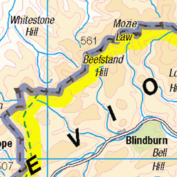
OS Map of Tosson Hill
Height: 442m / 1449ft • Prominence: 249m / 817ft • Summit : trig point • Trip reports (hill-bagging)

tosson hill
05-Oct-24 • kokoschka's doll • flickr
moorland hill heather stone crag bank escarpment northumberland northeast 54076529611

tosson hill
a little pool
05-Oct-24 • kokoschka's doll • flickr
hill moorland rock pool northumberland 54078831658


photo
Hidden pond in a huge plantation on the Simonside Hills.
04-Apr-23 • Paul Austin Murphy • flickr
52797574682

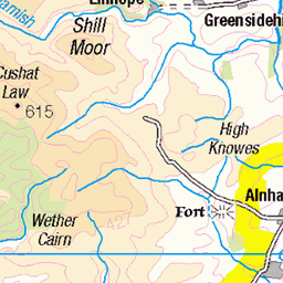
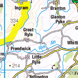
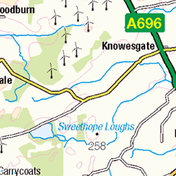
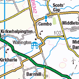
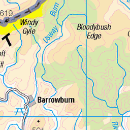
OS Map
This is OS mapping. In some areas, OpenStreetMap shows more footpaths
Spatial NI has online OSNI mapping. Click "Basemap Gallery" (4 squares icon at the top).
Now would be a good time for a cup of tea.
GPX Editor
Record map clicks
Reload map
Photos
Please tag your photos and upload them to the British and Irish Mountains group on Flickr
The other photos have been geo-tagged as on or around the summit. For less busy mountains, it can be a little hit and miss.
tosson hill
05-Oct-24 • kokoschka's doll • flickr
moorland hill heather stone crag bank escarpment northumberland northeast 54076529611
tosson hill
a little pool
05-Oct-24 • kokoschka's doll • flickr
hill moorland rock pool northumberland 54078831658
photo
Hidden pond in a huge plantation on the Simonside Hills.
04-Apr-23 • Paul Austin Murphy • flickr
52797574682

Simonside Hill - Through Harwood Forest
Northumberland National Park.
04-Apr-23 • Paul Austin Murphy • flickr
simonside 52801521672


Videos
8 miles walk around the stunning Simonside Hills. Due to the damage caused by Storm Arwen across the north of England in ...
A circular ride from Rothbury in Northumberland near Simonside taking in Tosson Hill Trig point summit at 441 MTRS. first time ...
I'm back for another adventure. A night on Tosson hill at the edge of Northumberland national park. So come with me on my ...
Jamie and I climb a Marilyn: Tosson Hill in Northumberland. With funky music and editing! Enjoyed this video? If it's brightened ...
With good weather forecast, I headed to Tosson Hill for a solo wild camp. Having arrived at Tosson Lime Kiln car park, I had a ...
Notes
- Data: Database of British and Irish Hills v18.2
- Maps: We use OS mapping for England, Scotland, Wales, and the Isle of Man. Sadly, Channel Islands, Northern (OSNI) and Southern Ireland (OSI) mapping isn't available online, so we use Openstreetmap.