Hills of Britain and Ireland
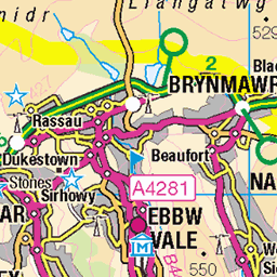
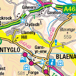
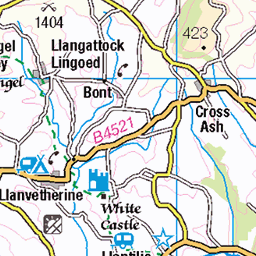
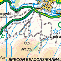
OS Map of Mynydd Machen
Height: 363m / 1192ft • Prominence: 193m / 633ft • Summit : rock 3m NW of trig point • Trip reports (hill-bagging)


Stagecoach Red & White 26189 passes Tredegar Grounds, Risca.
Now at Cwmbran garage hence mention of X24 on branding.
21-May-24 • DGlombardstown • flickr
53739918840
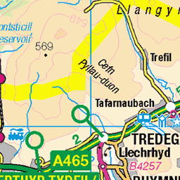
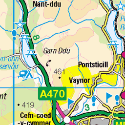
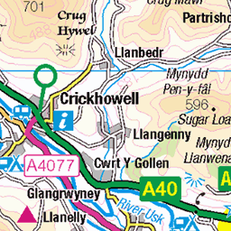
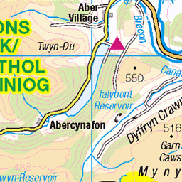
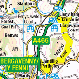
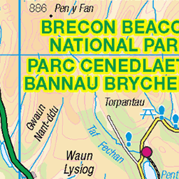
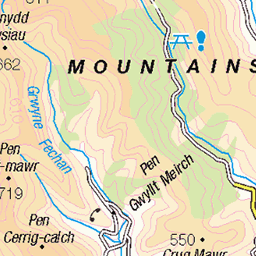
OS Map
This is OS mapping. In some areas, OpenStreetMap shows more footpaths
Spatial NI has online OSNI mapping. Click "Basemap Gallery" (4 squares icon at the top).
Now would be a good time for a cup of tea.


GPX Editor
Record map clicks
Reload map
Photos
Please tag your photos and upload them to the British and Irish Mountains group on Flickr
The other photos have been geo-tagged as on or around the summit. For less busy mountains, it can be a little hit and miss.
Stagecoach Red & White 26189 passes Tredegar Grounds, Risca.
Now at Cwmbran garage hence mention of X24 on branding.
21-May-24 • DGlombardstown • flickr
53739918840


Not sure why 26186 is oos at Moriah Baptist Church, Risca.
But interesting as ... - one of the few remaining gold 151s - Blackwood depot's imminent closure - defunct routes listed on the bus stop R1, R2, (last month) X16 (about 3 years ago) and X18 (5 years ago)
18-Jan-23 • DGlombardstown • flickr
52635386470


Railtour: The Gwent Growler
Machen Quarry, end of the line
14-Apr-90 • WildVanilla (Rob) • flickr
37298 bwrdeistrefsirolcaerffili caerphillycountyborough class37 growlergroup gwentgrowler machen railtour victor wales diesel engine loco locomotive geo:lon=31367888888883 geo:lat=51597722222222 camera:make=canon geo:city=machen geo:state=caerphillycountyborough geolocation geo:country=wales camera:model=mg5200series exif:model=mg5200series exif:make=canon 52105590126
Videos
A nice 6.9 mile linear walk taking in 3 hills, with the final one being the impressive Mynydd Machen. For full details of the walk, visit ...
Friday afternoon stroll to bag a trig. Number 238. Lovely colours. Great views to Cardiff the capital city of Wales. Views up to the ...
My first SOTA activation. Summits on the air activation of Mynydd Machen, near Caerphilly, South Wales. My first foray into SOTA ...
lescroupiers #lescroupiersrc #MachenMountain.
Trying to create decent content is a bit of a challenge at the moment so for this vid I leaned more to a vloggy style approach! I did a ...
Notes
- Data: Database of British and Irish Hills v18.2
- Maps: We use OS mapping for England, Scotland, Wales, and the Isle of Man. Sadly, Channel Islands, Northern (OSNI) and Southern Ireland (OSI) mapping isn't available online, so we use Openstreetmap.