Hills of Britain and Ireland
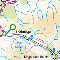
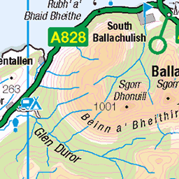
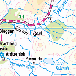
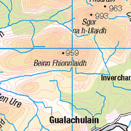
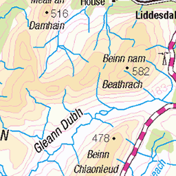
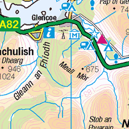
OS Map of Beinn Lora
Height: 308m / 1010ft • Prominence: 171m / 561ft • Summit : trig point • Trip reports (hill-bagging)


20211014 001 Mull Sunset (Wm)
14-Oct-21 • GHL Digital • flickr
scotland sunset oban sea sky 51836920691

20210919 001 Mull Sunset (Wm)
19-Sep-21 • GHL Digital • flickr
scotland sunset oban sea sky 51837651365


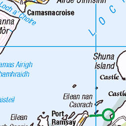
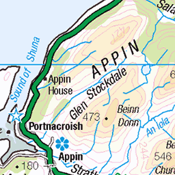
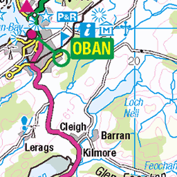
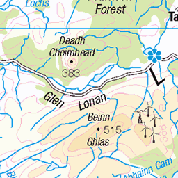
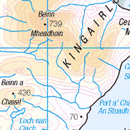
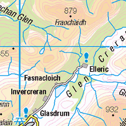
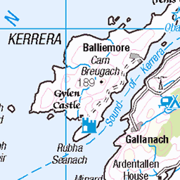
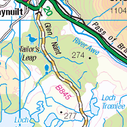
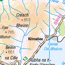
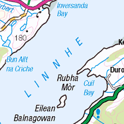
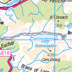
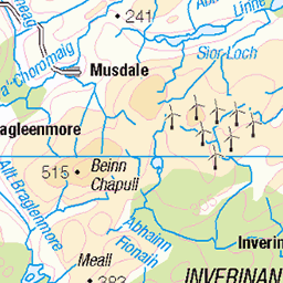
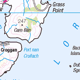
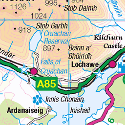
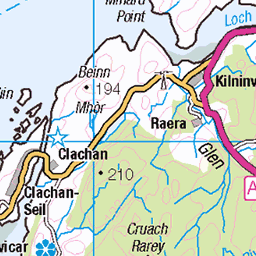
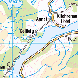
OS Map
This is OS mapping. In some areas, OpenStreetMap shows more footpaths
Spatial NI has online OSNI mapping. Click "Basemap Gallery" (4 squares icon at the top).
Now would be a good time for a cup of tea.
GPX Editor
Record map clicks
Reload map
Photos
Please tag your photos and upload them to the British and Irish Mountains group on Flickr
The other photos have been geo-tagged as on or around the summit. For less busy mountains, it can be a little hit and miss.
20211014 001 Mull Sunset (Wm)
14-Oct-21 • GHL Digital • flickr
scotland sunset oban sea sky 51836920691
20210919 001 Mull Sunset (Wm)
19-Sep-21 • GHL Digital • flickr
scotland sunset oban sea sky 51837651365


IMGP0635
Cliffs by the A828 in Benderloch.
17-Apr-21 • mattbuck4950 • flickr
unitedkingdom europe april cliffs photosbymatt camerapentaxk70 lenssigma18300mm visitswithheather scotland 2021 benderloch strathclyde a828 51321180222

IMGP0644
View across Ardmucknish Bay from Benderloch.
17-Apr-21 • mattbuck4950 • flickr
unitedkingdom europe april water photosbymatt camerapentaxk70 lenssigma18300mm visitswithheather scotland 2021 benderloch strathclyde a828 ardmucknishbay 51322115223

IMGP0648
View across Ardmucknish Bay from Benderloch.
17-Apr-21 • mattbuck4950 • flickr
unitedkingdom europe april water boats photosbymatt camerapentaxk70 lenssigma18300mm visitswithheather scotland 2021 benderloch dunbeg strathclyde a828 ardmucknishbay 51321179202
Videos
and my first outing in the hills in 7 or so months.
Whilst Beinn Lora may only be 308 metres high, its fine position ensures that the magnificent views from its summit match those ...
Beinn Lora on a sunny day after work!
Super views up Beinn Lora trailz, we are blessed by this super country. Trek Rail 5.
Notes
- Data: Database of British and Irish Hills v18.2
- Maps: We use OS mapping for England, Scotland, Wales, and the Isle of Man. Sadly, Channel Islands, Northern (OSNI) and Southern Ireland (OSI) mapping isn't available online, so we use Openstreetmap.