Hills of Britain and Ireland
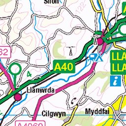
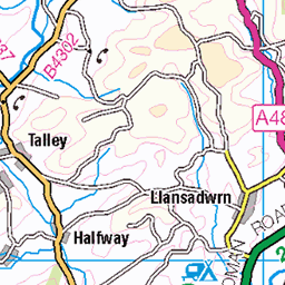
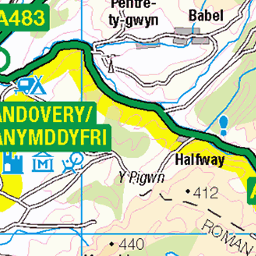
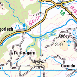
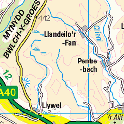
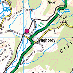
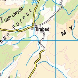
OS Map of Garreg Lwyd (Moel Gornach)
Height: 616m / 2021ft • Prominence: 104m / 341ft • Summit : ancient cairn • Trip reports (hill-bagging)


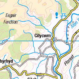
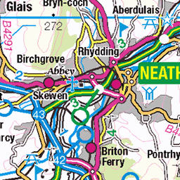
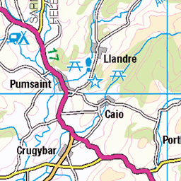
OS Map
This is OS mapping. In some areas, OpenStreetMap shows more footpaths
Spatial NI has online OSNI mapping. Click "Basemap Gallery" (4 squares icon at the top).
Now would be a good time for a cup of tea.
GPX Editor
Record map clicks
Reload map
Photos
Please tag your photos and upload them to the British and Irish Mountains group on Flickr
The other photos have been geo-tagged as on or around the summit. For less busy mountains, it can be a little hit and miss.


A HARD ROAD TO TRAVEL
The road to the lime kilns on the BLACK MOUNTAIN.
12-Jul-24 • jim eaton L. • flickr
54013092199
Videos
DJI Mavic Mini Edited in KDenLive Music: www.bensound.com.
Another visit to the Black Mountain moorland. Afternoon of some hill bagging , smaller hills in the area. Hill tops in order - Bryn ...
Another Black Mountain Adventure around the Brecon Beacons National Park. On the western edge of the the Black Mountain lies ...
Y Garn Goch is notable for the two impressive Iron Age hillforts of Y Gaer Fawr, (English: the big fort) and Y Gaer Fach, (English: ...
Back out to a old haunt, this has to be one of my favourite parts of the Black Mountain. Foel Fraith summit stands at 602 meters on ...
Notes
- Data: Database of British and Irish Hills v18.2
- Maps: We use OS mapping for England, Scotland, Wales, and the Isle of Man. Sadly, Channel Islands, Northern (OSNI) and Southern Ireland (OSI) mapping isn't available online, so we use Openstreetmap.