Hills of Britain and Ireland
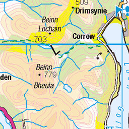
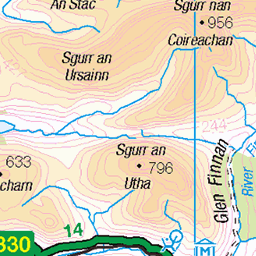
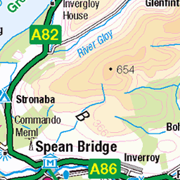
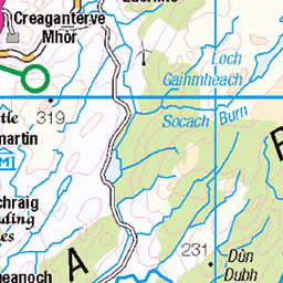
OS Map of Beinn Trilleachan


Burst of sunshine on Etive Slabs
Patrick started seconding P1 of The Long Reach.
02-Oct-15 • Masa Sakano • flickr
scotland scenery climbing highland climber trad lochetive etiveslabs beinntrilleachan thelongreach 21726264429


On top Stob Dubh
Buachaille Etive Beag, Glencoe
winter white mountain mountains geotagged scotland glencoe munro geolat565414 geolon5126505 108268303

View of Buachaille Etive Beag
winter white mountain mountains geotagged scotland glencoe munro geolat565414 geolon5126505 108268304
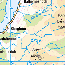
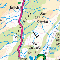
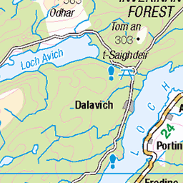
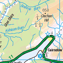
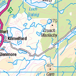
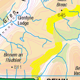
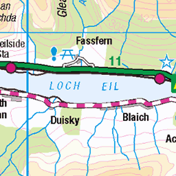
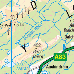
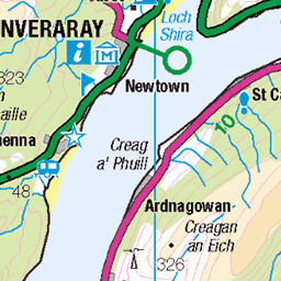
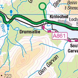
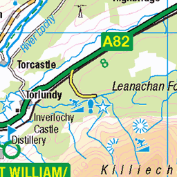
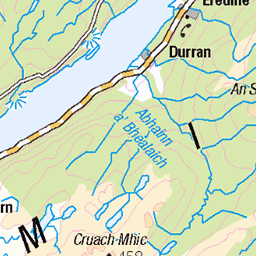
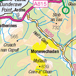
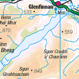
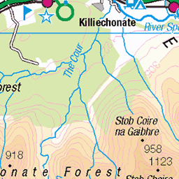
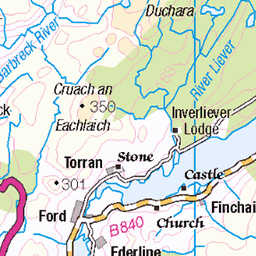
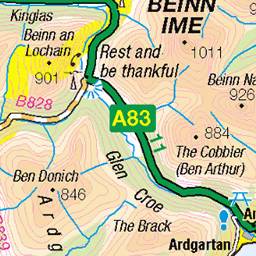
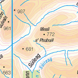
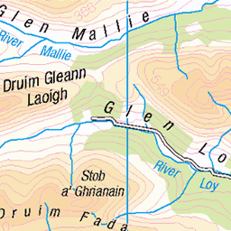
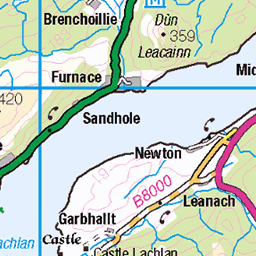
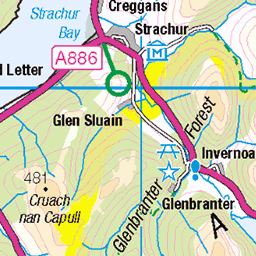
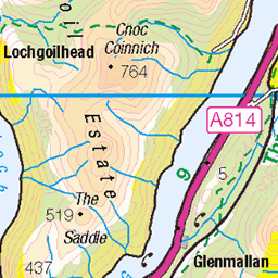
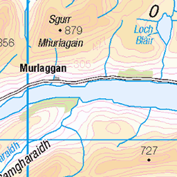
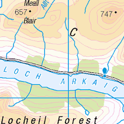
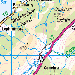
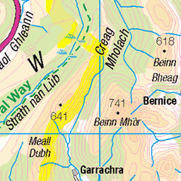
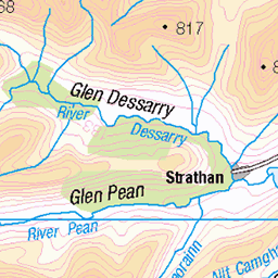
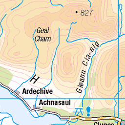
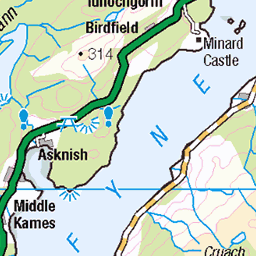
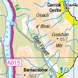
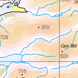
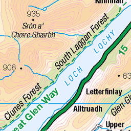
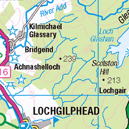
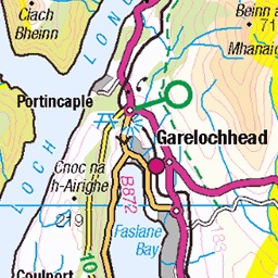
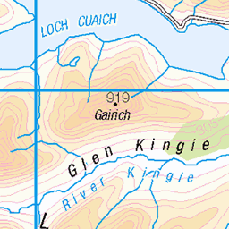
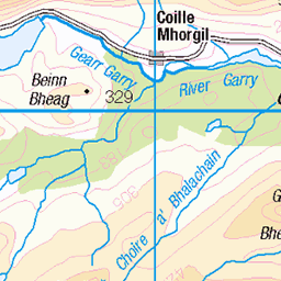
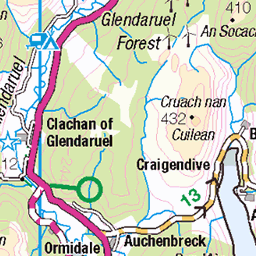
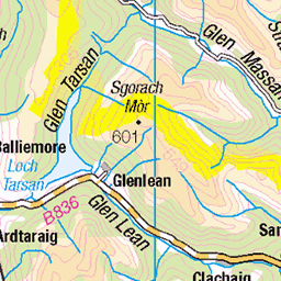
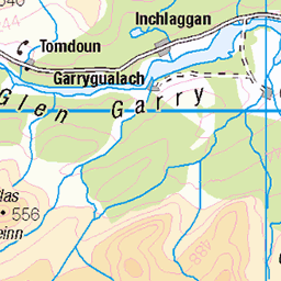
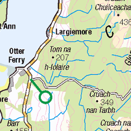
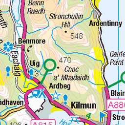
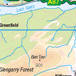
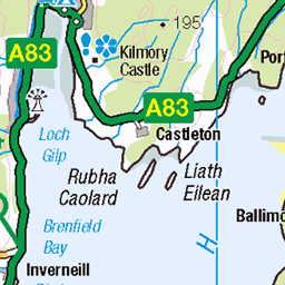
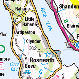
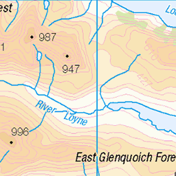
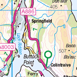
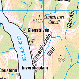
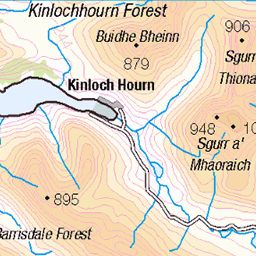
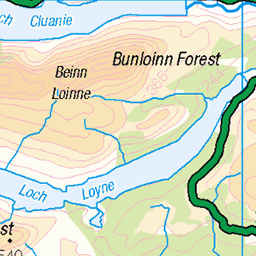
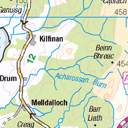
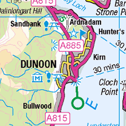
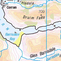
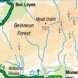
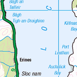
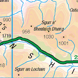
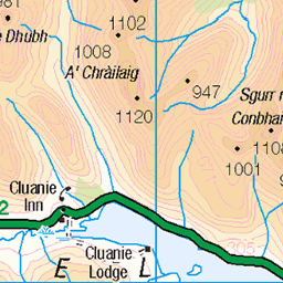
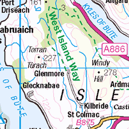
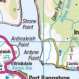
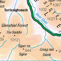
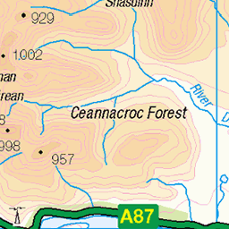
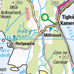
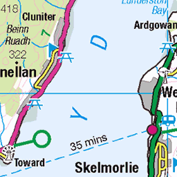
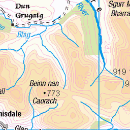
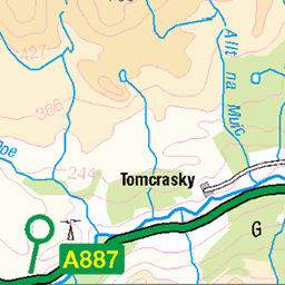
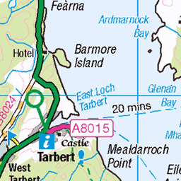
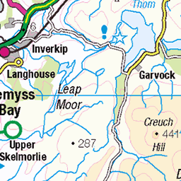
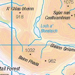
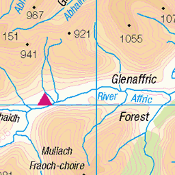
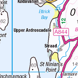
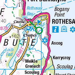
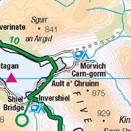
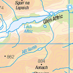
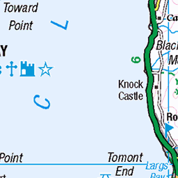
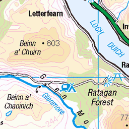
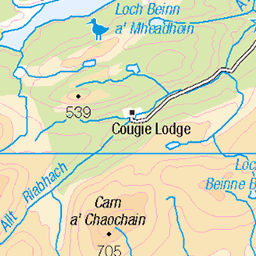
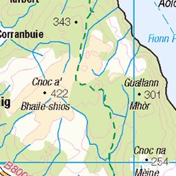
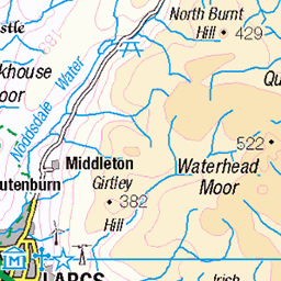
OS Map
This is OS mapping. In some areas, OpenStreetMap shows more footpaths
Spatial NI has online OSNI mapping. Click "Basemap Gallery" (4 squares icon at the top).
Now would be a good time for a cup of tea.


GPX Editor
Record map clicks
Reload map
Photos
Please tag your photos and upload them to the British and Irish Mountains group on Flickr
The other photos have been geo-tagged as on or around the summit. For less busy mountains, it can be a little hit and miss.
Burst of sunshine on Etive Slabs
Patrick started seconding P1 of The Long Reach.
02-Oct-15 • Masa Sakano • flickr
scotland scenery climbing highland climber trad lochetive etiveslabs beinntrilleachan thelongreach 21726264429
On top Stob Dubh
Buachaille Etive Beag, Glencoe
winter white mountain mountains geotagged scotland glencoe munro geolat565414 geolon5126505 108268303
View of Buachaille Etive Beag
winter white mountain mountains geotagged scotland glencoe munro geolat565414 geolon5126505 108268304

The Long Reach
Climbing on the Etive Slabs.
14-May-05 • andy.brown • flickr
film rock 35mm geotagged scotland climbing etive geotoolgmif geolat56552671 geolon5095983 112985398
Videos
A hike up the Corbett to bag Beinn Trilleachan. A fantastic day out in a mixture of typical Scottish weather with great views all ...
Panoramic shot from the top of Beinn Trilleachan.
Panoramic shot from the top of Beinn Maol Chaluim.
Notes
- Data: Database of British and Irish Hills v18.2
- Maps: We use OS mapping for England, Scotland, Wales, and the Isle of Man. Sadly, Channel Islands, Northern (OSNI) and Southern Ireland (OSI) mapping isn't available online, so we use Openstreetmap.