Hills of Britain and Ireland
Map of Oldtown Hill
Height: 127m / 417ft • Prominence: 100m / 328ft • Trip reports (MountainViews)

Hilltop B & B panorama
... with Loop Head in the distance
06-Sep-21 • WeatherMaker • flickr
ireland irland clare 51592145269
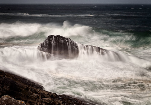
Trade War
Kilkee Cliffs
17-Apr-18 • Barnaby Nutt • flickr
county clare ireland seascape kilkee cliffs waves atlantic ocean 41548410252

Stormfront
Leaving Trusclieve in West Clare, headed for Dublin
29-Oct-12 • Stephen Holmes • flickr
ie 8135776774


Morning Sea Bird
around 6 am, the Sea Birds are just walking up. Summer 2007
seabird coclareirelandoceancliffsbird 2864055122
Open Street Map
This is Open Street Map mapping. Sorry, (topographic) OSNI/Channel Islands/OSI mapping is not available online
Spatial NI has online OSNI mapping. Click "Basemap Gallery" (4 squares icon at the top).
Now would be a good time for a cup of tea.
GPX Editor
Record map clicks
Reload map
Photos
Please tag your photos and upload them to the British and Irish Mountains group on Flickr
The other photos have been geo-tagged as on or around the summit. For less busy mountains, it can be a little hit and miss.
Hilltop B & B panorama
... with Loop Head in the distance
06-Sep-21 • WeatherMaker • flickr
ireland irland clare 51592145269
Trade War
Kilkee Cliffs
17-Apr-18 • Barnaby Nutt • flickr
county clare ireland seascape kilkee cliffs waves atlantic ocean 41548410252
Stormfront
Leaving Trusclieve in West Clare, headed for Dublin
29-Oct-12 • Stephen Holmes • flickr
ie 8135776774
Morning Sea Bird
around 6 am, the Sea Birds are just walking up. Summer 2007
seabird coclareirelandoceancliffsbird 2864055122


Videos
None found
Notes
- Data: Database of British and Irish Hills v18.2
- Maps: We use OS mapping for England, Scotland, Wales, and the Isle of Man. Sadly, Channel Islands, Northern (OSNI) and Southern Ireland (OSI) mapping isn't available online, so we use Openstreetmap.