Hills of Britain and Ireland
Map of Eagles Hill (An Bhinn Riabhach)
Height: 549m / 1801ft • Prominence: 232m / 761ft • Summit : no feature • Trip reports (MountainViews)

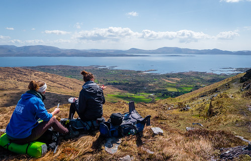
Windy Gap
Kerry Way
23-Apr-16 • Schmendrax • flickr
countykerry kerryway ocean ireland nature hiking ringofkerry backpacking kerry trekking coast cokerry irl view panorama breaktime travelling shore break scenic backpack lunch landscape coastline lunchtime 35322862643

Code Mountain
Co. Kerry, Ireland
08-Sep-15 • Crash Test Mike • flickr
county ireland irish mountain lake water grass river bay code eire kerry co kenmare 20627413274

ancestors view , staigue fort
Staigue Fort County Kerry March 2002 maps.google.com?q=51.8061111,-10.0416667(ancestors view , staigue fort)&t=h County Kerry www.flickr.com/groups/geotagging/discuss/72157594165549916/ [?]
18-Mar-02 • pamelaadam • flickr
2002 ireland film geotagged march spring fotolog rathmore countrykerry thebiggestgroup geo:lat=51806111 geo:lon=10041667 2613184
Open Street Map
This is Open Street Map mapping. Sorry, (topographic) OSNI/Channel Islands/OSI mapping is not available online
Spatial NI has online OSNI mapping. Click "Basemap Gallery" (4 squares icon at the top).
Now would be a good time for a cup of tea.
GPX Editor
Record map clicks
Reload map
Photos
Please tag your photos and upload them to the British and Irish Mountains group on Flickr
The other photos have been geo-tagged as on or around the summit. For less busy mountains, it can be a little hit and miss.
Windy Gap
Kerry Way
23-Apr-16 • Schmendrax • flickr
countykerry kerryway ocean ireland nature hiking ringofkerry backpacking kerry trekking coast cokerry irl view panorama breaktime travelling shore break scenic backpack lunch landscape coastline lunchtime 35322862643
Code Mountain
Co. Kerry, Ireland
08-Sep-15 • Crash Test Mike • flickr
county ireland irish mountain lake water grass river bay code eire kerry co kenmare 20627413274
ancestors view , staigue fort
Staigue Fort County Kerry March 2002 maps.google.com?q=51.8061111,-10.0416667(ancestors view , staigue fort)&t=h County Kerry www.flickr.com/groups/geotagging/discuss/72157594165549916/ [?]
18-Mar-02 • pamelaadam • flickr
2002 ireland film geotagged march spring fotolog rathmore countrykerry thebiggestgroup geo:lat=51806111 geo:lon=10041667 2613184
Videos
None found
Notes
- Data: Database of British and Irish Hills v18.2
- Maps: We use OS mapping for England, Scotland, Wales, and the Isle of Man. Sadly, Channel Islands, Northern (OSNI) and Southern Ireland (OSI) mapping isn't available online, so we use Openstreetmap.