Hills of Britain and Ireland
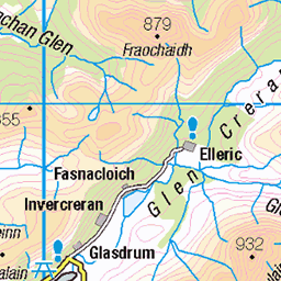
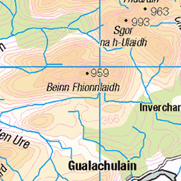
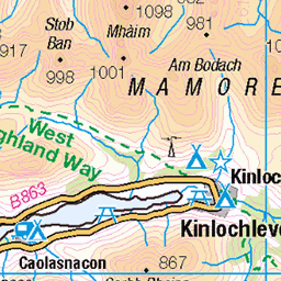
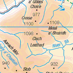
OS Map of Beinn a' Bheithir - Sgorr Dhonuill
Height: 1002m / 3288ft • Prominence: 245m / 804ft • Summit : embedded rock 8m WNW of cairn • Trip reports (hill-bagging)

Beinn a' Bheithir
View while descending Sgòrr Dhònuill
sgòrrdhearg sgòrrdhònuill sgorrdhearg sgorrdhonuill munro mountains hills landscape snow winter walk weather light clouds sky scotland nikon z7ii z7 ii 24120mm 24mm nikkor24120mm nikkor24120mmf4 54327934100

Edita on the ascent of Sgorr Dhonuill
Bheinn a' Bheithir
27-Dec-24 • markhorrell • flickr
hillwalking scotland britain glen coe 54238562715

Me on the way up Sgorr Dhonuill (Photo: Edita Horrell)
Ben a' Bheithir
27-Dec-24 • markhorrell • flickr
britain scotland hillwalking glencoe 54240374869

On the summit ridge of Sgorr Dhonuill (Photo: Edita Horrell)
Ben a' Bheithir
27-Dec-24 • markhorrell • flickr
britain scotland hillwalking glencoe 54240557230

Beneath the summit of Sgorr Dhonuill
Bheinn a' Bheithir
27-Dec-24 • markhorrell • flickr
hillwalking scotland britain glen coe 54238562695

Edita arrive on the summit of Sgorr Dhonuill (1001m), her 100th Munro
Bheinn a' Bheithir
27-Dec-24 • markhorrell • flickr
hillwalking scotland britain glen coe 54237255202
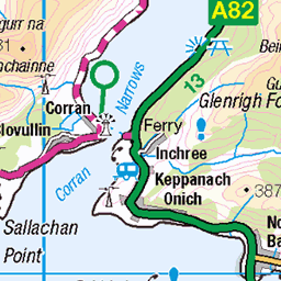
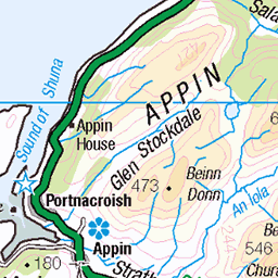
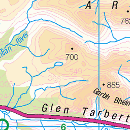
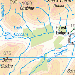
OS Map
This is OS mapping. In some areas, OpenStreetMap shows more footpaths
Spatial NI has online OSNI mapping. Click "Basemap Gallery" (4 squares icon at the top).
Now would be a good time for a cup of tea.

GPX Editor
Record map clicks
Reload map
Photos
Please tag your photos and upload them to the British and Irish Mountains group on Flickr
The other photos have been geo-tagged as on or around the summit. For less busy mountains, it can be a little hit and miss.
Beinn a' Bheithir
View while descending Sgòrr Dhònuill
sgòrrdhearg sgòrrdhònuill sgorrdhearg sgorrdhonuill munro mountains hills landscape snow winter walk weather light clouds sky scotland nikon z7ii z7 ii 24120mm 24mm nikkor24120mm nikkor24120mmf4 54327934100
Edita on the ascent of Sgorr Dhonuill
Bheinn a' Bheithir
27-Dec-24 • markhorrell • flickr
hillwalking scotland britain glen coe 54238562715
Me on the way up Sgorr Dhonuill (Photo: Edita Horrell)
Ben a' Bheithir
27-Dec-24 • markhorrell • flickr
britain scotland hillwalking glencoe 54240374869
On the summit ridge of Sgorr Dhonuill (Photo: Edita Horrell)
Ben a' Bheithir
27-Dec-24 • markhorrell • flickr
britain scotland hillwalking glencoe 54240557230
Beneath the summit of Sgorr Dhonuill
Bheinn a' Bheithir
27-Dec-24 • markhorrell • flickr
hillwalking scotland britain glen coe 54238562695
Edita arrive on the summit of Sgorr Dhonuill (1001m), her 100th Munro
Bheinn a' Bheithir
27-Dec-24 • markhorrell • flickr
hillwalking scotland britain glen coe 54237255202

Edita celebrates on the summit of Sgorr Dhonuill
Ben a' Bheithir
27-Dec-24 • markhorrell • flickr
britain scotland hillwalking glencoe 54239243182

Selfie on the summit of Sgorr Dhonuill
Ben a' Bheithir
27-Dec-24 • markhorrell • flickr
britain scotland hillwalking glencoe 54240381643

Me on the summit of Sgorr Dhonuill (1001m), my 170th Munro
Bheinn a' Bheithir
27-Dec-24 • markhorrell • flickr
hillwalking scotland britain glen coe 54238562720

Edita finds a tree on the summit ridge of Sgorr Dhonuill
Bheinn a' Bheithir
27-Dec-24 • markhorrell • flickr
hillwalking scotland britain glen coe 54238562670
Videos
This group of hills is dramatically know as the Hill of the Thunderbolt. Its an amazing walk along long ridges and rocky tops to take ...
It's my birthday and I'll climb if I want to Beinn a' Bheithir via Schoolhouse Ridge Sgòrr Dhearg 1024m Sgòrr Dhònuill 1001m A ...
A fine day with Greg on the Ballachulish horseshoe, taking in the 2 Munros Sgorr Dhearg & Sgorr Dhonuill, with an alternative ...
Thursday 22nd of June 2023 Join me as I attempt to bag all of scotlands 282 mountains or munros over 3000 feet. Today I'm ...
Join me on a stunning day as I take on a classic of Scottish hillwalking, Beinn a'Bheithir via Schoolhouse Ridge and bag 2 Munros ...
Notes
- Data: Database of British and Irish Hills v18.2
- Maps: We use OS mapping for England, Scotland, Wales, and the Isle of Man. Sadly, Channel Islands, Northern (OSNI) and Southern Ireland (OSI) mapping isn't available online, so we use Openstreetmap.