Hills of Britain and Ireland
OS Map of Andersey Island

Spring
26-Mar-25 • Ian Campsall • flickr
oxfordshire england unitedkingdom englishcountryside evening eveninglight sunset valeofthewhitehorse spring silhouette 54413154494


Oxford Bus Company 375 in Stert Street, Abingdon on Saturday 8 March 2025
08-Mar-25 • Wanderer 30 • flickr
54373535944

Sunset On The Thames
05-Mar-25 • Ian Campsall • flickr
oxfordshire england unitedkingdom reflection riverthames sunset sky abingdon valeofthewhitehorse 54410977296

Abingdon Lock At Dusk
03-Mar-25 • Ian Campsall • flickr
oxfordshire england unitedkingdom englishcountryside evening valeofthewhitehorse sunset reflection riverthames canalboat 54363517441

Abingdon Evening
03-Mar-25 • Ian Campsall • flickr
oxfordshire england unitedkingdom sthelenschurch valeofthewhitehorse sunset abingdon abingdononthames englishcountryside markettown 54363517226
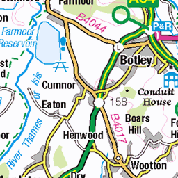
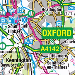
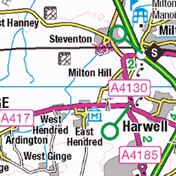
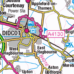
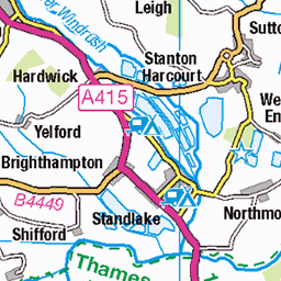
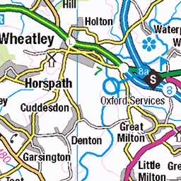
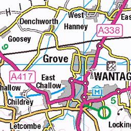
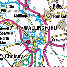
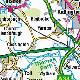
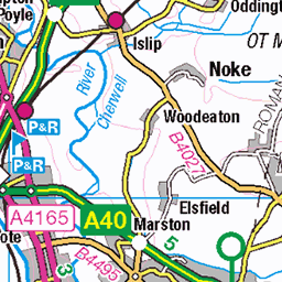
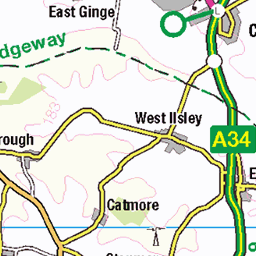
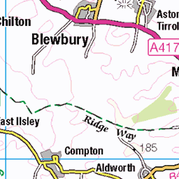
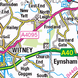
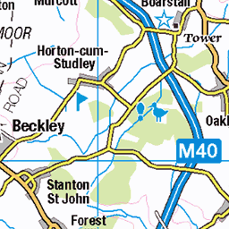
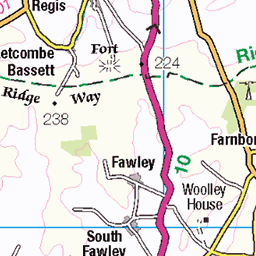
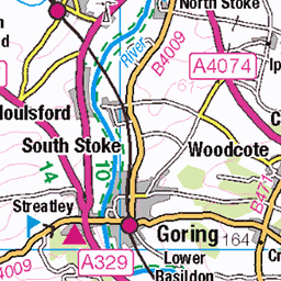
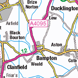
OS Map
This is OS mapping. In some areas, OpenStreetMap shows more footpaths
Spatial NI has online OSNI mapping. Click "Basemap Gallery" (4 squares icon at the top).
Now would be a good time for a cup of tea.
GPX Editor
Record map clicks
Reload map
Photos
Please tag your photos and upload them to the British and Irish Mountains group on Flickr
The other photos have been geo-tagged as on or around the summit. For less busy mountains, it can be a little hit and miss.
Spring
26-Mar-25 • Ian Campsall • flickr
oxfordshire england unitedkingdom englishcountryside evening eveninglight sunset valeofthewhitehorse spring silhouette 54413154494
Oxford Bus Company 375 in Stert Street, Abingdon on Saturday 8 March 2025
08-Mar-25 • Wanderer 30 • flickr
54373535944
Sunset On The Thames
05-Mar-25 • Ian Campsall • flickr
oxfordshire england unitedkingdom reflection riverthames sunset sky abingdon valeofthewhitehorse 54410977296
Abingdon Lock At Dusk
03-Mar-25 • Ian Campsall • flickr
oxfordshire england unitedkingdom englishcountryside evening valeofthewhitehorse sunset reflection riverthames canalboat 54363517441
Abingdon Evening
03-Mar-25 • Ian Campsall • flickr
oxfordshire england unitedkingdom sthelenschurch valeofthewhitehorse sunset abingdon abingdononthames englishcountryside markettown 54363517226

Sunset On The Thames
25-Feb-25 • Ian Campsall • flickr
oxfordshire england unitedkingdom abingdon englishcountryside evening eveninglight sunset reflection riverthames valeofthewhitehorse 54349881122

Evening On The Thames
17-Feb-25 • Ian Campsall • flickr
oxfordshire england unitedkingdom abingdon englishcountryside evening eveninglight riverthames reflection valeofthewhitehorse 54350774546

Witte Trappist
12-Feb-25 • Neilfatea • flickr
beer trappist brewerytap abbey glass drink 54397279579


19440 Andersey Island c
Rye Farm Car Park with one hour free to jump the gate to gain the island "high point" then on to explore the more interesting Nag's Head Island plus a few benchmarks in Abingdon. Name:Andersey Island Hill number:19440 Height:52.6m / 173ft Parent (Ma):none RHB Section:39: Central and Eastern England County/UA:Oxfordshire Island:Non Tump island Catchment:Thames Class:SIB Grid ref:SU 50239 96553 Summit feature:no feature Drop:2m Col:51m River Observations:level summit area; ground at SU 50842 96895 and ground at SU 50222 96501 are just lower
14-Aug-23 • Dugswell2 • flickr
restdayabingdon abingdon anderseyisland sib p2 nontumpisland 53152338451
Videos
Old cheap Hubsan drone, last year video. Saturday 9th May 2020. Used the sounds that were recorded on the phone using the ...
abingdon #uk #floods #breakingnews #breaking.
Floods playlist linked below. Last of this type of thing. On a missing disk just found yesterday in an unused DVD player so here is ...
Notes
- Data: Database of British and Irish Hills v18.2
- Maps: We use OS mapping for England, Scotland, Wales, and the Isle of Man. Sadly, Channel Islands, Northern (OSNI) and Southern Ireland (OSI) mapping isn't available online, so we use Openstreetmap.