Hills of Britain and Ireland
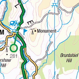
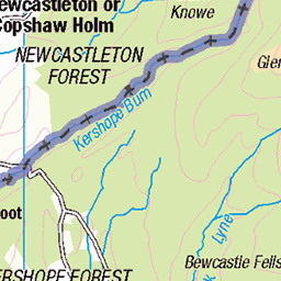
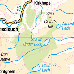
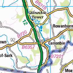
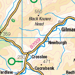
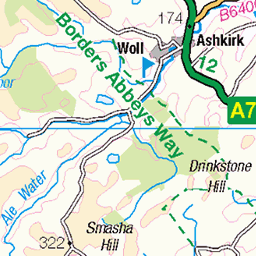
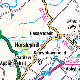
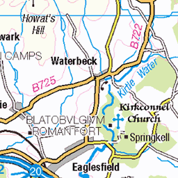
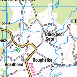
OS Map of Wisp Hill
Height: 595m / 1952ft • Prominence: 261m / 856ft • Summit : fence corner 2m SW of trig point • Trip reports (hill-bagging)

Leyland Olympian - H223VKU - Mosspaul Hotel
Leyland Olympian H223VKU, in livery of previous owner McLean's of Airdrie. This tri-axle Alexander bodied Leyland Olmpian saw service in Hong Kong, later being re-imported and operating for Stagecoach as fleet number 13611.
21-Sep-19 • cessna152towser • flickr
mosspaul stagecoach mcleans alexander leyland olympian h223vku 48770365986

S1554 - Wisp Hill
NY386993, LR79. HISTORY Pillar built in 1936, exact date and cost not on record. Computed as primary triangulation station PP317 within Figure 3 of the OSGB36 retriangulation network during 1937. Levelled to second class precision in 1958. Final pre-GPS maintenance by the OS was in May 1977. This marker continues to be maintained by the OS as a GPS passive station. SITE VISIT Approached from northeast. Parked in southbound layby on A7 at NY402997. Up from Mosspaul, beeline route up hill to summit. Pillar in fair condition. Spider centre plugged with tar. Flush bracket faces east, compass measurement 99°. All sight holes open, innards filled with debris. Full 360° panoramic view includes Skelfhill Pen, Tudhope Hill, Roan Fell, Monument Hill and longer views to the Lake District. Photographed: 21st April 2018, GRP. ═════════════════════════ Interactive index: www.google.com/maps/d/viewer?mid=1arx2Qmo5mVeVUJA2lzVG_uzbYPW59ffh&ll=55.284425,-2.967520&z=12" rel="noreferrer nofollow Google My Maps Map: www.flickr.com/photos/13460108@N06/30020901788/in/album-72157692190778971/ Trig Pillars on OS Landranger 79 ═════════════════════════ Neighbouring Triangulation Pillars www.flickr.com/photos/13460108@N06/8100954954/in/set-72157631801120468 S7502 - Tudhope Hill : 2.76 miles to the east. www.flickr.com/photos/13460108@N06/8117246255/in/set-72157631838876970 10240 - White Hill : 3.38 miles to the south. www.flickr.com/photos/13460108@N06/8117248109/in/set-72157631838876970/ 10257 - Dod Fell : 3.98 miles to the southwest. www.flickr.com/photos/13460108@N06/8100954182/in/set-72157631801120468/ S7510 - Skelfhill Pen : 4.14 miles to the northeast. www.flickr.com/photos/13460108@N06/8114094650/in/set-72157631831281682 S9903 - Stock Hill : 4.61 miles to the northwest. www.flickr.com/photos/13460108@N06/8100981860/in/set-72157631801120468 S7993 - Din Fell : 5.01 miles to the southeast. ═════════════════════════ www.360cities.net/image/s1554-wisp-hill" rel="noreferrer nofollow Panorama from Wisp Hilll [Open New Tab] ═════════════════════════
21-Apr-18 • Graeme5015 • flickr
s1554 wisphill teviothead mosspaul a7 hawick langholm 1372874894

comms
mast
26-Aug-12 • Lets Bike It (Howard D Mattinson in Canonbie) • flickr
mobile wire phone o2 hills packet mast microwave barb relay fell comb antenna lattice communications parabolic hillwalk combhill 7871475780

1915 Wisp Hill
Parked opposite Mosspaul Hotel, easy up and down in 65 mins on dry clear morning....no sign of over graizing here. Name:Wisp Hill Hill number:1915 Height:595m / 1952ft RHB Section:28B: The River Tweed to the English Border County/UA:Scottish Borders (UA), Dumfries and Galloway (UA) Catchment:Catchment Boundaries, Esk (Gretna), Tweed Watershed:Tweedmouth, Ardnamurchan Point to Lowestoft, Cardiff to Cape Wrath, Dover to Cape Wrath, Lowestoft to Duncansby Head, Land's End to John o' Groats, Solway Firth, The Lizard to Dunnet Head Class:Marilyn, Hump, Dodd (500-599m), Donald Dewey, Yeaman Grid ref:NY 38645 99346 Summit feature:fence corner 2m SW of trig point Drop:261m Col:334m NT253071
05-Aug-09 • Dugswell2 • flickr
trigpoint s1554 wisphilltrigpoint wisphill p261 marilyn hump dodd tump donalddewey yeaman 49248939143

1915 Wisp Hill a
05-Aug-09 • Dugswell2 • flickr
trigpoint s1554 wisphilltrigpoint wisphill p261 marilyn hump dodd tump donalddewey yeaman 49249409391

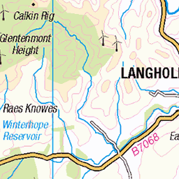
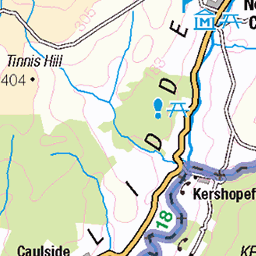
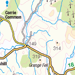
OS Map
This is OS mapping. In some areas, OpenStreetMap shows more footpaths
Spatial NI has online OSNI mapping. Click "Basemap Gallery" (4 squares icon at the top).
Now would be a good time for a cup of tea.
GPX Editor
Record map clicks
Reload map
Photos
Please tag your photos and upload them to the British and Irish Mountains group on Flickr
The other photos have been geo-tagged as on or around the summit. For less busy mountains, it can be a little hit and miss.
Leyland Olympian - H223VKU - Mosspaul Hotel
Leyland Olympian H223VKU, in livery of previous owner McLean's of Airdrie. This tri-axle Alexander bodied Leyland Olmpian saw service in Hong Kong, later being re-imported and operating for Stagecoach as fleet number 13611.
21-Sep-19 • cessna152towser • flickr
mosspaul stagecoach mcleans alexander leyland olympian h223vku 48770365986
S1554 - Wisp Hill
NY386993, LR79. HISTORY Pillar built in 1936, exact date and cost not on record. Computed as primary triangulation station PP317 within Figure 3 of the OSGB36 retriangulation network during 1937. Levelled to second class precision in 1958. Final pre-GPS maintenance by the OS was in May 1977. This marker continues to be maintained by the OS as a GPS passive station. SITE VISIT Approached from northeast. Parked in southbound layby on A7 at NY402997. Up from Mosspaul, beeline route up hill to summit. Pillar in fair condition. Spider centre plugged with tar. Flush bracket faces east, compass measurement 99°. All sight holes open, innards filled with debris. Full 360° panoramic view includes Skelfhill Pen, Tudhope Hill, Roan Fell, Monument Hill and longer views to the Lake District. Photographed: 21st April 2018, GRP. ═════════════════════════ Interactive index: www.google.com/maps/d/viewer?mid=1arx2Qmo5mVeVUJA2lzVG_uzbYPW59ffh&ll=55.284425,-2.967520&z=12" rel="noreferrer nofollow Google My Maps Map: www.flickr.com/photos/13460108@N06/30020901788/in/album-72157692190778971/ Trig Pillars on OS Landranger 79 ═════════════════════════ Neighbouring Triangulation Pillars www.flickr.com/photos/13460108@N06/8100954954/in/set-72157631801120468 S7502 - Tudhope Hill : 2.76 miles to the east. www.flickr.com/photos/13460108@N06/8117246255/in/set-72157631838876970 10240 - White Hill : 3.38 miles to the south. www.flickr.com/photos/13460108@N06/8117248109/in/set-72157631838876970/ 10257 - Dod Fell : 3.98 miles to the southwest. www.flickr.com/photos/13460108@N06/8100954182/in/set-72157631801120468/ S7510 - Skelfhill Pen : 4.14 miles to the northeast. www.flickr.com/photos/13460108@N06/8114094650/in/set-72157631831281682 S9903 - Stock Hill : 4.61 miles to the northwest. www.flickr.com/photos/13460108@N06/8100981860/in/set-72157631801120468 S7993 - Din Fell : 5.01 miles to the southeast. ═════════════════════════ www.360cities.net/image/s1554-wisp-hill" rel="noreferrer nofollow Panorama from Wisp Hilll [Open New Tab] ═════════════════════════
21-Apr-18 • Graeme5015 • flickr
s1554 wisphill teviothead mosspaul a7 hawick langholm 1372874894
comms
mast
26-Aug-12 • Lets Bike It (Howard D Mattinson in Canonbie) • flickr
mobile wire phone o2 hills packet mast microwave barb relay fell comb antenna lattice communications parabolic hillwalk combhill 7871475780
1915 Wisp Hill
Parked opposite Mosspaul Hotel, easy up and down in 65 mins on dry clear morning....no sign of over graizing here. Name:Wisp Hill Hill number:1915 Height:595m / 1952ft RHB Section:28B: The River Tweed to the English Border County/UA:Scottish Borders (UA), Dumfries and Galloway (UA) Catchment:Catchment Boundaries, Esk (Gretna), Tweed Watershed:Tweedmouth, Ardnamurchan Point to Lowestoft, Cardiff to Cape Wrath, Dover to Cape Wrath, Lowestoft to Duncansby Head, Land's End to John o' Groats, Solway Firth, The Lizard to Dunnet Head Class:Marilyn, Hump, Dodd (500-599m), Donald Dewey, Yeaman Grid ref:NY 38645 99346 Summit feature:fence corner 2m SW of trig point Drop:261m Col:334m NT253071
05-Aug-09 • Dugswell2 • flickr
trigpoint s1554 wisphilltrigpoint wisphill p261 marilyn hump dodd tump donalddewey yeaman 49248939143
1915 Wisp Hill a
05-Aug-09 • Dugswell2 • flickr
trigpoint s1554 wisphilltrigpoint wisphill p261 marilyn hump dodd tump donalddewey yeaman 49249409391
Videos
None found
Notes
- Data: Database of British and Irish Hills v18.2
- Maps: We use OS mapping for England, Scotland, Wales, and the Isle of Man. Sadly, Channel Islands, Northern (OSNI) and Southern Ireland (OSI) mapping isn't available online, so we use Openstreetmap.