Hills of Britain and Ireland
OS Map of Papa Stronsay
Height: 13m / 43ft • Prominence: 13m / 43ft • Summit : chambered cairn • Trip reports (hill-bagging)

19070 Papa Stronsay
10-Aug-22 • Dugswell2 • flickr
orkneyislands papastronsay p13 sib islandpapastronsay golgothamonasteryisland 52303052326

19070 Papa Stronsay a
10-Aug-22 • Dugswell2 • flickr
orkneyislands papastronsay p13 sib islandpapastronsay golgothamonasteryisland 52303326734

19070 Papa Stronsay b
Landed at Bountifur pier by the Brimoy having phoned Golgotha monastery first for permission. Walked around with no interaction or site of monks via track then fields to summit then flat pack lighthouse. A very tidy place with healthy sheep. Name:Papa Stronsay Hill number:19070 Height:13m / 43ft Parent (Ma):none RHB Section:23: Orkney Islands County/UA:Orkney Islands (UA) Island:Non Tump island Maritime area:Orkney - North Class:SIB Grid ref:HY665299 (est) Drop:13m Col:Sea
10-Aug-22 • Dugswell2 • flickr
papastronsay p13 sib islandpapastronsay golgothamonasteryisland 52303551095

19070 Papa Stronsay c
10-Aug-22 • Dugswell2 • flickr
orkneyislands papastronsay p13 sib islandpapastronsay golgothamonasteryisland 52303552990

Islander leaving Stronsay Airport
07-Sep-21 • Reading Tom • flickr
orkney stronsay airport islander 51484667675

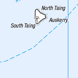
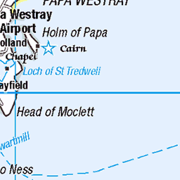
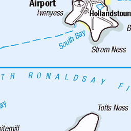
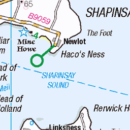
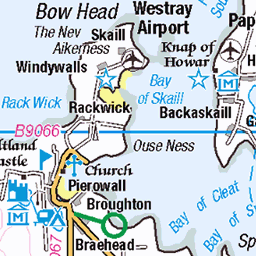
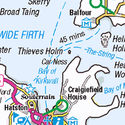
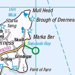
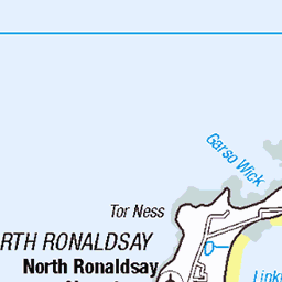
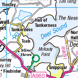
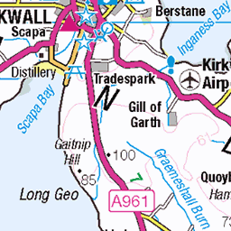
OS Map
This is OS mapping. In some areas, OpenStreetMap shows more footpaths
Spatial NI has online OSNI mapping. Click "Basemap Gallery" (4 squares icon at the top).
Now would be a good time for a cup of tea.


GPX Editor
Record map clicks
Reload map
Photos
Please tag your photos and upload them to the British and Irish Mountains group on Flickr
The other photos have been geo-tagged as on or around the summit. For less busy mountains, it can be a little hit and miss.
19070 Papa Stronsay
10-Aug-22 • Dugswell2 • flickr
orkneyislands papastronsay p13 sib islandpapastronsay golgothamonasteryisland 52303052326
19070 Papa Stronsay a
10-Aug-22 • Dugswell2 • flickr
orkneyislands papastronsay p13 sib islandpapastronsay golgothamonasteryisland 52303326734
19070 Papa Stronsay b
Landed at Bountifur pier by the Brimoy having phoned Golgotha monastery first for permission. Walked around with no interaction or site of monks via track then fields to summit then flat pack lighthouse. A very tidy place with healthy sheep. Name:Papa Stronsay Hill number:19070 Height:13m / 43ft Parent (Ma):none RHB Section:23: Orkney Islands County/UA:Orkney Islands (UA) Island:Non Tump island Maritime area:Orkney - North Class:SIB Grid ref:HY665299 (est) Drop:13m Col:Sea
10-Aug-22 • Dugswell2 • flickr
papastronsay p13 sib islandpapastronsay golgothamonasteryisland 52303551095
19070 Papa Stronsay c
10-Aug-22 • Dugswell2 • flickr
orkneyislands papastronsay p13 sib islandpapastronsay golgothamonasteryisland 52303552990
Islander leaving Stronsay Airport
07-Sep-21 • Reading Tom • flickr
orkney stronsay airport islander 51484667675


MV Earl Thorfinn at Whitehall Pier
07-Sep-21 • Reading Tom • flickr
orkney whitehall stronsay 51484661815


In the galley on the ferry from Stronsay to Kirkwall
07-Sep-21 • Reading Tom • flickr
orkney ferry 51483688861

Videos
This is a teaser of an upcoming interview with Bruce Fletcher of the Stronsay Limpet, which goes live on Wednesday 23rd Nov.
Bruce Fletcher has been the editor of The Stronsay Limpet since 2009. In this film he explains how the newsletter came about and ...
Our Lady's Chapel Stronsay island Orkney If you like, follow me❤️: Youtube: ...
This is my island tour of Orkney. Today I'm on Stronsay, I would've liked to go to Papa Stronsay but unfortunately didn't have time.
Notes
- Data: Database of British and Irish Hills v18.2
- Maps: We use OS mapping for England, Scotland, Wales, and the Isle of Man. Sadly, Channel Islands, Northern (OSNI) and Southern Ireland (OSI) mapping isn't available online, so we use Openstreetmap.