Hills of Britain and Ireland
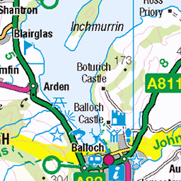
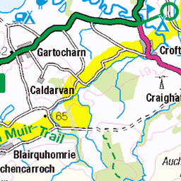
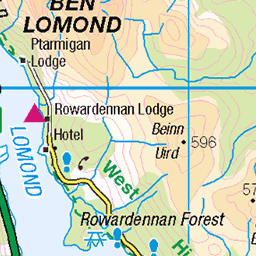
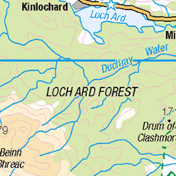
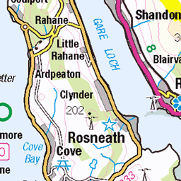
OS Map of Inchfad
Height: 24m / 79ft • Prominence: 16m / 52ft • Summit : no feature: bracken • Trip reports (hill-bagging)

"Inchfad Island" Loch Lomond. Scotland
A view over privately owned “Inchfad Island” to the village of Luss on the western shore of beautiful Loch Lomond, with “Beinn Dubh” and “Glen Striddle Horseshoe” mountain range in the background.
27-Nov-24 • The Jacobite • flickr
island landscape loch mountain mountains olympusom5 panoramic photography scotland water 54170656385

Evening approaches
Camera: Minolta X-300 Lens: Vivitar 28mm F2 Film: Kodak Tri-X 400 Processing and Scanning: Gulabi Photo Lab, Glasgow Post Processing: Photoscape X
27-Sep-24 • The Urban Hermit • flickr
minolta minoltax300 vivitar vivitarlens vivitar28mm kodak kodaktrix400 gulabi gulabiphoto blackandwhite blackwhite monochrome lochlomond scotland 54138548207

Sunset Island
Camera: Minolta X-300S Lens: Minolta 28-70 F3.5 Film: Kodak Aerocolor IV (Washi X) Processing and Scanning: Gulabi Photo Lab, Glasgow Post Processing: Photoscape X
27-Sep-24 • The Urban Hermit • flickr
minolta minoltax300s minoltalens minolta2870f35 kodak kodakaerocoloriv washi washix gulabi gulabiphoto 35mm 35mmfilm 35mmphotography lochlomond scotland 54103929107

Loch Lomond - Scotland
12-Sep-24 • TRABANTINO* • flickr
video scotland uk unitedkingdom lochlomond lake water boat cruise highlands 54000398332


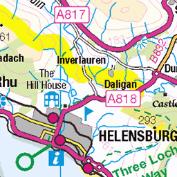
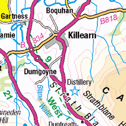
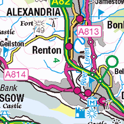
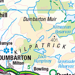
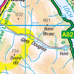
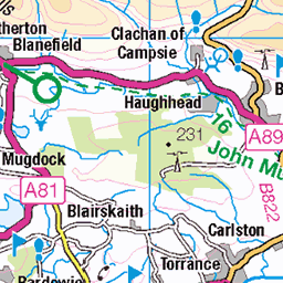
OS Map
This is OS mapping. In some areas, OpenStreetMap shows more footpaths
Spatial NI has online OSNI mapping. Click "Basemap Gallery" (4 squares icon at the top).
Now would be a good time for a cup of tea.

GPX Editor
Record map clicks
Reload map
Photos
Please tag your photos and upload them to the British and Irish Mountains group on Flickr
The other photos have been geo-tagged as on or around the summit. For less busy mountains, it can be a little hit and miss.
"Inchfad Island" Loch Lomond. Scotland
A view over privately owned “Inchfad Island” to the village of Luss on the western shore of beautiful Loch Lomond, with “Beinn Dubh” and “Glen Striddle Horseshoe” mountain range in the background.
27-Nov-24 • The Jacobite • flickr
island landscape loch mountain mountains olympusom5 panoramic photography scotland water 54170656385
Evening approaches
Camera: Minolta X-300 Lens: Vivitar 28mm F2 Film: Kodak Tri-X 400 Processing and Scanning: Gulabi Photo Lab, Glasgow Post Processing: Photoscape X
27-Sep-24 • The Urban Hermit • flickr
minolta minoltax300 vivitar vivitarlens vivitar28mm kodak kodaktrix400 gulabi gulabiphoto blackandwhite blackwhite monochrome lochlomond scotland 54138548207
Sunset Island
Camera: Minolta X-300S Lens: Minolta 28-70 F3.5 Film: Kodak Aerocolor IV (Washi X) Processing and Scanning: Gulabi Photo Lab, Glasgow Post Processing: Photoscape X
27-Sep-24 • The Urban Hermit • flickr
minolta minoltax300s minoltalens minolta2870f35 kodak kodakaerocoloriv washi washix gulabi gulabiphoto 35mm 35mmfilm 35mmphotography lochlomond scotland 54103929107
Loch Lomond - Scotland
12-Sep-24 • TRABANTINO* • flickr
video scotland uk unitedkingdom lochlomond lake water boat cruise highlands 54000398332


19050 Inchfad
Fifth SIB on a seven island cruise from Aldochlay with Jill & Charlie. Name:Inchfad Hill number:19050 Height:24m / 79ft Parent (Ma):none RHB Section:01C: Loch Lomond to Strathyre County/UA:Stirling (UA) Island:Non Tump island Maritime area:Freshwater Catchment:Leven (Dumbarton) Class:SIB Grid ref:NS 39822 90873 Summit feature:no feature: bracken Drop:16m Col:8m Loch
10-Sep-22 • Dugswell2 • flickr
lochlomond highbracken inchfad p16 sib freshwaterislandinchfad 52398820787
Videos
What a beautiful afternoon spent waiting on the #sunset in #lochlomond. peaceful ✌️ #scotland #mountains.
Cashel Campsite motorcycle parking at Loch Lomond on NC500 Scotland We had a fantastic stay at Cashel Campsite on the ...
Notes
- Data: Database of British and Irish Hills v18.2
- Maps: We use OS mapping for England, Scotland, Wales, and the Isle of Man. Sadly, Channel Islands, Northern (OSNI) and Southern Ireland (OSI) mapping isn't available online, so we use Openstreetmap.