Hills of Britain and Ireland
OS Map of Glas-leac Mor

ullapool dolphins
31-May-23 • stusmith_uk • flickr
scotland coast ullapool summerisles rossshire dolphin may 2023 53033227232

ullapool dolphins
31-May-23 • stusmith_uk • flickr
scotland rossshire westerross summerisles ullapool dolphins assynt june 2023 53004274372

ullapool dolphins
31-May-23 • stusmith_uk • flickr
scotland coast ullapool dolphins summerisles assynt rossshire may 2023 53091740555

ullapool dolphins
31-May-23 • stusmith_uk • flickr
scotland rossshire ullapool summerisles dolphins may 2023 53063133405

ullapool dolphins
31-May-23 • stusmith_uk • flickr
scotland coast ullapool dolphins summerisles rossshire may 2923 53119958512

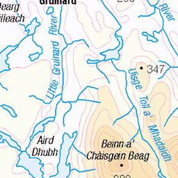
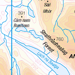
18791 Glas-leac Mòr
Fifth island of thirteen on day one of our Seascape Expedition Summer Isles trip organised by Captain Holmes. We landed on rocks to the east side of the island then used a narrow rocky ramp to gain the island proper. Name: Glas-leac Mòr Hill number: 18791 Height:30m / 98ft Parent (Ma/M): none Section: 16F: Lochinver to Ullapool County/UA: Highland (UA) Maritime Area:Gruinard & The Summer Isles Island: Mono Tump island Class: Tump (0-99m), SIB Grid ref: NB950099 (est) Drop: 30m Col: Sea
25-Jul-15 • Dugswell2 • flickr
summerisles glasleacmòr 20561489856
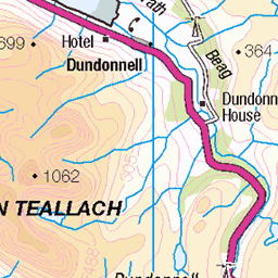
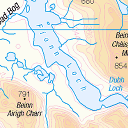
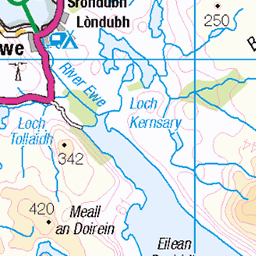
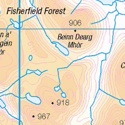
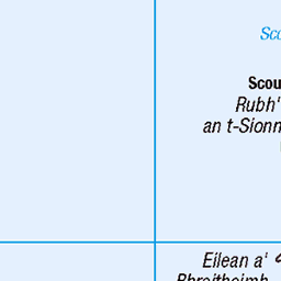
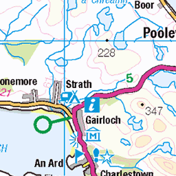
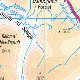
OS Map
This is OS mapping. In some areas, OpenStreetMap shows more footpaths
Spatial NI has online OSNI mapping. Click "Basemap Gallery" (4 squares icon at the top).
Now would be a good time for a cup of tea.


GPX Editor
Record map clicks
Reload map
Photos
Please tag your photos and upload them to the British and Irish Mountains group on Flickr
The other photos have been geo-tagged as on or around the summit. For less busy mountains, it can be a little hit and miss.
ullapool dolphins
31-May-23 • stusmith_uk • flickr
scotland coast ullapool summerisles rossshire dolphin may 2023 53033227232
ullapool dolphins
31-May-23 • stusmith_uk • flickr
scotland rossshire westerross summerisles ullapool dolphins assynt june 2023 53004274372
ullapool dolphins
31-May-23 • stusmith_uk • flickr
scotland coast ullapool dolphins summerisles assynt rossshire may 2023 53091740555
ullapool dolphins
31-May-23 • stusmith_uk • flickr
scotland rossshire ullapool summerisles dolphins may 2023 53063133405
ullapool dolphins
31-May-23 • stusmith_uk • flickr
scotland coast ullapool dolphins summerisles rossshire may 2923 53119958512
18791 Glas-leac Mòr
Fifth island of thirteen on day one of our Seascape Expedition Summer Isles trip organised by Captain Holmes. We landed on rocks to the east side of the island then used a narrow rocky ramp to gain the island proper. Name: Glas-leac Mòr Hill number: 18791 Height:30m / 98ft Parent (Ma/M): none Section: 16F: Lochinver to Ullapool County/UA: Highland (UA) Maritime Area:Gruinard & The Summer Isles Island: Mono Tump island Class: Tump (0-99m), SIB Grid ref: NB950099 (est) Drop: 30m Col: Sea
25-Jul-15 • Dugswell2 • flickr
summerisles glasleacmòr 20561489856

18791 Glas-leac Mòr a
Fifth island of thirteen on day one of our Seascape Expedition Summer Isles trip organised by Captain Holmes. We landed on rocks to the east side of the island then used a narrow rocky ramp to gain the island proper. Name: Glas-leac Mòr Hill number: 18791 Height:30m / 98ft Parent (Ma/M): none Section: 16F: Lochinver to Ullapool County/UA: Highland (UA) Maritime Area:Gruinard & The Summer Isles Island: Mono Tump island Class: Tump (0-99m), SIB Grid ref: NB950099 (est) Drop: 30m Col: Sea
25-Jul-15 • Dugswell2 • flickr
summerisles p30 tump islandtop glasleacmòr 20587809705

18791 Glas-leac Mòr b
Fifth island of thirteen on day one of our Seascape Expedition Summer Isles trip organised by Captain Holmes. We landed on rocks to the east side of the island then used a narrow rocky ramp to gain the island proper. Name: Glas-leac Mòr Hill number: 18791 Height:30m / 98ft Parent (Ma/M): none Section: 16F: Lochinver to Ullapool County/UA: Highland (UA) Maritime Area:Gruinard & The Summer Isles Island: Mono Tump island Class: Tump (0-99m), SIB Grid ref: NB950099 (est) Drop: 30m Col: Sea
25-Jul-15 • Dugswell2 • flickr
summerisles p30 tump islandtop glasleacmòr 19966861113


Videos
None found
Notes
- Data: Database of British and Irish Hills v18.2
- Maps: We use OS mapping for England, Scotland, Wales, and the Isle of Man. Sadly, Channel Islands, Northern (OSNI) and Southern Ireland (OSI) mapping isn't available online, so we use Openstreetmap.