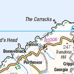
Hills of Britain and Ireland
OS Map of Mullion Island

Porth Mellin
Next to Mullion Cove on the Lizard peninsular Cornwall
england sea uk water winter porthmellin mullion thelizard cornwall ocean tlantic ea coast harbour harbourside wayoutwest britain february boat fishingboats boats 54324333629


A Quiet Corner
Mullion Harbour, located on the west coast of the Lizard peninsula, has been withstanding the Atlantic waves since the 1890s, when it was built by Lord Robartes of Lanhydrock in an attempt to create a commercial port. The harbour did not function well for larger vessels but it did work well to shelter the local fishing fleet. Today it provides a haven for a few commercial fishing boats, outdoor activity providers, recreational boats and a dozen seafront properties. In 2004, looking to an uncertain future with a predicted increase in the frequency and strength of storms along with rising sea levels and growing cost implications, the National Trust commissioned the Mullion Harbour Study, which was completed in 2006. The study looked at the harbour structure and the impact of coastal change and a changing climate on its future management. The conclusion was that the harbour was in better condition than anticipated, but that maintenance alone would not be able to counteract increasing environmental pressures. A long-term strategy and management plan for Mullion Harbour was drawn together with the local community, statutory organisations and other stakeholders. It was agreed that money would be spent on regular maintenance and repairs, until a ‘tipping point’ or ‘threshold’ was reached: when it is no longer viable to repair the continual and increasing damage to affected parts of the harbour structure. It is hard to predict when these ‘thresholds’ will be reached and what they will look like. As each challenge arises the focus would move towards adapting affected parts of the harbour to improve resilience. Unfortunately, in 2023 parts of the southern breakwater reached a ‘threshold’ and adaptations to ensure it remains safe are being made. On a Sunday morning last spring, I found myself squashed into a corner with Katorrria. at the top of the harbour slipway. This was because a small army of volunteers was scattered around the remainder of the concrete apron on their hands and knees. Each was armed with a trowel and a pot of cement. They appeared to be filling in potholes. Apparently they were taking part in a lime pointing training session. One of the community initiatives co-ordinated by the National Trust to keep this lovely place maintained. Adapted from: www.nationaltrust.org.uk/visit/cornwall/mullion-cove/our-work-at-mullion-cove" rel="noreferrer nofollow www.nationaltrust.org.uk/visit/cornwall/mullion-cove/our-... www.nationaltrust.org.uk/visit/cornwall/mullion-cove/events" rel="noreferrer nofollow www.nationaltrust.org.uk/visit/cornwall/mullion-cove/events
14-Apr-24 • suerowlands2013 • flickr
mullioncove lizardpeninsula westcornwall nationaltrust fishingboat netloft harbourwalls spring greysky 54341589775

Linnet
Predannack Head, The Lizard
18-May-23 • doublejeopardy • flickr
linnet thelizard predannick helston england unitedkingdom 54229202425

Stonechat
Predannack Head, The Lizard
18-May-23 • doublejeopardy • flickr
bird cornwall avian stonechat helston england unitedkingdom 54229032128
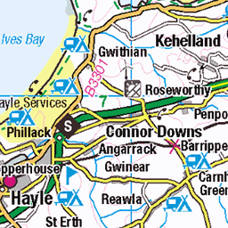
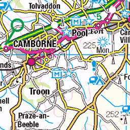
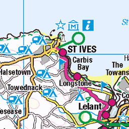
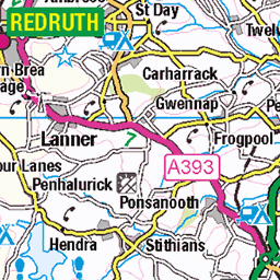
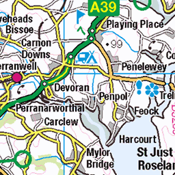
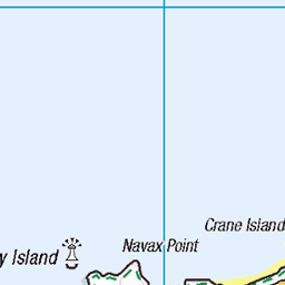
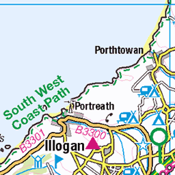
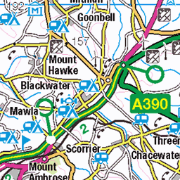
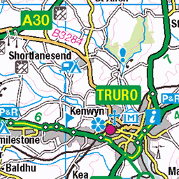
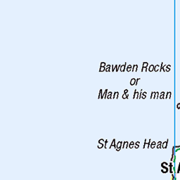
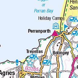
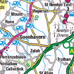
OS Map
This is OS mapping. In some areas, OpenStreetMap shows more footpaths
Spatial NI has online OSNI mapping. Click "Basemap Gallery" (4 squares icon at the top).
Now would be a good time for a cup of tea.


GPX Editor
Record map clicks
Reload map
Photos
Please tag your photos and upload them to the British and Irish Mountains group on Flickr
The other photos have been geo-tagged as on or around the summit. For less busy mountains, it can be a little hit and miss.
Porth Mellin
Next to Mullion Cove on the Lizard peninsular Cornwall
england sea uk water winter porthmellin mullion thelizard cornwall ocean tlantic ea coast harbour harbourside wayoutwest britain february boat fishingboats boats 54324333629
A Quiet Corner
Mullion Harbour, located on the west coast of the Lizard peninsula, has been withstanding the Atlantic waves since the 1890s, when it was built by Lord Robartes of Lanhydrock in an attempt to create a commercial port. The harbour did not function well for larger vessels but it did work well to shelter the local fishing fleet. Today it provides a haven for a few commercial fishing boats, outdoor activity providers, recreational boats and a dozen seafront properties. In 2004, looking to an uncertain future with a predicted increase in the frequency and strength of storms along with rising sea levels and growing cost implications, the National Trust commissioned the Mullion Harbour Study, which was completed in 2006. The study looked at the harbour structure and the impact of coastal change and a changing climate on its future management. The conclusion was that the harbour was in better condition than anticipated, but that maintenance alone would not be able to counteract increasing environmental pressures. A long-term strategy and management plan for Mullion Harbour was drawn together with the local community, statutory organisations and other stakeholders. It was agreed that money would be spent on regular maintenance and repairs, until a ‘tipping point’ or ‘threshold’ was reached: when it is no longer viable to repair the continual and increasing damage to affected parts of the harbour structure. It is hard to predict when these ‘thresholds’ will be reached and what they will look like. As each challenge arises the focus would move towards adapting affected parts of the harbour to improve resilience. Unfortunately, in 2023 parts of the southern breakwater reached a ‘threshold’ and adaptations to ensure it remains safe are being made. On a Sunday morning last spring, I found myself squashed into a corner with Katorrria. at the top of the harbour slipway. This was because a small army of volunteers was scattered around the remainder of the concrete apron on their hands and knees. Each was armed with a trowel and a pot of cement. They appeared to be filling in potholes. Apparently they were taking part in a lime pointing training session. One of the community initiatives co-ordinated by the National Trust to keep this lovely place maintained. Adapted from: www.nationaltrust.org.uk/visit/cornwall/mullion-cove/our-work-at-mullion-cove" rel="noreferrer nofollow www.nationaltrust.org.uk/visit/cornwall/mullion-cove/our-... www.nationaltrust.org.uk/visit/cornwall/mullion-cove/events" rel="noreferrer nofollow www.nationaltrust.org.uk/visit/cornwall/mullion-cove/events
14-Apr-24 • suerowlands2013 • flickr
mullioncove lizardpeninsula westcornwall nationaltrust fishingboat netloft harbourwalls spring greysky 54341589775
Linnet
Predannack Head, The Lizard
18-May-23 • doublejeopardy • flickr
linnet thelizard predannick helston england unitedkingdom 54229202425
Stonechat
Predannack Head, The Lizard
18-May-23 • doublejeopardy • flickr
bird cornwall avian stonechat helston england unitedkingdom 54229032128


December Storm
Mullion
08-Dec-19 • doublejeopardy • flickr
bw storm mullionharbour helston england unitedkingdom 54224930922

Crested unknown bird
Photographed on the Lizard
21-Jun-19 • doublejeopardy • flickr
helston england unitedkingdom 54225522325

A gull keeping an eye on me
Cornwall
09-Sep-15 • Ian Gedge • flickr
uk britain england greatbritain cornwall kernow bird gull 54342694768
Videos
Please like & Subscribe. Enjoy the views of Mullion Cove Harbour on a sunny winter day. Join the Adventure! Footage shot in 4K ...
Did you know there was lighthouse in Mullion Cove? We take a short 3 mile circular walk exploring Mullion and the coast nearby.
Notes
- Data: Database of British and Irish Hills v18.2
- Maps: We use OS mapping for England, Scotland, Wales, and the Isle of Man. Sadly, Channel Islands, Northern (OSNI) and Southern Ireland (OSI) mapping isn't available online, so we use Openstreetmap.