Hills of Britain and Ireland
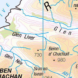
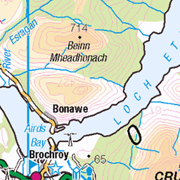
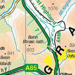
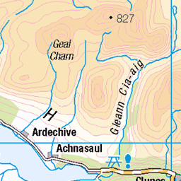
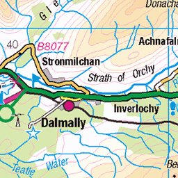
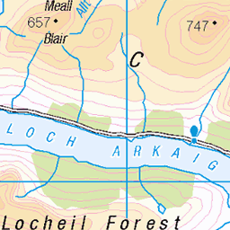
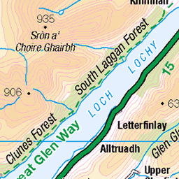
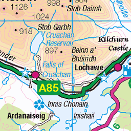
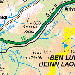
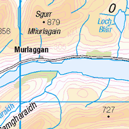
OS Map of Garbh Bheinn

Ascending Glen a Chaolais
Meall Dearg
26-Dec-24 • markhorrell • flickr
hillwalking britain scotland glencoe 54236610368

Still ascending Glen a Chaolais
Meall Dearg
26-Dec-24 • markhorrell • flickr
hillwalking britain scotland glencoe 54236610343

Edita at the top end of Glen a Chaolais
Meall Dearg
26-Dec-24 • markhorrell • flickr
hillwalking britain scotland glencoe 54236374441

Edita crosses a river in Glen a Chaolais
Meall Dearg
26-Dec-24 • markhorrell • flickr
hillwalking britain scotland glencoe 54236786200

Approaching the top of Glen a Chaolais
Meall Dearg
26-Dec-24 • markhorrell • flickr
hillwalking britain scotland glencoe 54236610318

View across Coire Cam to the Aonach Eagach ridge
Meall Dearg
26-Dec-24 • markhorrell • flickr
hillwalking britain scotland glencoe 54235473072
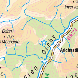
OS Map
This is OS mapping. In some areas, OpenStreetMap shows more footpaths
Spatial NI has online OSNI mapping. Click "Basemap Gallery" (4 squares icon at the top).
Now would be a good time for a cup of tea.
GPX Editor
Record map clicks
Reload map
Photos
Please tag your photos and upload them to the British and Irish Mountains group on Flickr
The other photos have been geo-tagged as on or around the summit. For less busy mountains, it can be a little hit and miss.
Ascending Glen a Chaolais
Meall Dearg
26-Dec-24 • markhorrell • flickr
hillwalking britain scotland glencoe 54236610368
Still ascending Glen a Chaolais
Meall Dearg
26-Dec-24 • markhorrell • flickr
hillwalking britain scotland glencoe 54236610343
Edita at the top end of Glen a Chaolais
Meall Dearg
26-Dec-24 • markhorrell • flickr
hillwalking britain scotland glencoe 54236374441
Edita crosses a river in Glen a Chaolais
Meall Dearg
26-Dec-24 • markhorrell • flickr
hillwalking britain scotland glencoe 54236786200
Approaching the top of Glen a Chaolais
Meall Dearg
26-Dec-24 • markhorrell • flickr
hillwalking britain scotland glencoe 54236610318
View across Coire Cam to the Aonach Eagach ridge
Meall Dearg
26-Dec-24 • markhorrell • flickr
hillwalking britain scotland glencoe 54235473072

Edita with the Aonach Eagach ridge behind
Meall Dearg
26-Dec-24 • markhorrell • flickr
hillwalking britain scotland glencoe 54236374406

Me with the Aonach Eagach ridge behind
Meall Dearg
26-Dec-24 • markhorrell • flickr
hillwalking britain scotland glencoe 54236374341

High above Glen a Chaolais
Meall Dearg
26-Dec-24 • markhorrell • flickr
hillwalking britain scotland glencoe 54235473027

On the way up Meall Dearg
Meall Dearg
26-Dec-24 • markhorrell • flickr
hillwalking britain scotland glencoe 54236610228
Videos
a great day out on this hill.all bits of scrambling in video can easily bypassed.
Name: Garbh Bheinn Classifications: Corbett, Marilyn Area: Kinlochleven Height: 867m / 2844ft Grid Ref. NN 16950 60080 ...
Coiseach air Garbh Bheinn (Ceann Loch Liobhainn). Bha duil agam Beinn Trilleachan a dheanamh ach bha rathad Gleann Eite ...
The Great wall of China is one of the greatest wonders of the world. We had the divide of Germany with the Berlin wall. Then there ...
My latest Munro Bagging adventure. A trip to Glencoe with questionable weather forecast saw us heading up into the hills. Creise ...
Notes
- Data: Database of British and Irish Hills v18.2
- Maps: We use OS mapping for England, Scotland, Wales, and the Isle of Man. Sadly, Channel Islands, Northern (OSNI) and Southern Ireland (OSI) mapping isn't available online, so we use Openstreetmap.