Hills of Britain and Ireland
OS Map of Saddle Yoke


Moffat - 1/850 - f/6.4
140710_3sw_4996.dng
10-Jul-14 • Stefan 'Stoipi' Seger • flickr
scotland flickr unitedkingdom moffat 2014 island2014 15143427377


Carrifran and Ravencraig - 133
10-Jun-13 • warthog373 • flickr
dumfriesshire moffatdale carrifran 9061198420

Saddle Yoke
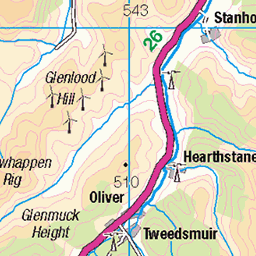
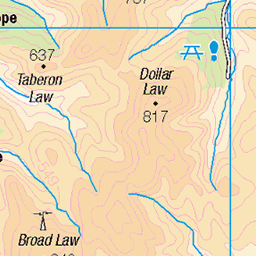
Saddle Yoke (2,411 feet) and its near neighbour Under Saddle Yoke (2,444 feet) are two of the most distinctive peaks in the Southern Uplands of Scotland. They are located approximately 6 miles north-east of the Dumfries and Galloway town of Moffat and tower impressively above the U-shaped glacial valley of the Moffat Water. Unlike most of the other hills hereabouts which are rounded and flat-topped, Saddle Yoke and Under Saddle Yoke have shapely summits and lie on a highly defined ridge, sandwiched between the lateral valleys of the Blackhope Burn and the Carrifran Burn. Saddle Yoke and Under Saddle Yoke can be quickly climbed by following the south ridge up from Capplegill on the A708 road in Moffat Dale. Such a short walk hardly does justice to the area, however, and it is far better to continue around the head of the Blackhope Burn to Hart Fell ( www.flickr.com/photos/67668518@N08/8595730543/in/photostream www.flickr.com/photos/67668518@N08/8595730543/in/photostream ) and then return southwards to Capplegill over Swatte Fell. The horseshoe walk is about 10 miles long and involves 2,245 feet of climbing. It is relatively easy in good conditions but some of the ascents are steep and great care will be needed in winter if there is ice on the ground or cornices on the ridge. The picture I have uploaded was taken looking northwards over Moffat Dale towards the twin peaks of Saddle Yoke from the lower slopes of Broken Back, near Selcoth. The heather-clad hill to the right of Saddle Yoke is Carrifran Gans (2,484 feet).
02-Jun-11 • Tony Garofalo • flickr
mountain rural walking landscape scotland countryside day pentax cloudy hiking hill scenic donald moffat hillwalking southernuplands saddleyoke moffathills moffatwater moffatdale carrifrangans donaldtop undersaddleyoke 8595384396
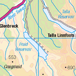
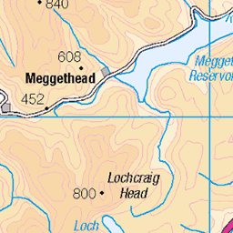
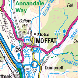
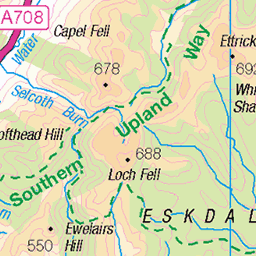
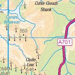
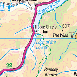
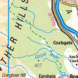
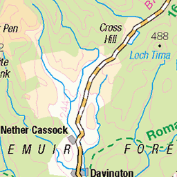
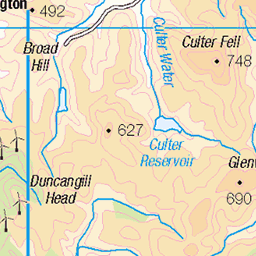
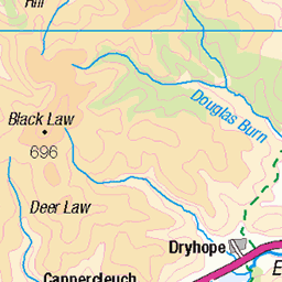
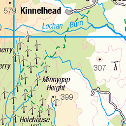
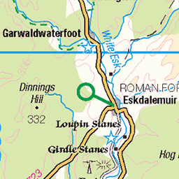
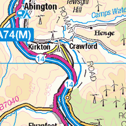
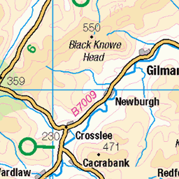
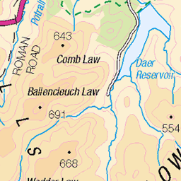
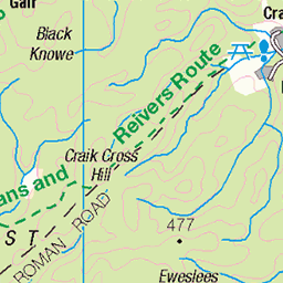
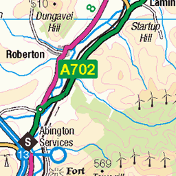
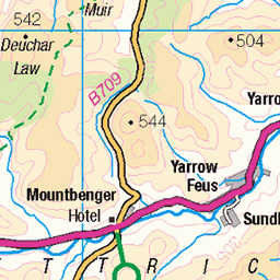
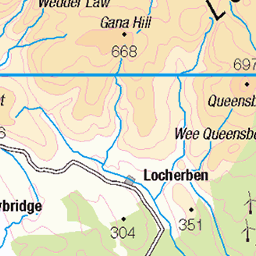
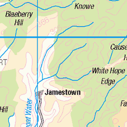
OS Map
This is OS mapping. In some areas, OpenStreetMap shows more footpaths
Spatial NI has online OSNI mapping. Click "Basemap Gallery" (4 squares icon at the top).
Now would be a good time for a cup of tea.
GPX Editor
Record map clicks
Reload map
Photos
Please tag your photos and upload them to the British and Irish Mountains group on Flickr
The other photos have been geo-tagged as on or around the summit. For less busy mountains, it can be a little hit and miss.
Moffat - 1/850 - f/6.4
140710_3sw_4996.dng
10-Jul-14 • Stefan 'Stoipi' Seger • flickr
scotland flickr unitedkingdom moffat 2014 island2014 15143427377
Carrifran and Ravencraig - 133
10-Jun-13 • warthog373 • flickr
dumfriesshire moffatdale carrifran 9061198420
Saddle Yoke
Saddle Yoke (2,411 feet) and its near neighbour Under Saddle Yoke (2,444 feet) are two of the most distinctive peaks in the Southern Uplands of Scotland. They are located approximately 6 miles north-east of the Dumfries and Galloway town of Moffat and tower impressively above the U-shaped glacial valley of the Moffat Water. Unlike most of the other hills hereabouts which are rounded and flat-topped, Saddle Yoke and Under Saddle Yoke have shapely summits and lie on a highly defined ridge, sandwiched between the lateral valleys of the Blackhope Burn and the Carrifran Burn. Saddle Yoke and Under Saddle Yoke can be quickly climbed by following the south ridge up from Capplegill on the A708 road in Moffat Dale. Such a short walk hardly does justice to the area, however, and it is far better to continue around the head of the Blackhope Burn to Hart Fell ( www.flickr.com/photos/67668518@N08/8595730543/in/photostream www.flickr.com/photos/67668518@N08/8595730543/in/photostream ) and then return southwards to Capplegill over Swatte Fell. The horseshoe walk is about 10 miles long and involves 2,245 feet of climbing. It is relatively easy in good conditions but some of the ascents are steep and great care will be needed in winter if there is ice on the ground or cornices on the ridge. The picture I have uploaded was taken looking northwards over Moffat Dale towards the twin peaks of Saddle Yoke from the lower slopes of Broken Back, near Selcoth. The heather-clad hill to the right of Saddle Yoke is Carrifran Gans (2,484 feet).
02-Jun-11 • Tony Garofalo • flickr
mountain rural walking landscape scotland countryside day pentax cloudy hiking hill scenic donald moffat hillwalking southernuplands saddleyoke moffathills moffatwater moffatdale carrifrangans donaldtop undersaddleyoke 8595384396
Videos
Join Douglas as he takes an opportunistic Monday afternoon off work to head to the Southern Uplands to tackle the Hart Fell ...
Hart Fell, Swatte Fell and Under Saddle Yoke Circular on a lovely day in November 2020.
This time I was going to tackle the Hart fell Horseshoe from Capplegill , it was a lovely day for it but a few steep climbs lay ahead in ...
Explore the stunning landscapes of Moffatt Dale, Scotland, as we take on the Hart Fell Ridge Horseshoe! This breath-taking hike ...
A nice hillwalk near Moffat in Dumfries and Galloway. 22nd Oct 2020.
Notes
- Data: Database of British and Irish Hills v18.2
- Maps: We use OS mapping for England, Scotland, Wales, and the Isle of Man. Sadly, Channel Islands, Northern (OSNI) and Southern Ireland (OSI) mapping isn't available online, so we use Openstreetmap.