Hills of Britain and Ireland
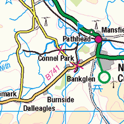
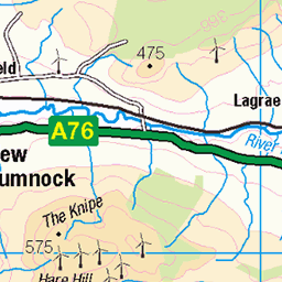
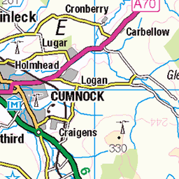
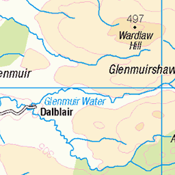
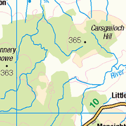
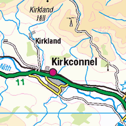
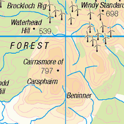
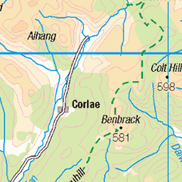
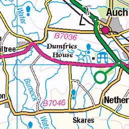
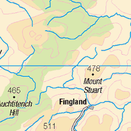
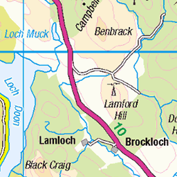
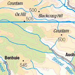
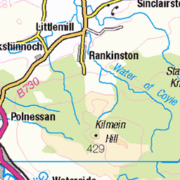
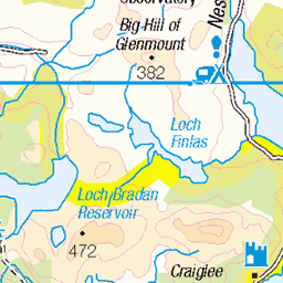
OS Map of Blackcraig Hill

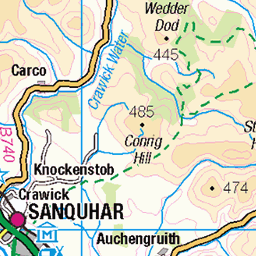
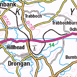
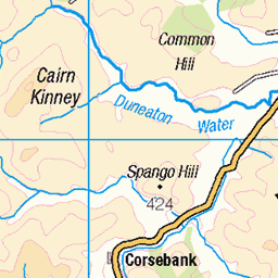
OS Map
This is OS mapping. In some areas, OpenStreetMap shows more footpaths
Spatial NI has online OSNI mapping. Click "Basemap Gallery" (4 squares icon at the top).
Now would be a good time for a cup of tea.
GPX Editor
Record map clicks
Reload map
Photos
Please tag your photos and upload them to the British and Irish Mountains group on Flickr
The other photos have been geo-tagged as on or around the summit. For less busy mountains, it can be a little hit and miss.


1743 Blackcraig Hill
Blackcraig farm. Then up towards this farm beford diverting across a small bridge to use gate to get onto hill. Then north through some fields before taking a more direct route to Blackcraig Hill with 2 inches of snow on its northern side. Then onto Blacklorg Hill which was easy enough before returning by a route crossing the Craig Burn to join a track lower down to Craig Farm and then back to the minor road Name:Blackcraig Hill Hill number:1743 Height:700.9m / 2300ft Section:27C: The Glenkens to Annandale Area:Carsphairn Hills County/UA:East Ayrshire (UA) Class:Marilyn, Hump, Simm, Graham, Donald, Current County/UA Top (Ma,Hu,Tu,Sim,G,D,DN,CoU) Grid ref:NS 64767 06407 Summit feature:cairn Drop:236m Col:465m NX608982 Observations:trig point 50m NW at NS 64741 06451 is 0.4m lower Survey:Leica RX1250
10-Apr-16 • Dugswell2 • flickr
marilyn donald graham hump simm trigpoint tump p236 blackcraighill currentcountyuatop 25749134143

1743 Blackcraig Hill
Looking towards trig point from near the summit. Name:Blackcraig Hill Hill number:1743 Height:700.9m / 2300ft Section:27C: The Glenkens to Annandale Area:Carsphairn Hills County/UA:East Ayrshire (UA) Class:Marilyn, Hump, Simm, Graham, Donald, Current County/UA Top (Ma,Hu,Tu,Sim,G,D,DN,CoU) Grid ref:NS 64767 06407 Summit feature:cairn Drop:236m Col:465m NX608982 Observations:trig point 50m NW at NS 64741 06451 is 0.4m lower Survey:Leica RX1250
10-Apr-16 • Dugswell2 • flickr
marilyn donald graham hump simm trigpoint tump p236 blackcraighill currentcountyuatop 26079032800
Videos
We get a reasonable days weather for a change as we walk a Cannock Hill, Blackcraig and Blacklorg route. A good days walking.
Some great views today as we walk the Blaclcraig and Blacklorg curcuit down at Glen Afton. A perfect day for walking albeit cold ...
Karen and I took a wee wander up Glen Afton which is about 15 miles down the road. We did no go for a long walk as Karen was ...
Carrick Lane burn flowing into the top end of Loch Doon. Bow, Coran of Portmark and Black Craig in the background. Beautiful ...
This trailer for 'Back to the Fields' (a film documenting the history of the Ayrshire town of New Cumnock) deals with the towns ...
Notes
- Data: Database of British and Irish Hills v18.2
- Maps: We use OS mapping for England, Scotland, Wales, and the Isle of Man. Sadly, Channel Islands, Northern (OSNI) and Southern Ireland (OSI) mapping isn't available online, so we use Openstreetmap.