Hills of Britain and Ireland
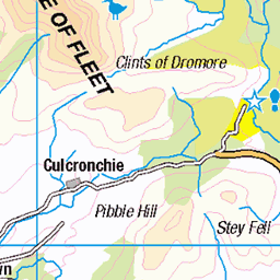
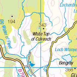
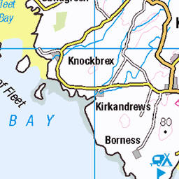
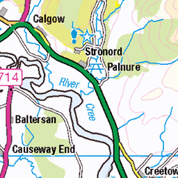
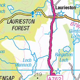
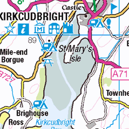
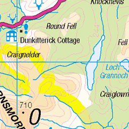
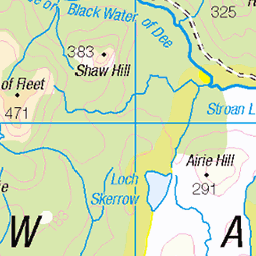
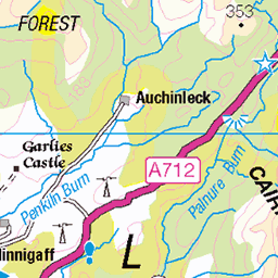
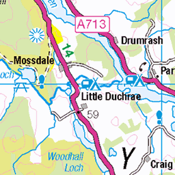
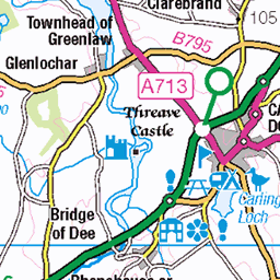
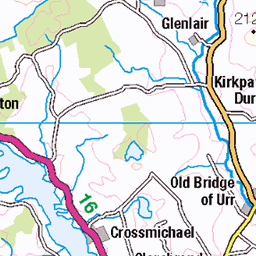
OS Map of Cairnharrow


Cairnharrow hill detail
30-Sep-19 • Odd Wellies • flickr
cairnharrowhill covenanters nx5254 49022647787

96. Kirkdale, Dumfries & Galloway. 30/05/12.
DCIM\100GOPRO
06-May-13 • Dannie & Chris • flickr
8927397476

un20 - NoFB - Cairnharrow
NX533560, LR83. HISTORY Pillar completed 26th November 1954 costing £50.10s.0d. Computed by Distomat survey as secondary triangulation station NX56/DM/8 within the Kirkcudbright secondary block, and levelled (height to top of pillar) to second class precision during 1958. This pillar station was last maintained by the Ordnance Survey in May 1988. SITE VISIT Parked at NX525546 where the badly maintained public road ends. Followed the boundary line NE to the shoulder of the hill at NX535552 then turned northwards and headed up to the summit. The pillar is in good condition. The spider centre is plugged with tar. This pillar was built without a flush bracket. The northmost and southmost sight holes are open. Long views to the Lake District and Isle of Man. Photographed: 16th June 2010, GRP. ═════════════════════════ Map: www.flickr.com/photos/13460108@N06/39995539702 Trig Pillars on OS Landranger 83 ═════════════════════════ Neighbouring Triangulation Pillars www.flickr.com/photos/13460108@N06/8109916226/in/set-72157631821839859/ S8317 - Anwoth : 3.3 miles, 91.5 ° (east) S8372 - Meikle Bennan : 3.4 miles, 15.4 ° (NNE) www.flickr.com/photos/13460108@N06/8109895641/in/set-72157631821839859/ S8191 - Cree : 5.2 miles, 300.6 ° (WNW) S8291 - Barlocco : 5.6 miles, 138.0 ° (southeast) S8230 - Eggerness : 6.2 miles, 207.5 ° (SSW) S8465 - Bengray : 6.5 miles, 69.1 ° (ENE) S1561 - Cairnsmore of Fleet : 7.1 miles, 343.9 ° (NNW) S8428 - Standing Stone : 7.2 miles, 107.0 ° (ESE) ═════════════════════════
16-Jun-10 • Graeme5015 • flickr
cairnharrow nofb triangulationpillar triangulation trigpoint trig anwoth 8132121767

Cambret Hill TV / Radio Relay Station, 1986
Senior Transmitter Engineer Brian Mackay takes some measurements on the main BBC1 (Scotland) UHF TV relay transposer and amplifier, a 1kW Klystron 'steamer' (vapour-cooled). The equipment in the back corner was a VHF radio transposer. Senior Transmitter Engineer Harry Crossley, hiding behind the steps, undertakes some maintenance. This was in 1986, not too long after the integration of HF (overseas broadcasting) and TV Transmitter Maintenance Teams, whereby new and different transmitter engineering disciplines were undertaken on both sides, and routine maintenance visits such as this were carried out by former HF transmitter staff - Skelton, in this case. The site is on Cambret Hill, near Creetown, on the south coast of Scotland, over the Solway from Sandale, the parent (main) transmitter. A flat-plate lifting mount can be seen next to the fluorescent light, used for lifting the Klystron and its cavities into, and out of the focussing magnet coils. - And not a computer or IP addressed piece of kit in sight! Pentax MX, Unknown colour slide film, probably ISO200 somethingorother.
01-Nov-86 • russell_w_b • flickr
cumbria cumberland uhf vhf sandale tvrelay bbctransmitters uhftelevision cambrethill britainsbroadcastingheritage 6421386615
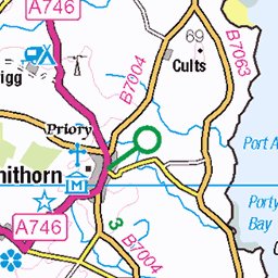
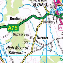
OS Map
This is OS mapping. In some areas, OpenStreetMap shows more footpaths
Spatial NI has online OSNI mapping. Click "Basemap Gallery" (4 squares icon at the top).
Now would be a good time for a cup of tea.

GPX Editor
Record map clicks
Reload map
Photos
Please tag your photos and upload them to the British and Irish Mountains group on Flickr
The other photos have been geo-tagged as on or around the summit. For less busy mountains, it can be a little hit and miss.
Cairnharrow hill detail
30-Sep-19 • Odd Wellies • flickr
cairnharrowhill covenanters nx5254 49022647787
96. Kirkdale, Dumfries & Galloway. 30/05/12.
DCIM\100GOPRO
06-May-13 • Dannie & Chris • flickr
8927397476
un20 - NoFB - Cairnharrow
NX533560, LR83. HISTORY Pillar completed 26th November 1954 costing £50.10s.0d. Computed by Distomat survey as secondary triangulation station NX56/DM/8 within the Kirkcudbright secondary block, and levelled (height to top of pillar) to second class precision during 1958. This pillar station was last maintained by the Ordnance Survey in May 1988. SITE VISIT Parked at NX525546 where the badly maintained public road ends. Followed the boundary line NE to the shoulder of the hill at NX535552 then turned northwards and headed up to the summit. The pillar is in good condition. The spider centre is plugged with tar. This pillar was built without a flush bracket. The northmost and southmost sight holes are open. Long views to the Lake District and Isle of Man. Photographed: 16th June 2010, GRP. ═════════════════════════ Map: www.flickr.com/photos/13460108@N06/39995539702 Trig Pillars on OS Landranger 83 ═════════════════════════ Neighbouring Triangulation Pillars www.flickr.com/photos/13460108@N06/8109916226/in/set-72157631821839859/ S8317 - Anwoth : 3.3 miles, 91.5 ° (east) S8372 - Meikle Bennan : 3.4 miles, 15.4 ° (NNE) www.flickr.com/photos/13460108@N06/8109895641/in/set-72157631821839859/ S8191 - Cree : 5.2 miles, 300.6 ° (WNW) S8291 - Barlocco : 5.6 miles, 138.0 ° (southeast) S8230 - Eggerness : 6.2 miles, 207.5 ° (SSW) S8465 - Bengray : 6.5 miles, 69.1 ° (ENE) S1561 - Cairnsmore of Fleet : 7.1 miles, 343.9 ° (NNW) S8428 - Standing Stone : 7.2 miles, 107.0 ° (ESE) ═════════════════════════
16-Jun-10 • Graeme5015 • flickr
cairnharrow nofb triangulationpillar triangulation trigpoint trig anwoth 8132121767
Cambret Hill TV / Radio Relay Station, 1986
Senior Transmitter Engineer Brian Mackay takes some measurements on the main BBC1 (Scotland) UHF TV relay transposer and amplifier, a 1kW Klystron 'steamer' (vapour-cooled). The equipment in the back corner was a VHF radio transposer. Senior Transmitter Engineer Harry Crossley, hiding behind the steps, undertakes some maintenance. This was in 1986, not too long after the integration of HF (overseas broadcasting) and TV Transmitter Maintenance Teams, whereby new and different transmitter engineering disciplines were undertaken on both sides, and routine maintenance visits such as this were carried out by former HF transmitter staff - Skelton, in this case. The site is on Cambret Hill, near Creetown, on the south coast of Scotland, over the Solway from Sandale, the parent (main) transmitter. A flat-plate lifting mount can be seen next to the fluorescent light, used for lifting the Klystron and its cavities into, and out of the focussing magnet coils. - And not a computer or IP addressed piece of kit in sight! Pentax MX, Unknown colour slide film, probably ISO200 somethingorother.
01-Nov-86 • russell_w_b • flickr
cumbria cumberland uhf vhf sandale tvrelay bbctransmitters uhftelevision cambrethill britainsbroadcastingheritage 6421386615
Videos
None found
Notes
- Data: Database of British and Irish Hills v18.2
- Maps: We use OS mapping for England, Scotland, Wales, and the Isle of Man. Sadly, Channel Islands, Northern (OSNI) and Southern Ireland (OSI) mapping isn't available online, so we use Openstreetmap.