Hills of Britain and Ireland
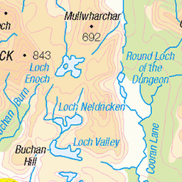
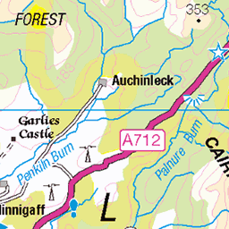
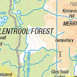
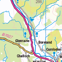
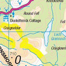
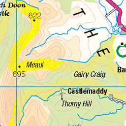
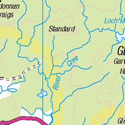
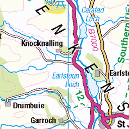
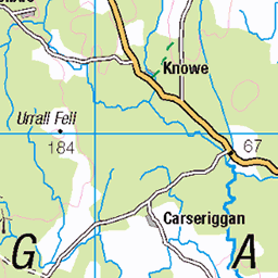
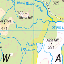
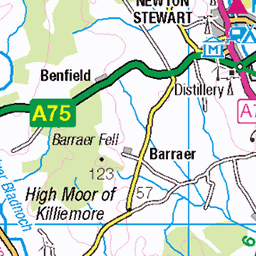
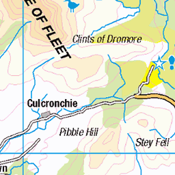
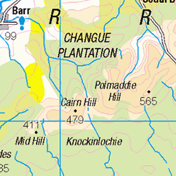
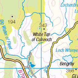
OS Map of Curleywee


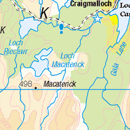
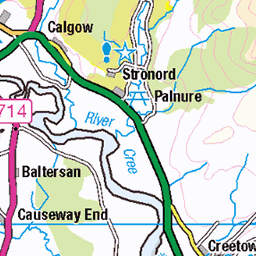
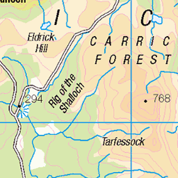
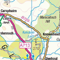
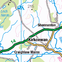
OS Map
This is OS mapping. In some areas, OpenStreetMap shows more footpaths
Spatial NI has online OSNI mapping. Click "Basemap Gallery" (4 squares icon at the top).
Now would be a good time for a cup of tea.

GPX Editor
Record map clicks
Reload map
Photos
Please tag your photos and upload them to the British and Irish Mountains group on Flickr
The other photos have been geo-tagged as on or around the summit. For less busy mountains, it can be a little hit and miss.


Sunset from the Minnigaff hills.
27-Jun-18 • Mark McKie Photography • flickr
galloway gallowayforestpark gallowayhills glentrool minnigaff newtonstewart hills sunset clouds nikon nikonphotography nikond7500 scotland scottishlowlands scottish landscape hillside 29178869538

The Pulnee burn
12-Apr-18 • Mark McKie Photography • flickr
galloway gallowayforestpark gallowayhills minnigaff minnigaffhills nikon nikonphotography nikond7500 scotland scottishlowlands dumfriesgalloway dumfriesandgalloway bonniegalloway stream burn waterfall hill 41429103851
Videos
Lamachan Hill is a hill in the Minnigaff Hills, a sub-range of the Galloway Hills range, part of the Southern Uplands of Scotland.
Contour lines are one of the most useful things shown on a map but there are a few things that you need to know in order to use ...
A wonderful walk available around Loch Trool in Galloway Forrest Park. Very well marked route and very good paths around the ...
Hey guys, Here is episode 2 of our first adventure in the stunning Galloway Forest Park in Scotland. LIKE-SUBSCRIBE & SHARE ...
Hey Guys, Here is the final episode from our adventure in Galloway Forest. Stay tuned for more weekly uploads and don't forget.
Notes
- Data: Database of British and Irish Hills v18.2
- Maps: We use OS mapping for England, Scotland, Wales, and the Isle of Man. Sadly, Channel Islands, Northern (OSNI) and Southern Ireland (OSI) mapping isn't available online, so we use Openstreetmap.