Hills of Britain and Ireland
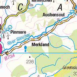
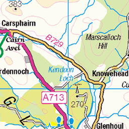
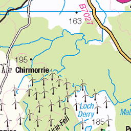
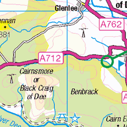
OS Map of Benyellary
Height: 719m / 2359ft • Prominence: 57m / 187ft • Summit : large cairn • Trip reports (hill-bagging)

The Merrick
The Merrick, which is the highest point in the Galloway Hills and the whole of the Southern Uplands, taken from the minor summit Benyellary.
09-Aug-23 • Jonathan Malpass • flickr
themerrick lochenoch galloway dumfriesandgalloway merrick gallowayhills corbetts southwestscotland southernuplands 53180535417


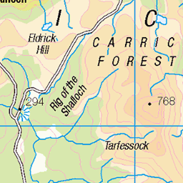
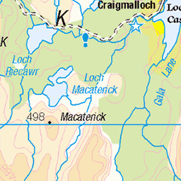
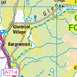
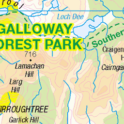
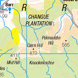
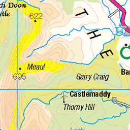
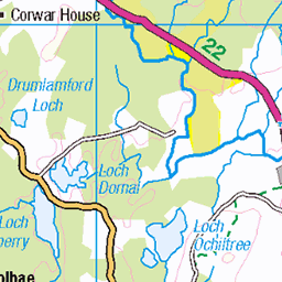
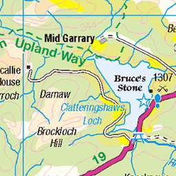
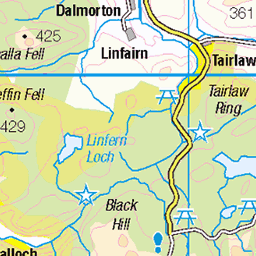
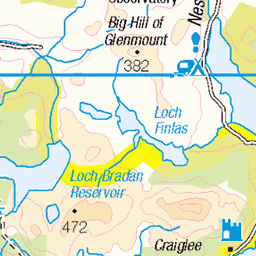
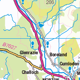
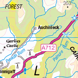
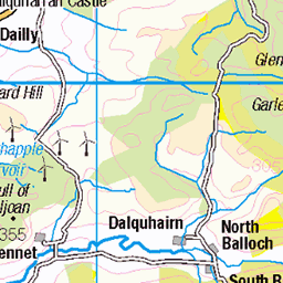
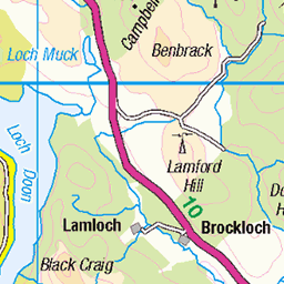
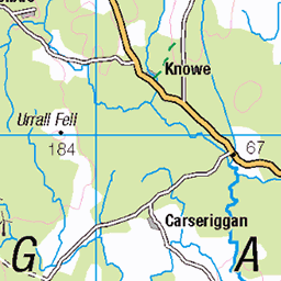
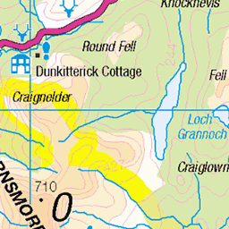
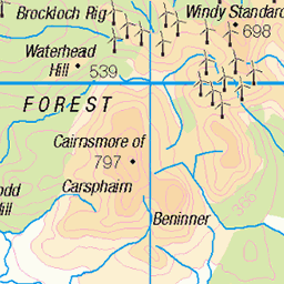
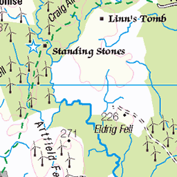
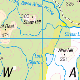
OS Map
This is OS mapping. In some areas, OpenStreetMap shows more footpaths
Spatial NI has online OSNI mapping. Click "Basemap Gallery" (4 squares icon at the top).
Now would be a good time for a cup of tea.
GPX Editor
Record map clicks
Reload map
Photos
Please tag your photos and upload them to the British and Irish Mountains group on Flickr
The other photos have been geo-tagged as on or around the summit. For less busy mountains, it can be a little hit and miss.
The Merrick
The Merrick, which is the highest point in the Galloway Hills and the whole of the Southern Uplands, taken from the minor summit Benyellary.
09-Aug-23 • Jonathan Malpass • flickr
themerrick lochenoch galloway dumfriesandgalloway merrick gallowayhills corbetts southwestscotland southernuplands 53180535417


A silhouette of hikers,the Merrick, Galloway Forest Park, Scotland UK
Returning from walking the highest peak in the area, the Merrick.
themerrick blue scotland galloway gallowayforestpark walking clouds sky silhouette uk hikers dog 49493085988
Videos
Whilst on holiday in Galloway I got the opportunity to go for a day hike and went off to climb the highest point in Galloway and ...
Merrick Mountain Solo Hike - Wild Camp Loch Enoch Scotland. I followed the Merrick trail early afternoon. Passing by Culsharg ...
Join us as we take on Merrick, the highest peak in southern Scotland, from Bruce's Stone at the head of Loch Trool! This wintry ...
Short hike up the Merrick (834m) from Loch Trool via Culsharg Bothy and Benyellary (719m)
'Before Caledonia' A Journey Through Scotland's Ancient Sites. ---------- PayPal - One off Donation ...
Notes
- Data: Database of British and Irish Hills v18.2
- Maps: We use OS mapping for England, Scotland, Wales, and the Isle of Man. Sadly, Channel Islands, Northern (OSNI) and Southern Ireland (OSI) mapping isn't available online, so we use Openstreetmap.