Hills of Britain and Ireland
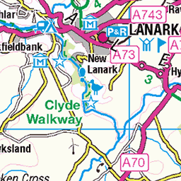
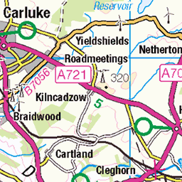
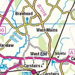
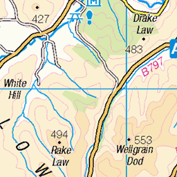
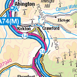
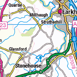
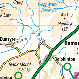
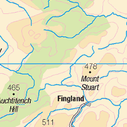
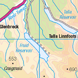
OS Map of Tinto
Height: 712m / 2335ft • Prominence: 443m / 1453ft • Summit : very large cairn • Trip reports (hill-bagging)

Fatlips Castle (9)
This photo, which looks in the same direction as the previous one, is just to show that it isn't always a warm sunny day 1,200 feet up the side of Tinto. (Photo courtesy of www.canmore.org.uk" rel="noreferrer nofollow www.canmore.org.uk )
08-Dec-24 • arjayempee • flickr
2022 fatlipscastle ruinedtower clydesdale scotland dungavelhill 54190470486

Tinto, Lanarkshire, Scotland
Tinto, near Lanark, Lanarkshire, Scotland. Nearing the summit, on top of a bronze-age cairn.
19-Sep-23 • Richard Wintle • flickr
tinto lanarkshire scotland uk hill britain greatbritain cairn bronzeage 53218376074

Fatlips Castle (2)
The site of the castle would appear to be a manmade platform scooped out of the side of the hill, rather than a natural feature, and looks as if the nearby lumps and bumps might contain the remains of subsidiary buildings.
13-Aug-22 • arjayempee • flickr
dji007173stitch symington 2022 fatlipscastle ruinedtower clydesdale scotland 54190908955

Fatlips Castle (3)
The relatively unusual feature of this tower is the wall corners, which are rounded rather than being built with quoin stones.
13-Aug-22 • arjayempee • flickr
dji0075 2022 fatlipscastle ruinedtower clydesdale scotland 54189578037

Fatlips Castle (4)
The rectangular hole in the west (left) wall is the fireplace chimney.
13-Aug-22 • arjayempee • flickr
dji0076 2022 fatlipscastle ruinedtower clydesdale scotland 54190476131

Fatlips Castle (5)
This arch in the east wall is a reinforcing arch over a slit window. The splay provided defenders with a better field of fire, and at other times, with more light to those inside.
13-Aug-22 • arjayempee • flickr
dji0077 2022 fatlipscastle ruinedtower clydesdale scotland 54190740878
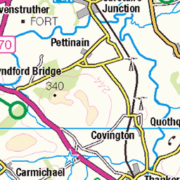
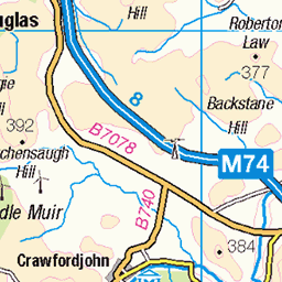
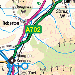
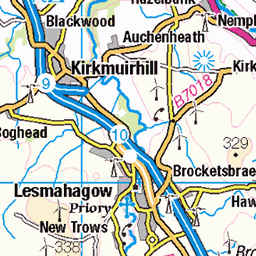
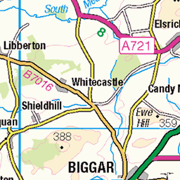
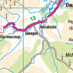
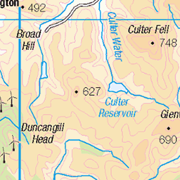
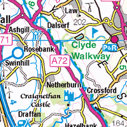
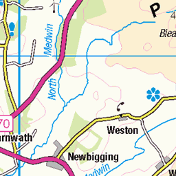
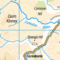
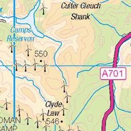
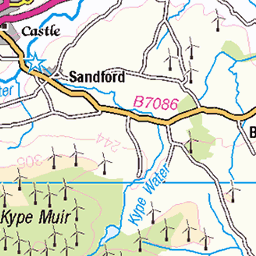
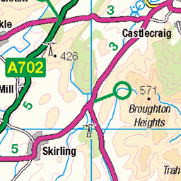
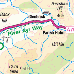
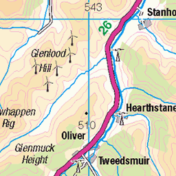
OS Map
This is OS mapping. In some areas, OpenStreetMap shows more footpaths
Spatial NI has online OSNI mapping. Click "Basemap Gallery" (4 squares icon at the top).
Now would be a good time for a cup of tea.
GPX Editor
Record map clicks
Reload map
Photos
Please tag your photos and upload them to the British and Irish Mountains group on Flickr
The other photos have been geo-tagged as on or around the summit. For less busy mountains, it can be a little hit and miss.
Fatlips Castle (9)
This photo, which looks in the same direction as the previous one, is just to show that it isn't always a warm sunny day 1,200 feet up the side of Tinto. (Photo courtesy of www.canmore.org.uk" rel="noreferrer nofollow www.canmore.org.uk )
08-Dec-24 • arjayempee • flickr
2022 fatlipscastle ruinedtower clydesdale scotland dungavelhill 54190470486
Tinto, Lanarkshire, Scotland
Tinto, near Lanark, Lanarkshire, Scotland. Nearing the summit, on top of a bronze-age cairn.
19-Sep-23 • Richard Wintle • flickr
tinto lanarkshire scotland uk hill britain greatbritain cairn bronzeage 53218376074
Fatlips Castle (2)
The site of the castle would appear to be a manmade platform scooped out of the side of the hill, rather than a natural feature, and looks as if the nearby lumps and bumps might contain the remains of subsidiary buildings.
13-Aug-22 • arjayempee • flickr
dji007173stitch symington 2022 fatlipscastle ruinedtower clydesdale scotland 54190908955
Fatlips Castle (3)
The relatively unusual feature of this tower is the wall corners, which are rounded rather than being built with quoin stones.
13-Aug-22 • arjayempee • flickr
dji0075 2022 fatlipscastle ruinedtower clydesdale scotland 54189578037
Fatlips Castle (4)
The rectangular hole in the west (left) wall is the fireplace chimney.
13-Aug-22 • arjayempee • flickr
dji0076 2022 fatlipscastle ruinedtower clydesdale scotland 54190476131
Fatlips Castle (5)
This arch in the east wall is a reinforcing arch over a slit window. The splay provided defenders with a better field of fire, and at other times, with more light to those inside.
13-Aug-22 • arjayempee • flickr
dji0077 2022 fatlipscastle ruinedtower clydesdale scotland 54190740878

Fatlips Castle (6)
There is evidently several feet of fill inside and around the outside of the building. The arch over the fireplace can just be seen behind the stinging-nettles, just above ground level. The arch towards the left of the far (west) wall, contains a slit window, and there is another beside it, facing south, positioned to defend the approach to the door
13-Aug-22 • arjayempee • flickr
dji0079 2022 fatlipscastle ruinedtower clydesdale scotland 54190486741

Fatlips Castle (7)
As stated before, the penetration in the near wall was a slit window. Underground windows being found to be generally ineffective, the ground level on this side would appear to be several feet higher than it used to be.
13-Aug-22 • arjayempee • flickr
dji0080 2022 fatlipscastle ruinedtower clydesdale scotland 54190762394

Fatlips Castle (8)
This is an improbable position to build a castle, however small. Its only real attribute is its expansive view down and across Upper Clydesdale - and that may indeed have been the entire purpose of building it here. Who built it, lived in it and decided to call it 'Fatlips', seems to be a complete mystery. I can't offhand think of any other castle in Scotland that we don't know who owned it. (I have seen one reference to the Turnbulls owning it, but it was a far from conclusive claim in my opinion!)
13-Aug-22 • arjayempee • flickr
dji008184stitch clydewindfarm lamington eastfieldfarm chesterhallfarm startuphill whitesidehill devonshawhill marchlandsfarm dungavelhill lanimerburn 2022 fatlipscastle ruinedtower clydesdale scotland 54190750714

Fatlips Castle (10 of 10)
Looking south across the Clyde, towards the Borderlands. I have nothing further to add about Fatlips, so I will mention that there was for a long time, a rivalry between the relative heights of Tinto, on the side of which we are, and Culter Fell, the highest hill in the distance. There was an old saying in these parts that “Twixt Tintock Tap and Culter Fell there is just one third part of an ell.” A Scots ell equaled 15 inches. Much to the disappointment of the locals round here, when an accurate survey was at last made, Culter Fell was found to be 135 foot higher. Ever since, locals have encouraged the tradition of carrying a stone to the top of Tinto and adding it to the already considerable cairn on the top!
13-Aug-22 • arjayempee • flickr
dji008588stitchb midhangingshaw culterfell wyndaleshouse langholm lamingtonhill lamingtontower feufield meadowfoot eastfieldfarm chesterhallfarm lowtherhillradarstation 2022 fatlipscastle ruinedtower clydesdale scotland 54190732673

1678 Tinto
25th time up Tinto for Chris Watson's promotion to the Marilyn Upper Hall of Fame then to The Crown in Biggar for a lovely meal. Name:Tinto Hill number:1678 Height:711m / 2333ft Section:27A: Ayr to the River Clyde Area:Culter Hills and Tinto County/UA:South Lanarkshire (UA) Class:Marilyn, Hump, Simm, Graham, Donald Grid ref:NS 95322 34368 Summit feature:very large cairn Drop:442m Col:269m NS840203 Observations:trig point 65m W at NS 95287 34366 is lower
16-Oct-16 • Dugswell2 • flickr
tinto marilyn hump simm graham donald tump p442 29901326873
Videos
https://hotelkdm.com/post/review-tinto-hotel #TintoHotel #HotelKDM #hotel #accommodation #motel #review #discount ...
A very popular hill walk in the Southern Uplands, Tinto stands at 711m. This hill had been my first proper hill walk aged 12 or 13 ...
Join me on my quest to 100000 @YouTube subscribers Todays adventure was climbing Tinto hill Please like & subscribe so I can ...
16 Miles, 3 Peaks & 1 Big Adventure – Tinto Hills MTB Ride!** For the very first time in his mountain biking career, Big Stoozer ...
South Lanarkshire MTB Stage 2 – Tinto Summit to Lochlyoch Descent! After conquering the mighty climb to the summit of Tinto ...
Notes
- Data: Database of British and Irish Hills v18.2
- Maps: We use OS mapping for England, Scotland, Wales, and the Isle of Man. Sadly, Channel Islands, Northern (OSNI) and Southern Ireland (OSI) mapping isn't available online, so we use Openstreetmap.