Hills of Britain and Ireland
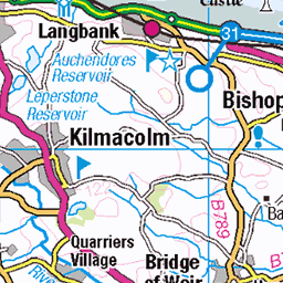
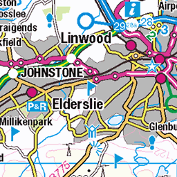
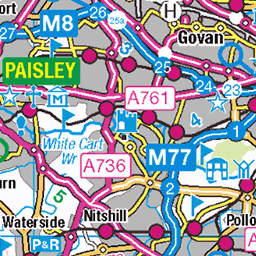
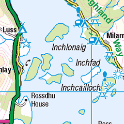
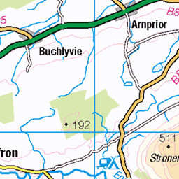
OS Map of Duncolm
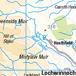
Height: 401m / 1316ft • Prominence: 305m / 1001ft • Summit : no feature 3m SSW of trig point • Trip reports (hill-bagging)


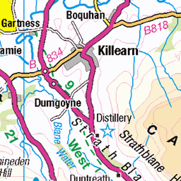
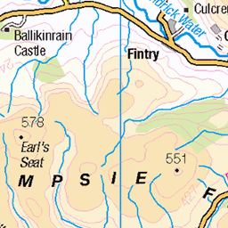
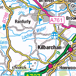
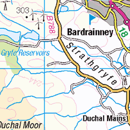
OS Map
This is OS mapping. In some areas, OpenStreetMap shows more footpaths
Spatial NI has online OSNI mapping. Click "Basemap Gallery" (4 squares icon at the top).
Now would be a good time for a cup of tea.

GPX Editor
Record map clicks
Reload map
Photos
Please tag your photos and upload them to the British and Irish Mountains group on Flickr
The other photos have been geo-tagged as on or around the summit. For less busy mountains, it can be a little hit and miss.


Videos
A moderate walk, free parking at Eden Mill Farm Shop G63 9AX Carbeth. Taking in part of the John Muir Way. Approximately 9.5 ...
Duncolm trek.
Duncolm (Scottish Gaelic: Dùn Choluim) is the highest point in both West Dunbartonshire and the Kilpatrick Hills, at an elevation ...
We set off from Brymern st Greenock at 8am so we would have an early start on the hills as the weather forecast wasn't good in ...
Notes
- Data: Database of British and Irish Hills v18.2
- Maps: We use OS mapping for England, Scotland, Wales, and the Isle of Man. Sadly, Channel Islands, Northern (OSNI) and Southern Ireland (OSI) mapping isn't available online, so we use Openstreetmap.