Hills of Britain and Ireland
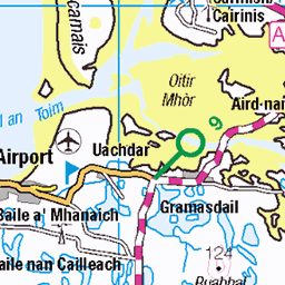
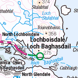
OS Map of Beinn Tairbeirt (Ben Tarbert)
Height: 169m / 553ft • Prominence: 145m / 476ft • Summit : outcrop 3m E of trig point • Trip reports (hill-bagging)


Green caterpillar
08-Jun-16 • Odd Wellies • flickr
scotland unitedkingdom caterpillar southuist nf8038 28178147255

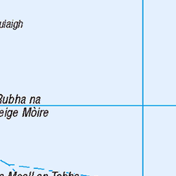
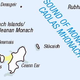
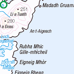
OS Map
This is OS mapping. In some areas, OpenStreetMap shows more footpaths
Spatial NI has online OSNI mapping. Click "Basemap Gallery" (4 squares icon at the top).
Now would be a good time for a cup of tea.


GPX Editor
Record map clicks
Reload map
Photos
Please tag your photos and upload them to the British and Irish Mountains group on Flickr
The other photos have been geo-tagged as on or around the summit. For less busy mountains, it can be a little hit and miss.
Green caterpillar
08-Jun-16 • Odd Wellies • flickr
scotland unitedkingdom caterpillar southuist nf8038 28178147255

Beinn Tairbeirt trigpoint
08-Jun-16 • Odd Wellies • flickr
southuist trigpoint beinntairbeirt nf8039 28143931466

Beinn Tairbeirt trigpoint-2
08-Jun-16 • Odd Wellies • flickr
southuist trigpoint beinntairbeirt nf8039 28178223585

Beinn Tairbeirt FB
08-Jun-16 • Odd Wellies • flickr
benchmark southuist trigpoint flushbracket beinntairbeirt nf8039 28178262895

Painted Lady
08-Jun-16 • Odd Wellies • flickr
butterfly scotland unitedkingdom paintedlady beinntairbeirt nf8039 28178027055
Videos
None found
Notes
- Data: Database of British and Irish Hills v18.2
- Maps: We use OS mapping for England, Scotland, Wales, and the Isle of Man. Sadly, Channel Islands, Northern (OSNI) and Southern Ireland (OSI) mapping isn't available online, so we use Openstreetmap.