Hills of Britain and Ireland
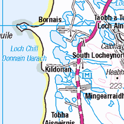
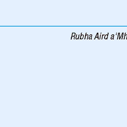
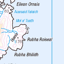
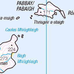
OS Map of Beinn Sgritheann (Ben Scrien)
Height: 186m / 610ft • Prominence: 186m / 610ft • Summit : rocky rib 5m WNW of trig pillar • Trip reports (hill-bagging)


Eriskay football pitch .
The famous Eriskay football pitch,Isle of Eriskay.
12-Aug-24 • Allan ,South Uist. • flickr
53925228391

St Michael's church, Eriskay
A Roman Catholic church sits in Eriskay's main village. It was built in 1903 and has a rounded apse. In this apse is a boat shaped altar designed by Father Calum MacNeill, a former parish priest and pays homage to the local fishing industry.
uk scotland eriskay outerhebrides church building ambaile fathercalummacneill 54018003718

Boat shaped altar
A Roman Catholic church sits in Eriskay's main village. It was built in 1903 and has a rounded apse. In this apse is a boat shaped altar designed by Father Calum MacNeill, a former parish priest and pays homage to the local fishing industry.
uk scotland eriskay outerhebrides church building ambaile fathercalummacneill altar 54017780806

Prince's Beach, Eriskay
Eriskay is a small island now joined to South Uist by a causeway. The ferry to Barra goes from here.
uk scotland outerhebrides eriskay scenery princesbeach 54015319843
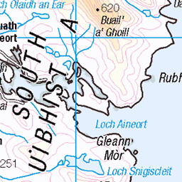
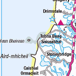
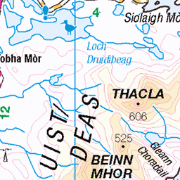
OS Map
This is OS mapping. In some areas, OpenStreetMap shows more footpaths
Spatial NI has online OSNI mapping. Click "Basemap Gallery" (4 squares icon at the top).
Now would be a good time for a cup of tea.


GPX Editor
Record map clicks
Reload map
Photos
Please tag your photos and upload them to the British and Irish Mountains group on Flickr
The other photos have been geo-tagged as on or around the summit. For less busy mountains, it can be a little hit and miss.
Eriskay football pitch .
The famous Eriskay football pitch,Isle of Eriskay.
12-Aug-24 • Allan ,South Uist. • flickr
53925228391
St Michael's church, Eriskay
A Roman Catholic church sits in Eriskay's main village. It was built in 1903 and has a rounded apse. In this apse is a boat shaped altar designed by Father Calum MacNeill, a former parish priest and pays homage to the local fishing industry.
uk scotland eriskay outerhebrides church building ambaile fathercalummacneill 54018003718
Boat shaped altar
A Roman Catholic church sits in Eriskay's main village. It was built in 1903 and has a rounded apse. In this apse is a boat shaped altar designed by Father Calum MacNeill, a former parish priest and pays homage to the local fishing industry.
uk scotland eriskay outerhebrides church building ambaile fathercalummacneill altar 54017780806
Prince's Beach, Eriskay
Eriskay is a small island now joined to South Uist by a causeway. The ferry to Barra goes from here.
uk scotland outerhebrides eriskay scenery princesbeach 54015319843

A beach near the Eriskay causeway
Eriskay is a small island now joined to South Uist by a causeway. The ferry to Barra goes from here.
uk scotland outerhebrides eriskay scenery 54015424264

Eriskay Beach
Beach on Eriskay in the Outer Hebrides.
24-Jun-22 • Errantrail • flickr
sea scotland beach cloud 53940390856
![1623 Beinn Scritheann [Ben Scrien]](https://live.staticflickr.com/65535/52157188388_9719e372d3.jpg)
1623 Beinn Scritheann [Ben Scrien]
05-Jun-22 • Dugswell2 • flickr
beinnscritheannbenscrien eriskay trigpoint s8890 benscrieneriskayitrigpoint p186 marilyn hump tump sib yeaman 52157188388
![1623 Beinn Scritheann [Ben Scrien] a](https://live.staticflickr.com/65535/52157675530_5ab4ace3df.jpg)
1623 Beinn Scritheann [Ben Scrien] a
Parked off road near the highpoint of road then used a track of sorts to a gate then onward to Ben Scrien. Then off to bag the nearby Tump called Cnoc Pairceanan. Name:Beinn Scritheann [Ben Scrien] Hill number:1623 Height:186m / 610ft RHB Section:24C: North Uist, South Uist and Nearby Islands County/UA:Na h-Eileanan Siar [Western Isles] (UA) Island:Eriskay Maritime area:Eriskay & South Uist Watershed:Long Island Class:Marilyn, Hump, Tump (100-199m), SIB, Yeaman Grid ref:NF 79524 11213 Summit feature:rocky rib 5m NW of trig point Drop:186m Col:Sea OS map sheet(s):(1:50k) 31 (1:25k) 452N 453S Survey:Abney level
05-Jun-22 • Dugswell2 • flickr
trigpoint beinnscritheannbenscrien eriskay s8890 benscrieneriskayitrigpoint p186 marilyn hump tump sib yeaman 52157675530

Eriskay
view from Beinn Scrien on Eriskay over the causeway to South Uist
27-Sep-03 • Neil F King • flickr
scotland westernisles outerhebrides island eriskay southuist causeway croft cottage 54078050720

Old ferries at Eriskay Ferry Terminal - MV Eilean na-Oige on the outside with possibly MV Eilean Bhearnaraigh on the inside.
01-Mar-03 • Donald Morrison • flickr
isleofbarra barra mveileanbhearnaraigh mveileannahoige 53944635530
Videos
This is how the Eriskay Ponies have traditionally lived on Eriskay since the time of the Clearances when our ancestors were ...
This walk will take you on a short tour of Eriskay. We will journey along the main road, past the Am Politician, island shop ...
Notes
- Data: Database of British and Irish Hills v18.2
- Maps: We use OS mapping for England, Scotland, Wales, and the Isle of Man. Sadly, Channel Islands, Northern (OSNI) and Southern Ireland (OSI) mapping isn't available online, so we use Openstreetmap.