Hills of Britain and Ireland
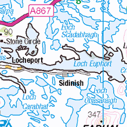
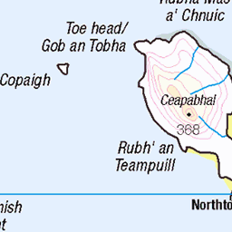
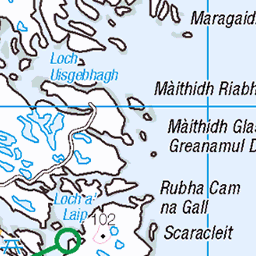
OS Map of Beinn Mhor


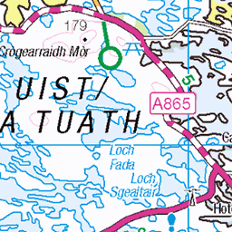
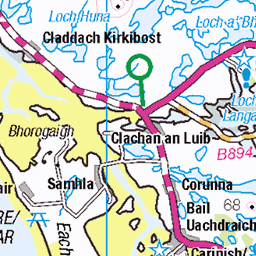
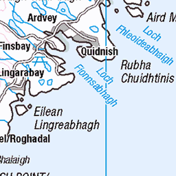
1622 Beinn Mhor
Parked where the Hebridean Way meets the road to the north then up Beinn Mhor and down via Beinn Bhreac with Dangerous Dave. Name:Beinn Mhor Hill number:1622 Height:190m / 623ft RHB Section:24C: North Uist, South Uist and Nearby Islands County/UA:Na h-Eileanan Siar [Western Isles] (UA) Island:North Uist Maritime area:Sound of Harris & Loch Maddy Watershed:Long Island Class:Marilyn, Hump, Tump (100-199m), Yeaman Grid ref:NF 89801 76156 Summit feature:trig point Drop:185m Col:5m NF886747
06-Jun-22 • Dugswell2 • flickr
trigpoint islandnorthuist beinnmhornorthuisttrigpoint s8995 beinnmhor p185 marilyn hump tump yeaman 52160206394

Lunch Stop
06-Jun-22 • Dugswell2 • flickr
trigpoint islandnorthuist beinnmhornorthuisttrigpoint s8995 beinnmhor p185 marilyn hump tump yeaman lunchstop 52160200989

1622 Beinn Mhor d
06-Jun-22 • Dugswell2 • flickr
trigpoint islandnorthuist beinnmhornorthuisttrigpoint s8995 beinnmhor p185 marilyn hump tump yeaman 52158939457
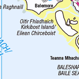
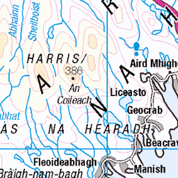
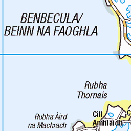
OS Map
This is OS mapping. In some areas, OpenStreetMap shows more footpaths
Spatial NI has online OSNI mapping. Click "Basemap Gallery" (4 squares icon at the top).
Now would be a good time for a cup of tea.


GPX Editor
Record map clicks
Reload map
Photos
Please tag your photos and upload them to the British and Irish Mountains group on Flickr
The other photos have been geo-tagged as on or around the summit. For less busy mountains, it can be a little hit and miss.
1622 Beinn Mhor
Parked where the Hebridean Way meets the road to the north then up Beinn Mhor and down via Beinn Bhreac with Dangerous Dave. Name:Beinn Mhor Hill number:1622 Height:190m / 623ft RHB Section:24C: North Uist, South Uist and Nearby Islands County/UA:Na h-Eileanan Siar [Western Isles] (UA) Island:North Uist Maritime area:Sound of Harris & Loch Maddy Watershed:Long Island Class:Marilyn, Hump, Tump (100-199m), Yeaman Grid ref:NF 89801 76156 Summit feature:trig point Drop:185m Col:5m NF886747
06-Jun-22 • Dugswell2 • flickr
trigpoint islandnorthuist beinnmhornorthuisttrigpoint s8995 beinnmhor p185 marilyn hump tump yeaman 52160206394
Lunch Stop
06-Jun-22 • Dugswell2 • flickr
trigpoint islandnorthuist beinnmhornorthuisttrigpoint s8995 beinnmhor p185 marilyn hump tump yeaman lunchstop 52160200989
1622 Beinn Mhor d
06-Jun-22 • Dugswell2 • flickr
trigpoint islandnorthuist beinnmhornorthuisttrigpoint s8995 beinnmhor p185 marilyn hump tump yeaman 52158939457


Dun An Sticer
dunansticer dun lochansticir ironage reused tower hall 16thcentury dunoftheskulker loch lochan causeway northuist uibhistatuath naheileanansiar naheileanananiar westernisles outerhebrides scotland archhist itmpa tomparnell canon 6d canon6d 48051191317

Dun An Sticer
dunansticer dun lochansticir ironage reused tower hall 16thcentury dunoftheskulker loch lochan composite stitch stitched panorama causeway northuist uibhistatuath naheileanansiar naheileanananiar westernisles outerhebrides scotland archhist itmpa tomparnell canon 6d canon6d 48051104021

Dun An Sticer
You can clearly see the how the later (16th century) tower or hall has reused the earlier dun.
scotland panorama tower composite canon hall stitch loch westernisles stitched dun 16thcentury 6d ironage reused lochan outerhebrides northuist naheileanansiar uibhistatuath canon6d naheileanananiar tomparnell itmpa dunansticer archhist lochansticir dunoftheskulker 48051068191
Videos
Song recorded is 'The Dark Island' about the Isle of Benbecula in Scotland.This 'version' was filmed at Dun an Sticir on the island ...
Teampall Na Trianaid, Uist, Exploring Scotland's History The significant site of Christianity and learning, of Teampull Na Trianaid.
Notes
- Data: Database of British and Irish Hills v18.2
- Maps: We use OS mapping for England, Scotland, Wales, and the Isle of Man. Sadly, Channel Islands, Northern (OSNI) and Southern Ireland (OSI) mapping isn't available online, so we use Openstreetmap.