Hills of Britain and Ireland
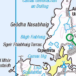
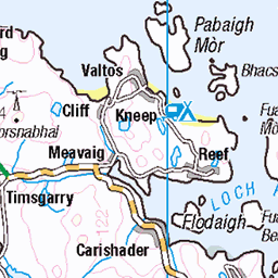
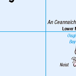
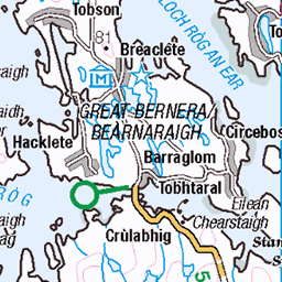
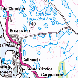
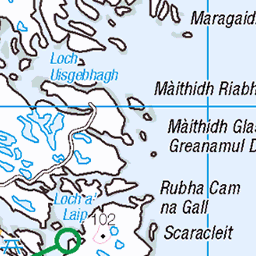
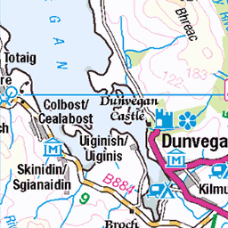
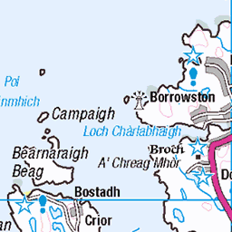
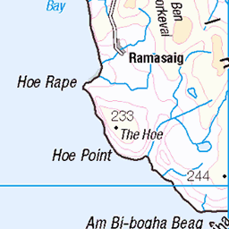
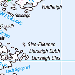
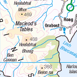
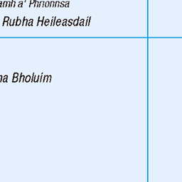
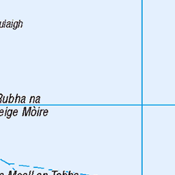
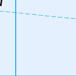
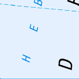
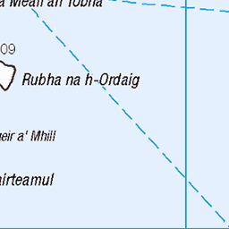
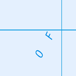
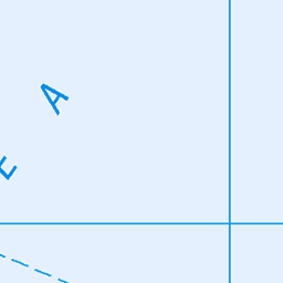
OS Map of An Coileach
Height: 389m / 1276ft • Prominence: 327m / 1073ft • Summit : small pile of stones • Trip reports (hill-bagging)

Sound of Harris
Looking over the Sound of Harris to NOrth Uist. From the summit of Heileasbhal Mòr, with a shower coming in over Loch Langabhat
05-Apr-16 • Donald Noble • flickr
sea sky water clouds landscape island coast scotland hill hills coastline harris westernisles hdr hillwalking outerhebrides northuist naheileanansiar uibhistatuath 26753864015

Panorama from Heileasbhal Mòr
With Roineabhal on the left, the distant mountains of North Harris visible in the centre above the ridge we were on, and Loch Fhleoideabhaigh on the right. 11 photos, stitched using Lightroom
05-Apr-16 • Donald Noble • flickr
sea sky panorama water rock marilyn clouds landscape scotland hill hills harris westernisles hillwalking outerhebrides naheileanansiar 26660398552

Heading Home
Walking back down towards Luskentyre, after a great walk over Heileasbhal Mòr and An Coileach.
05-Apr-16 • Donald Noble • flickr
sea plant beach water rock marilyn landscape person scotland flora heather hill hills harris westernisles hillwalking outerhebrides luskentyre southharris naheileanansiar losgaintir ceannadeasnahearadh 26686827471

1600 An Coileach c
12-Jun-11 • Dugswell2 • flickr
trigpoint ancoileach p323 marilyn hump tump yeaman ancoileachtrigpoint 10095 50336746227

1600 An Coileach
Dropped off by Jim Bloomer at new bridge to east to bag four HuMPs as I walked back to my B&B at Horgabost. Teashirt and sunshine,small cairn at high point then off to visit trig. Name:An Coileach Hill number:1600 Height:389m / 1276ft RHB Section:24B: Harris and Nearby Islands County/UA:Na h-Eileanan Siar [Western Isles] (UA) Island:Lewis and Harris Maritime area:South Harris - East Watershed:Long Island Class:Marilyn, Hump, Tump (300-399m), Yeaman Grid ref:NG 08626 92784 Summit feature:small pile of stones Drop:323m Col:66m NG111949 Observations:rock 7m W at NG 08619 92786 is as high; rock 90m S at NG 08641 92697 is slightly lower Survey:Abney level
12-Jun-11 • Dugswell2 • flickr
ancoileach p323 marilyn hump tump yeaman 50336745672

1600 An Coileach a
12-Jun-11 • Dugswell2 • flickr
ancoileach p323 marilyn hump tump yeaman 50335900508
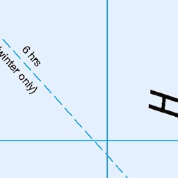
OS Map
This is OS mapping. In some areas, OpenStreetMap shows more footpaths
Spatial NI has online OSNI mapping. Click "Basemap Gallery" (4 squares icon at the top).
Now would be a good time for a cup of tea.


GPX Editor
Record map clicks
Reload map
Photos
Please tag your photos and upload them to the British and Irish Mountains group on Flickr
The other photos have been geo-tagged as on or around the summit. For less busy mountains, it can be a little hit and miss.
Sound of Harris
Looking over the Sound of Harris to NOrth Uist. From the summit of Heileasbhal Mòr, with a shower coming in over Loch Langabhat
05-Apr-16 • Donald Noble • flickr
sea sky water clouds landscape island coast scotland hill hills coastline harris westernisles hdr hillwalking outerhebrides northuist naheileanansiar uibhistatuath 26753864015
Panorama from Heileasbhal Mòr
With Roineabhal on the left, the distant mountains of North Harris visible in the centre above the ridge we were on, and Loch Fhleoideabhaigh on the right. 11 photos, stitched using Lightroom
05-Apr-16 • Donald Noble • flickr
sea sky panorama water rock marilyn clouds landscape scotland hill hills harris westernisles hillwalking outerhebrides naheileanansiar 26660398552
Heading Home
Walking back down towards Luskentyre, after a great walk over Heileasbhal Mòr and An Coileach.
05-Apr-16 • Donald Noble • flickr
sea plant beach water rock marilyn landscape person scotland flora heather hill hills harris westernisles hillwalking outerhebrides luskentyre southharris naheileanansiar losgaintir ceannadeasnahearadh 26686827471
1600 An Coileach c
12-Jun-11 • Dugswell2 • flickr
trigpoint ancoileach p323 marilyn hump tump yeaman ancoileachtrigpoint 10095 50336746227
1600 An Coileach
Dropped off by Jim Bloomer at new bridge to east to bag four HuMPs as I walked back to my B&B at Horgabost. Teashirt and sunshine,small cairn at high point then off to visit trig. Name:An Coileach Hill number:1600 Height:389m / 1276ft RHB Section:24B: Harris and Nearby Islands County/UA:Na h-Eileanan Siar [Western Isles] (UA) Island:Lewis and Harris Maritime area:South Harris - East Watershed:Long Island Class:Marilyn, Hump, Tump (300-399m), Yeaman Grid ref:NG 08626 92784 Summit feature:small pile of stones Drop:323m Col:66m NG111949 Observations:rock 7m W at NG 08619 92786 is as high; rock 90m S at NG 08641 92697 is slightly lower Survey:Abney level
12-Jun-11 • Dugswell2 • flickr
ancoileach p323 marilyn hump tump yeaman 50336745672
1600 An Coileach a
12-Jun-11 • Dugswell2 • flickr
ancoileach p323 marilyn hump tump yeaman 50335900508

1600 An Coileach b
12-Jun-11 • Dugswell2 • flickr
ancoileach p323 marilyn hump tump yeaman 50336592106
Videos
None found
Notes
- Data: Database of British and Irish Hills v18.2
- Maps: We use OS mapping for England, Scotland, Wales, and the Isle of Man. Sadly, Channel Islands, Northern (OSNI) and Southern Ireland (OSI) mapping isn't available online, so we use Openstreetmap.