Hills of Britain and Ireland
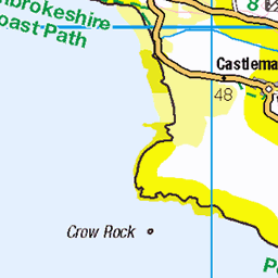
OS Map of Ynys Cantwr


OS Map
This is OS mapping. In some areas, OpenStreetMap shows more footpaths
Spatial NI has online OSNI mapping. Click "Basemap Gallery" (4 squares icon at the top).
Now would be a good time for a cup of tea.


GPX Editor
Record map clicks
Reload map
Photos
Please tag your photos and upload them to the British and Irish Mountains group on Flickr
The other photos have been geo-tagged as on or around the summit. For less busy mountains, it can be a little hit and miss.

DS012997
202404wales canimaux coiseaux ctous ramseyisland wales royaumeuni exif:focallength=50mm exif:model=xh2 geo:country=royaumeuni camera:model=xh2 geo:lon=53339122216667 geo:location=ramseyisland geo:state=wales exif:lens=xf50140mmf28rlmoiswr geocity exif:aperture=ƒ80 exif:make=fujifilm exif:isospeed=125 camera:make=fujifilm geo:lat=51855653888333 53731436390

DS012998
202404wales canimaux coiseaux ctous ramseyisland wales royaumeuni exif:focallength=50mm exif:model=xh2 geo:country=royaumeuni camera:model=xh2 geo:lon=53339122216667 geo:location=ramseyisland geo:state=wales exif:lens=xf50140mmf28rlmoiswr geocity exif:aperture=ƒ80 exif:make=fujifilm exif:isospeed=125 camera:make=fujifilm geo:lat=51855653888333 53731009446

DS013000
202404wales canimaux coiseaux ctous ramseyisland wales royaumeuni camera:make=fujifilm exif:model=xh2 geo:country=royaumeuni camera:model=xh2 geo:lon=53339122216667 exif:isospeed=320 geo:state=wales exif:lens=xf50140mmf28rlmoiswr geocity geo:location=ramseyisland exif:make=fujifilm exif:aperture=ƒ80 exif:focallength=140mm geo:lat=51855653888333 53731009921


15573 Ynys Cantwr
Name: Ynys Cantwr Hill number: 15573 Height:54m / 177ft Parent (Ma/M): none Section:31C: South-West Wales County/UA:Pembrokeshire [Sir Benfro] (CoU) Island:Mono Tump island (t) Maritime Area:Pembrokeshire Coast - West Class:Tump (0-99m), SIB Grid ref:SM705223 (est) Drop: 54m Col:Sea
10-Sep-15 • Dugswell2 • flickr
sib ramseyisland p54 tump ynyscantwr 20888211553
Videos
None found
Notes
- Data: Database of British and Irish Hills v18.2
- Maps: We use OS mapping for England, Scotland, Wales, and the Isle of Man. Sadly, Channel Islands, Northern (OSNI) and Southern Ireland (OSI) mapping isn't available online, so we use Openstreetmap.