Hills of Britain and Ireland
OS Map of Hill of Foudland
Height: 467m / 1532ft • Prominence: 286m / 938ft • Summit : trig point • Trip reports (hill-bagging)

The slate track over Hill of Foudland
After sunset, dark by the time we got back. Cold but not too bad.
03-Dec-22 • We travel the Spaceways • flickr
52540722008

The slate track on Hill of Foudland
The tracks have been resurfaced since last we were here. The use of slate is a natural choice as this hill and its neighbours are known for their quality slate. The hill is pockmarked with quarries everywhere. Starting in the 1700s, quarrying carried on into the mid 19th century until the coming of the railway and cheaper slates from elsewhere.
17-Apr-21 • We travel the Spaceways • flickr
51121156187

Glens of Foudland 07 August 2017 0003
A section of the old slate quarries in Glens of Foudland, Aberdeenshire. Please see my other Photographs at: www.jamespdeans.co.uk" rel="nofollow www.jamespdeans.co.uk View my 2018 Calendar at plus.google.com/u/0/collection/c0FETE" rel="nofollow plus.google.com/u/0/collection/c0FETE
07-Aug-17 • JamesPDeans.co.uk • flickr
landscape prints for sale hill slatequarry unitedkingdom commerce man who has everything aberdeenshire wwwjamespdeanscouk quarry landscapeforwalls europe uk ships plants nature greatbritain transporttransportinfrastructure hills colour digital downloads licence scotland masts bing gb purple heather history mining britain james p deans photography 36403283566

IMG_0648_5950_0010
Still on the ascent, but near the top - there are a few water-filled quarry pits - some hidden in the heather. Should we have a swim? I declined the suggestion #hilloffoudland #insch #aberdeenshire
06-Sep-16 • RobertE1950 • flickr
foudland insch aberdeenshire 29423515490


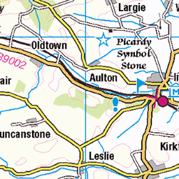
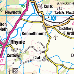
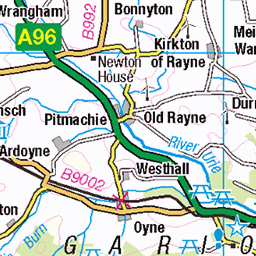
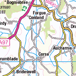
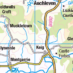
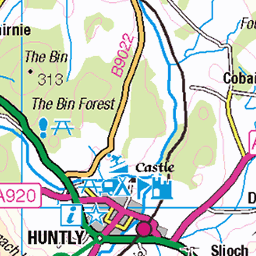
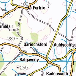
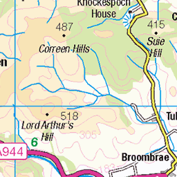
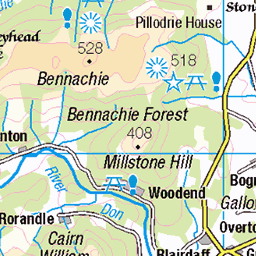
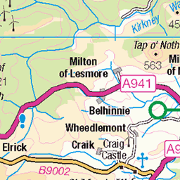
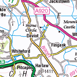
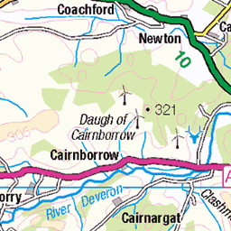
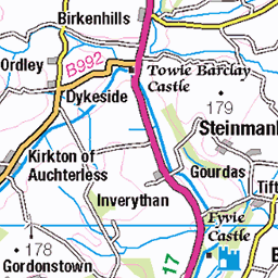
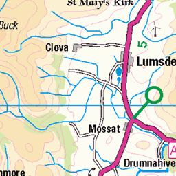
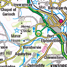
OS Map
This is OS mapping. In some areas, OpenStreetMap shows more footpaths
Spatial NI has online OSNI mapping. Click "Basemap Gallery" (4 squares icon at the top).
Now would be a good time for a cup of tea.
GPX Editor
Record map clicks
Reload map
Photos
Please tag your photos and upload them to the British and Irish Mountains group on Flickr
The other photos have been geo-tagged as on or around the summit. For less busy mountains, it can be a little hit and miss.
The slate track over Hill of Foudland
After sunset, dark by the time we got back. Cold but not too bad.
03-Dec-22 • We travel the Spaceways • flickr
52540722008
The slate track on Hill of Foudland
The tracks have been resurfaced since last we were here. The use of slate is a natural choice as this hill and its neighbours are known for their quality slate. The hill is pockmarked with quarries everywhere. Starting in the 1700s, quarrying carried on into the mid 19th century until the coming of the railway and cheaper slates from elsewhere.
17-Apr-21 • We travel the Spaceways • flickr
51121156187
Glens of Foudland 07 August 2017 0003
A section of the old slate quarries in Glens of Foudland, Aberdeenshire. Please see my other Photographs at: www.jamespdeans.co.uk" rel="nofollow www.jamespdeans.co.uk View my 2018 Calendar at plus.google.com/u/0/collection/c0FETE" rel="nofollow plus.google.com/u/0/collection/c0FETE
07-Aug-17 • JamesPDeans.co.uk • flickr
landscape prints for sale hill slatequarry unitedkingdom commerce man who has everything aberdeenshire wwwjamespdeanscouk quarry landscapeforwalls europe uk ships plants nature greatbritain transporttransportinfrastructure hills colour digital downloads licence scotland masts bing gb purple heather history mining britain james p deans photography 36403283566
IMG_0648_5950_0010
Still on the ascent, but near the top - there are a few water-filled quarry pits - some hidden in the heather. Should we have a swim? I declined the suggestion #hilloffoudland #insch #aberdeenshire
06-Sep-16 • RobertE1950 • flickr
foudland insch aberdeenshire 29423515490

S6906 - Foudland Hill
NJ603332, LR29. HISTORY Pillar completed 24th May 1952 costing £15.3s.8d. Computed as secondary triangulation station NJ75/5 within the Banff secondary block and levelled to second class precision during 1952. This station was also used for the reconnaissance of secondary block NJ45 (Elgin) in 1953. This pillar station was last maintained by the Ordnance Survey in May 1989. SITE VISIT Easiest approached from Colpy (east side). The pillar is in good condition. Spider centre open. The flush bracket on southeast face of pillar. Dominant hill with open views in all directions. Comms mast near summit. Highest trig point on OS Landranger map 29. Photographed: 9th October 2002, GRP. ═════════════════════════ Interactive Index: www.google.com/maps/d/viewer?mid=1arx2Qmo5mVeVUJA2lzVG_uzbYPW59ffh&ll=57.387778,-2.661756&z=12" rel="noreferrer nofollow Google My Maps Map: www.flickr.com/photos/13460108@N06/26893066148/in/album-72157692190778971/ Trig Pillars on OS Landranger 29 ═════════════════════════ Neighbouring Triangulation Pillars www.flickr.com/photos/13460108@N06/8098099903/in/album-72157631793900484/ S6908 - Broom Hill : 3.03 miles to the northeast. www.flickr.com/photos/13460108@N06/8098100325/in/album-72157631793900484/ S6901 - Hill Of Tillymorgan : 3.21 miles to the east. www.flickr.com/photos/13460108@N06/8100917300/in/album-72157631801120468/ S7127 - Knockandy Hill : 3.52 miles to the west. www.flickr.com/photos/13460108@N06/8100915115/in/album-72157631801120468/ S7227 - Hill Of Christs Kirk : 3.61 miles to the south. www.flickr.com/photos/13460108@N06/8098107914/in/album-72157631793900484/ S6894 - Mellenside : 3.70 miles to the southeast. www.flickr.com/photos/13460108@N06/8100916424/in/album-72157631801120468/ S7138 - Boghead : 4.23 miles to the northwest. ═════════════════════════
09-Oct-02 • Graeme5015 • flickr
foudlandhill s6906 colpy largie skares bainshole 8098100087
Videos
This walk starts from the west on a track through forest then up Red Hill. After the summit of Red Hill walk through the heather to ...
A mixed surface cycle in the north east of Scotland, climbing up the new gravel access road on the western end of Foudland ...
Notes
- Data: Database of British and Irish Hills v18.2
- Maps: We use OS mapping for England, Scotland, Wales, and the Isle of Man. Sadly, Channel Islands, Northern (OSNI) and Southern Ireland (OSI) mapping isn't available online, so we use Openstreetmap.