Hills of Britain and Ireland
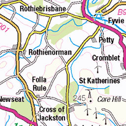
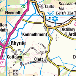
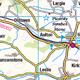
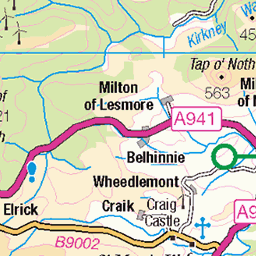
OS Map of Knock Hill
Height: 430m / 1411ft • Prominence: 303m / 994ft • Summit : large cairn 15m SW of trig point • Trip reports (hill-bagging)

Atop the Knock!
This boulder can be found on top of Knock Hill after a leg aching and lung bursting short but steep climb. Very windy up here but it made for great views and a dramatic looking sky as well. bighugelabs.com/onblack.php?id=4663331685" rel="nofollow View On Black loc.alize.us/#/flickr:4663331685" rel="nofollow Knock Hill near Cornhill. www.flickr.com/groups/geotagging/discuss/72157594165549916/ [?]
01-Jun-10 • Pleasureprinciple2013 • flickr
mountain canon geotagged scotland aberdeenshire hill hills knockhill pleasureprinciple banffshire 40d geo:lat=57585018 geo:lon=2775743 4663331685

Unofficial Cairn
Over the years walkers have picked up stones and rocks on their way up Knock Hill and added them to this ever growing pile. The stones in the background actually spell out peoples names but are difficult to make out. bighugelabs.com/onblack.php?id=4663334629" rel="nofollow View On Black loc.alize.us/#/flickr:4663334629" rel="nofollow Knock Hill, Near Cornhill www.flickr.com/groups/geotagging/discuss/72157594165549916/ [?]
01-Jun-10 • Pleasureprinciple2013 • flickr
mountain canon geotagged scotland aberdeenshire hill hills knockhill pleasureprinciple banffshire 40d geo:lat=57583936 geo:lon=2775207 4663334629
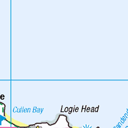
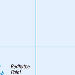
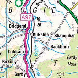
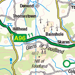
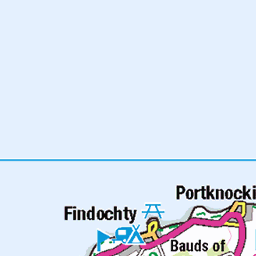
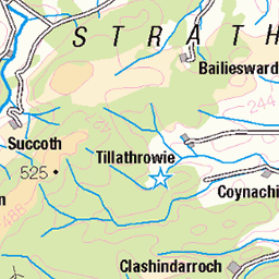
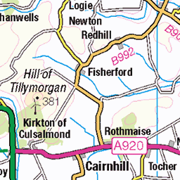
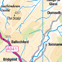
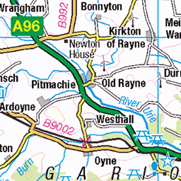
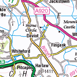
OS Map
This is OS mapping. In some areas, OpenStreetMap shows more footpaths
Spatial NI has online OSNI mapping. Click "Basemap Gallery" (4 squares icon at the top).
Now would be a good time for a cup of tea.


GPX Editor
Record map clicks
Reload map
Photos
Please tag your photos and upload them to the British and Irish Mountains group on Flickr
The other photos have been geo-tagged as on or around the summit. For less busy mountains, it can be a little hit and miss.
Atop the Knock!
This boulder can be found on top of Knock Hill after a leg aching and lung bursting short but steep climb. Very windy up here but it made for great views and a dramatic looking sky as well. bighugelabs.com/onblack.php?id=4663331685" rel="nofollow View On Black loc.alize.us/#/flickr:4663331685" rel="nofollow Knock Hill near Cornhill. www.flickr.com/groups/geotagging/discuss/72157594165549916/ [?]
01-Jun-10 • Pleasureprinciple2013 • flickr
mountain canon geotagged scotland aberdeenshire hill hills knockhill pleasureprinciple banffshire 40d geo:lat=57585018 geo:lon=2775743 4663331685
Unofficial Cairn
Over the years walkers have picked up stones and rocks on their way up Knock Hill and added them to this ever growing pile. The stones in the background actually spell out peoples names but are difficult to make out. bighugelabs.com/onblack.php?id=4663334629" rel="nofollow View On Black loc.alize.us/#/flickr:4663334629" rel="nofollow Knock Hill, Near Cornhill www.flickr.com/groups/geotagging/discuss/72157594165549916/ [?]
01-Jun-10 • Pleasureprinciple2013 • flickr
mountain canon geotagged scotland aberdeenshire hill hills knockhill pleasureprinciple banffshire 40d geo:lat=57583936 geo:lon=2775207 4663334629
Videos
Starting at Swilebog this is a very short out and back ascent of Knock Hill.
A short out and back walk starting from the dead end road just where the B9001 and A97 meet. This is just north of the town of ...
This walk starts at a small parking area outside Keith. From Keith take Bridge Street and follow the minor road to the parking area ...
Notes
- Data: Database of British and Irish Hills v18.2
- Maps: We use OS mapping for England, Scotland, Wales, and the Isle of Man. Sadly, Channel Islands, Northern (OSNI) and Southern Ireland (OSI) mapping isn't available online, so we use Openstreetmap.