Hills of Britain and Ireland
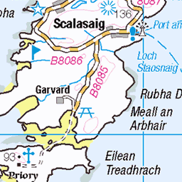
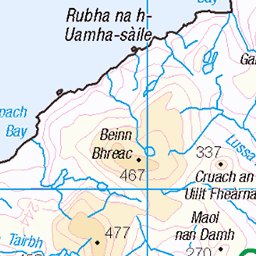
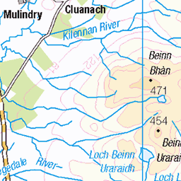
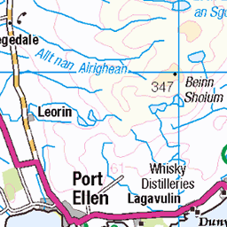
OS Map of Beinn Shiantaidh
Height: 757m / 2484ft • Prominence: 303m / 994ft • Summit : large cairn • Trip reports (hill-bagging)

Beinn A'Chaolais
The magnificent cone of Beinn a'Chaolais viewed from the summit of Beinn an Òir.
24-Jul-23 • Russell-Davies • flickr
jura isleofjura papsofjura beinnanòir beinnachaolais corbett fiona hillwalking summer canon canonr6 clouds hiking landscape mountain scotland summit uk islay argyll 53296279684

Beinn Shiantaidh
Beinn Shiantaidh viewed from Beinn an Òir.
24-Jul-23 • Russell-Davies • flickr
fiona corbett papsofjura jura isleofjura soundofjura argyll beinnshiantaidh beinnanòir canon canonr6 clouds hiking landscape loch mountain scotland summer summit uk 53297940950

Jura Landscape
Jura Quartzite landscape at the foot of Beinn a' Chaolais.
24-Jul-23 • Russell-Davies • flickr
jura isleofjura beinnachaolais quartzite argyll canon canonr6 hiking landscape mountains scotland summer uk lochan heather 53298397000

Ascending Beinn Shiantaidh
A great view back to Beinn a' Chaolais while climbing a steep gully to the summit of Beinn Shiantaidh.
24-Jul-23 • Russell-Davies • flickr
beinnshiantaidh beinnachaolais canon canonr6 clouds hiking landscape mountains scotland summer summit uk papsofjura jura isleofjura corbett fiona 53300850649

The Paps Of Jura
A view over the Paps of Jura from Beinn Shiantaidh.
24-Jul-23 • Russell-Davies • flickr
beinnachaolais beinnanòir beinnshiantaidh isleofjura jura papsofjura corbett fiona argyll canon canonr6 clouds hiking landscape mountains scotland summer summit uk 53301178860

Video - 20 seconds - crossing the Corran River
I was probably a lot less elegant :-)
22-May-23 • Jackie & Dennis • flickr
jura scotland video 53015425590
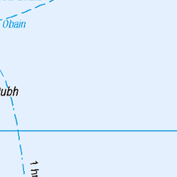
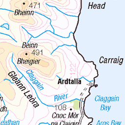
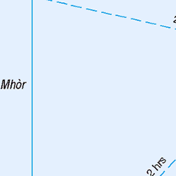
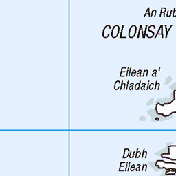
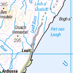
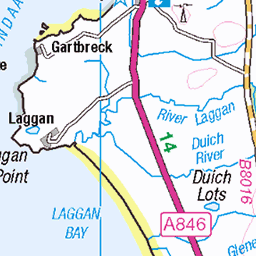
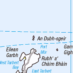
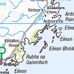
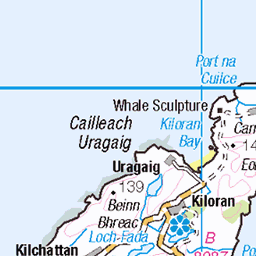
OS Map
This is OS mapping. In some areas, OpenStreetMap shows more footpaths
Spatial NI has online OSNI mapping. Click "Basemap Gallery" (4 squares icon at the top).
Now would be a good time for a cup of tea.


GPX Editor
Record map clicks
Reload map
Photos
Please tag your photos and upload them to the British and Irish Mountains group on Flickr
The other photos have been geo-tagged as on or around the summit. For less busy mountains, it can be a little hit and miss.
Beinn A'Chaolais
The magnificent cone of Beinn a'Chaolais viewed from the summit of Beinn an Òir.
24-Jul-23 • Russell-Davies • flickr
jura isleofjura papsofjura beinnanòir beinnachaolais corbett fiona hillwalking summer canon canonr6 clouds hiking landscape mountain scotland summit uk islay argyll 53296279684
Beinn Shiantaidh
Beinn Shiantaidh viewed from Beinn an Òir.
24-Jul-23 • Russell-Davies • flickr
fiona corbett papsofjura jura isleofjura soundofjura argyll beinnshiantaidh beinnanòir canon canonr6 clouds hiking landscape loch mountain scotland summer summit uk 53297940950
Jura Landscape
Jura Quartzite landscape at the foot of Beinn a' Chaolais.
24-Jul-23 • Russell-Davies • flickr
jura isleofjura beinnachaolais quartzite argyll canon canonr6 hiking landscape mountains scotland summer uk lochan heather 53298397000
Ascending Beinn Shiantaidh
A great view back to Beinn a' Chaolais while climbing a steep gully to the summit of Beinn Shiantaidh.
24-Jul-23 • Russell-Davies • flickr
beinnshiantaidh beinnachaolais canon canonr6 clouds hiking landscape mountains scotland summer summit uk papsofjura jura isleofjura corbett fiona 53300850649
The Paps Of Jura
A view over the Paps of Jura from Beinn Shiantaidh.
24-Jul-23 • Russell-Davies • flickr
beinnachaolais beinnanòir beinnshiantaidh isleofjura jura papsofjura corbett fiona argyll canon canonr6 clouds hiking landscape mountains scotland summer summit uk 53301178860
Video - 20 seconds - crossing the Corran River
I was probably a lot less elegant :-)
22-May-23 • Jackie & Dennis • flickr
jura scotland video 53015425590

We can see the top
But when we got to the top we were in the cloud.
22-May-23 • Jackie & Dennis • flickr
jura scotland 53015053776

Crossing back over Corran River
I managed to get all of the mountain behind in the shot :-)
22-May-23 • Jackie & Dennis • flickr
jura scotland 53017620094

S3680 - Jura
NR498749, LR60 & LR61. HISTORY Pillar completed 28th May 1946 costing £42.7s.6d. Computed as primary triangulation station PP392 within figure 6 of the OSGB36 network during 1951. This station was also used for the reconnaissance of secondary blocks NR55 (Islay) in 1957, and NM52 (Mull) during 1960. Levelled to second class precision in 1957 along with the triangulation of the neighbouring secondary and tertiary pillars of secondary block NR55, Islay. Last maintained by the OS in May 1979. SITE VISIT Overall approach from southeast. Parking to NW side of A846 just north of bridge at NR522720. Unmapped on the OS maps but indicated on the WalkHighlands map is a footpath which follows the south side of the Corran River as far as Loch an t Siob. Crossing the rover over stepping stones where the Loch flows into the river, the path then continues westwards along the north bank of the loch. Continued to the bealach at NR296740, then turned right (northwards) and climbed directly to the summit. The pillar is in a wind shelter and in good condition. Spider centre plugged with tar. Flush bracket faces southwest, compass measurement 225°. The right sight hole is buried but was presumably open to vent the pillar as the other three are plugged. The panoramic view was lost to low cloud on the day of visit. Photographed: 16th May 2023, GRP. ═════════════════════════ Interactive index: www.google.com/maps/d/viewer?mid=1arx2Qmo5mVeVUJA2lzVG_uzbYPW59ffh&ll=55.902399,-6.004152&z=11" rel="noreferrer nofollow Google My Maps ═════════════════════════ Neighbouring Triangulation Pillars www.flickr.com/photos/13460108@N06/53753463851/in/album-72157631838876970/ 10500 - Leac Fhola : 4.08 miles to the east. www.flickr.com/photos/13460108@N06/53745381399/in/album-72157631831281682/ S9365 - Dubh Beinn : 4.19 miles to the south. www.flickr.com/photos/13460108@N06/52922867414/in/album-72157631821839859/ S8990 - Ardfernal : 4.48 miles to the southeast. S8983 - Coinein : 4.98 miles to the southeast. www.flickr.com/photos/13460108@N06/52081288874/in/album-72157631831281682/ S9076 - Rhuvaal : 5.08 miles to the northwest. www.flickr.com/photos/13460108@N06/52081543480/in/album-72157631831281682/ S9077 - Sgarbh Breac : 5.80 miles to the west. www.flickr.com/photos/13460108@N06/52079188305/in/album-72157631831281682/ S9074 - Persabus : 5.87 miles to the southwest. www.flickr.com/photos/13460108@N06/52923099640/in/album-72157631831281682/ S9082 - Beinn Na Doire Leithe : 5.97 miles southwest. ═════════════════════════
16-May-23 • Graeme5015 • flickr
s3680 3680 bsm jura beinnanoir papsofjura paps 52922127932

1450 Beinn Shiantaidh b
14-Jun-12 • Dugswell2 • flickr
beinnshiantaidh p303 marilyn hump simm graham yeaman papsofjura isleofjura jura 52049500458

1450 Beinn Shiantaidh a
First top of a 4 top round with Cliff Speight in mist until we were on the Corbett. Started from Corran Bridge. Name:Beinn Shiantaidh Hill number:1450 Height:757m / 2484ft RHB Section:20A: Jura, Scarba and Colonsay County/UA:Argyll and Bute (UA) Island:Jura Maritime area:Islay, Jura & surrounding islands Class:Marilyn, Hump, Simm, Graham, Yeaman Grid ref:NR 51356 74770 Summit feature:large cairn Drop:303m Col:454m NR506748
14-Jun-12 • Dugswell2 • flickr
beinnshiantaidh p303 marilyn hump simm graham yeaman papsofjura isleofjura jura 52049462266

1450 Beinn Shiantaidh
View back towards Beinn Shiantaidh.
14-Jun-12 • Dugswell2 • flickr
beinnshiantaidh p303 marilyn hump simm graham yeaman papsofjura isleofjura jura 52049690504

Loch an t-Siob, Jura
bighugelabs.com/onblack.php?id=6047294490&size=large" rel="nofollow View On Black IMGP7231 - IMGP7234 4 shot stitch-up
03-Aug-11 • PrawnFM 05 • flickr
scotland august jura loch 2011 lochantsiob 6047294490
Videos
Video series about climbing the major mountains of the Scottish Highlands, England and Wales. Videó sorozat a Skót Felföld, ...
Record of a hillwalking trip by ferry and bike to climb the Paps of Jura August 2014. This replaces a video I made 5 years ago.
Notes
- Data: Database of British and Irish Hills v18.2
- Maps: We use OS mapping for England, Scotland, Wales, and the Isle of Man. Sadly, Channel Islands, Northern (OSNI) and Southern Ireland (OSI) mapping isn't available online, so we use Openstreetmap.