Hills of Britain and Ireland
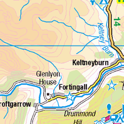
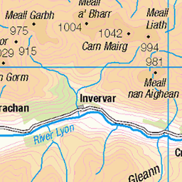
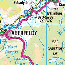
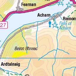
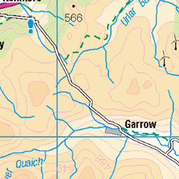
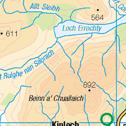
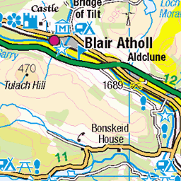
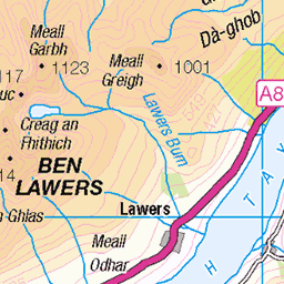
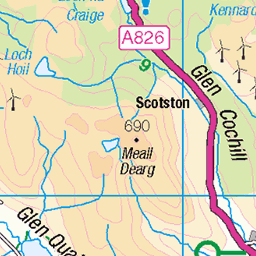
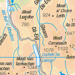
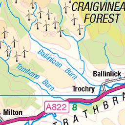
OS Map of Dun Coillich
Height: 572m / 1877ft • Prominence: 187m / 614ft • Summit : no feature 3m W of cairn • Trip reports (hill-bagging)
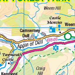
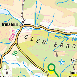
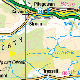
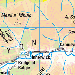
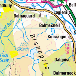
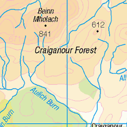
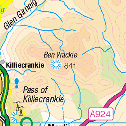
OS Map
This is OS mapping. In some areas, OpenStreetMap shows more footpaths
Spatial NI has online OSNI mapping. Click "Basemap Gallery" (4 squares icon at the top).
Now would be a good time for a cup of tea.
GPX Editor
Record map clicks
Reload map
Photos
Please tag your photos and upload them to the British and Irish Mountains group on Flickr
The other photos have been geo-tagged as on or around the summit. For less busy mountains, it can be a little hit and miss.


G1214 - Glengoulandie
NN 7675 5253, LR42/51/52. Second Geodetic Levelling, Scotland (1936-52). Flush bracket G1214 was used during the second geodetic levelling of Scotland, and was levelled with a height of 939.3820 feet [286.3236 metres] above mean sea level (Newlyn datum). It was included on the Tummel Bridge to Crianlarich levelling line. Geodetic line G.277, levelled between 1946 and 1947. The surveyor's description was S face of building "Glengowlandie", 10' SW from E angle, NW side of road. Third Geodetic Levelling, Scotland (1956-68). This flush bracket was used again during the third geodetic levelling of Scotland. It was included on the Tummel Bridge to Crianlarich levelling line. Geodetic line G.352, levelled during 1958. The surveyor's description was SE face of building, W side of road. This marker was last verified in 1958. The OS Online Archive gives the description as building, W side of road, NW side of road, SE face. SITE VISIT On middle of front gable to building on left on approach from the public road. FB painted white as is building. Buildings for sale at time of visit. Redevelopment potential? If so, the FB would be under threat? Photographed 30/05/2009, GRP. UPDATE By 2011, this building had been reported demolished, another FB now lost! ════════════════════════════════════ Interactive index: www.google.com/maps/d/viewer?mid=1ip-cqtEG7IiEvWbtXy-tM0_uAgainiAE&ll=56.648283,-4.011664&z=12" rel="noreferrer nofollow Google My Maps BMD: www.bench-marks.org.uk/bm18019" rel="noreferrer nofollow www.bench-marks.org.uk/bm ════════════════════════════════════ Neighbouring Flush Brackets www.flickr.com/photos/13460108@N06/26547242113/in/album-72157662157184532/ G1213 - White Bridge Inn : 0.94 miles to the north. www.flickr.com/photos/13460108@N06/23758551992/in/album-72157662157184532/ G1215 - Coshieville Inn : 2.19 miles to the south. www.flickr.com/photos/13460108@N06/26547242543/in/album-72157662157184532/ G1212 - Foss Mill : 3.15 miles to the north. www.flickr.com/photos/13460108@N06/23784414901/in/album-72157662157184532/ G1216 - Garth House Lodge : 3.23 miles to the south. www.flickr.com/photos/13460108@N06/23840822336/in/album-72157662157184532/ G1217 - Fortingall, Old Post House : 3.84 miles to the southwest. G1086 - Tummel Bridge : 4.14 miles to the north. www.flickr.com/photos/13460108@N06/27418744720/in/album-72157662157184532/ G1085 - Dalno : 4.36 miles to the north. ════════════════════════════════════
30-May-09 • Graeme5015 • flickr
g1214 glengoulandie whitebridge 27083169951

G1213 - White Bridge Inn
NN 7734 5393, LR42/51/52. Second Geodetic Levelling, Scotland (1936-52). Flush bracket G1213 was used during the second geodetic levelling of Scotland, and was levelled with a height of 1143.6410 feet [348.5818 metres] above mean sea level (Newlyn datum). It was included on the Tummel Bridge to Crianlarich levelling line. Geodetic line G.277, levelled between 1946 and 1947. The surveyor's description was N face of "White Bridge Inn", 6' N from NE angle, W side of road. Third Geodetic Levelling, Scotland (1956-68). This flush bracket was used again during the third geodetic levelling of Scotland. It was included on the Tummel Bridge to Crianlarich levelling line. Geodetic line G.352, levelled during 1958. The surveyor's description was N face, 6' from NE angle of barn, W side of road. This marker was last verified in 1958. The OS Online Archive gives the description as barn, W side of road, N face, 1.8m from NE angle. SITE VISIT Unless proved otherwise, this flush bracket seems to be in original position. Affixed to mid front gable of outbuilding which is attached to the main cottage. Owner friendly and interested to know more about this levelling marker. Bracket in good condition. Photographed 30/05/2009, GRP. ════════════════════════════════════ Interactive index: www.google.com/maps/d/viewer?mid=1ip-cqtEG7IiEvWbtXy-tM0_uAgainiAE&ll=56.661008,-4.002715&z=12" rel="noreferrer nofollow Google My Maps BMD: www.bench-marks.org.uk/bm18018" rel="noreferrer nofollow www.bench-marks.org.uk/bm ════════════════════════════════════ Neighbouring Flush Brackets www.flickr.com/photos/13460108@N06/27083169951/in/album-72157662157184532/ G1214 - Glengoulandie : 0.94 miles to the south. www.flickr.com/photos/13460108@N06/26547242543/in/album-72157662157184532/ G1212 - Foss Mill : 2.22 miles to the north. www.flickr.com/photos/13460108@N06/23758551992/in/album-72157662157184532/ G1215 - Coshieville Inn : 2.98 miles to the south. G1086 - Tummel Bridge : 3.23 miles to the north. www.flickr.com/photos/13460108@N06/27418744720/in/album-72157662157184532/ G1085 - Dalno : 3.56 miles to the north. www.flickr.com/photos/13460108@N06/23784414901/in/album-72157662157184532/ G1216 - Garth House Lodge : 4.16 miles to the south. ════════════════════════════════════
30-May-09 • Graeme5015 • flickr
g1213 whitebridgeinn whitebridge 26547242113
Videos
We climb Dùn Coillich, a mountain close to Aberfeldy in Perthshire, Scotland. I'll show you the route, what the distance is and the ...
Was lovely day up neer aberfeldy.
After a nice night in John O'Groats, we came off the NC500 and drove through the Cairngorms and arrived at Glengoulandie ...
Notes
- Data: Database of British and Irish Hills v18.2
- Maps: We use OS mapping for England, Scotland, Wales, and the Isle of Man. Sadly, Channel Islands, Northern (OSNI) and Southern Ireland (OSI) mapping isn't available online, so we use Openstreetmap.