Hills of Britain and Ireland
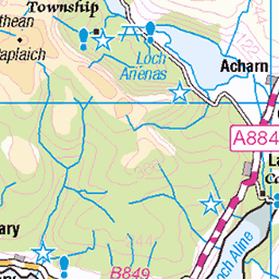
OS Map of Beinn na Cille


Drone shot.49AD477F-3182-4259-8CD6-2B4BC06B37A3 .
DCIM\100MEDIA\DJI_0904.JPG DJI Mavic Pro Platinum.
49692243147


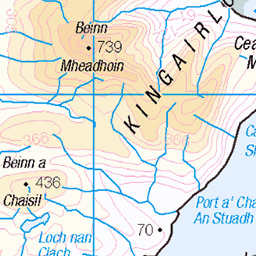
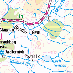
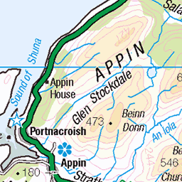
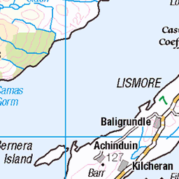
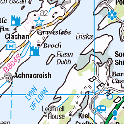
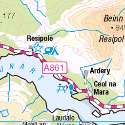
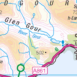
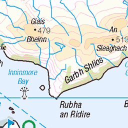
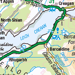
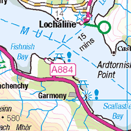
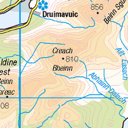
OS Map
This is OS mapping. In some areas, OpenStreetMap shows more footpaths
Spatial NI has online OSNI mapping. Click "Basemap Gallery" (4 squares icon at the top).
Now would be a good time for a cup of tea.
GPX Editor
Record map clicks
Reload map
Photos
Please tag your photos and upload them to the British and Irish Mountains group on Flickr
The other photos have been geo-tagged as on or around the summit. For less busy mountains, it can be a little hit and miss.
Drone shot.49AD477F-3182-4259-8CD6-2B4BC06B37A3 .
DCIM\100MEDIA\DJI_0904.JPG DJI Mavic Pro Platinum.
49692243147


Pier Cottage, Kingairloch, Lochaber, Nov 2017
As you can see this old cottage has been refurbished and if you really fancy getting away from it all you can rent it as a holiday let. It should be said the The Kingairloch Estate have spent a fair bit of money because there are a few cottages round Loch a'Choire and they are all available for holiday let. No #115 on Explore, 08/12/2017
20-Nov-17 • allanmaciver • flickr
kingairloch old pier cottage road damp remote lochaber scotland trees shelter estate allanmaciver 24023303487

Loch a' Choire, Kingairloch, Lochaber, Nov 2017
It was misty and atmospheric at Loch a 'Choire . I parked the car, it was not actually raining and my brother and I went for a walk beside the Loch. Although it was so overcast we saw enough to let us know that on a lovely day this would be a special place. I hope you like the little fishing boat on the loch it was not going anywhere.
20-Nov-17 • allanmaciver • flickr
loch uisge lochaber scotland kingairloch misty atmospheric low cloud water damp trees remote allanmaciver 38837580762

Videos
None found
Notes
- Data: Database of British and Irish Hills v18.2
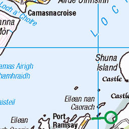
- Maps: We use OS mapping for England, Scotland, Wales, and the Isle of Man. Sadly, Channel Islands, Northern (OSNI) and Southern Ireland (OSI) mapping isn't available online, so we use Openstreetmap.