Hills of Britain and Ireland
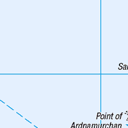
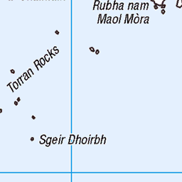
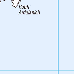
OS Map of Gometra
Height: 155m / 509ft • Prominence: 155m / 509ft • Summit : cairn 3m SE of trig point • Trip reports (hill-bagging)

Gannet (Morus bassanus)
Isle of Mull
20-May-23 • Jim Muller • flickr
isleofmull scotland unitedkingdom gannet uk 52936334258


Female sea eagle
14-Sep-20 • Davescunningplan • flickr
mull scotland mountains moody bird sea eagle white tail cloudy brokenwing 50344654472

Majestic eagle
14-Sep-20 • Davescunningplan • flickr
whitetailedseaeagle mull scotland wwwmullcharterscom bird 50346732277

Sea eagle with fish
14-Sep-20 • Davescunningplan • flickr
eagle white tailed sea scotland mull bird 50345808238

Candle light in Teachers Bothy on Gometra Island
13-Sep-19 • Rons Images • flickr
candle gometra scotland light flame rontoothill canoneos7d canonef100400mmf4556lisiiusm 48784143192
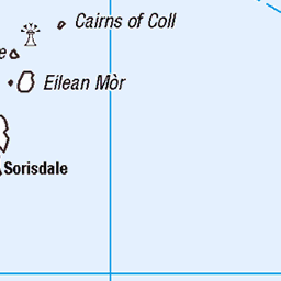
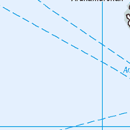
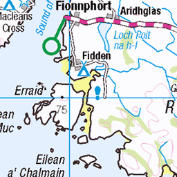
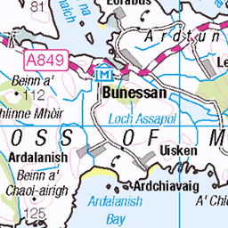
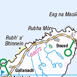
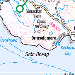
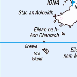
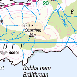
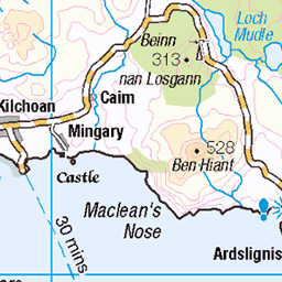
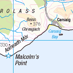
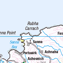
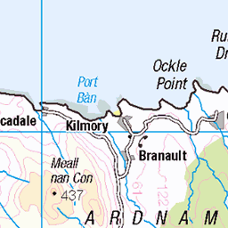
OS Map
This is OS mapping. In some areas, OpenStreetMap shows more footpaths
Spatial NI has online OSNI mapping. Click "Basemap Gallery" (4 squares icon at the top).
Now would be a good time for a cup of tea.


GPX Editor
Record map clicks
Reload map
Photos
Please tag your photos and upload them to the British and Irish Mountains group on Flickr
The other photos have been geo-tagged as on or around the summit. For less busy mountains, it can be a little hit and miss.
Gannet (Morus bassanus)
Isle of Mull
20-May-23 • Jim Muller • flickr
isleofmull scotland unitedkingdom gannet uk 52936334258
Female sea eagle
14-Sep-20 • Davescunningplan • flickr
mull scotland mountains moody bird sea eagle white tail cloudy brokenwing 50344654472
Majestic eagle
14-Sep-20 • Davescunningplan • flickr
whitetailedseaeagle mull scotland wwwmullcharterscom bird 50346732277
Sea eagle with fish
14-Sep-20 • Davescunningplan • flickr
eagle white tailed sea scotland mull bird 50345808238
Candle light in Teachers Bothy on Gometra Island
13-Sep-19 • Rons Images • flickr
candle gometra scotland light flame rontoothill canoneos7d canonef100400mmf4556lisiiusm 48784143192

NIDF20170607-0026
Mull, boottocht naar Fingalk's Cave op het eilandje Staffa.
07-Jun-17 • eduard.dekam • flickr
scotland verenigdkoninkrijk gb 35340384074

NIDF20170607-0027
Mull, boottocht naar Fingalk's Cave op het eilandje Staffa.
07-Jun-17 • eduard.dekam • flickr
scotland verenigdkoninkrijk gb 36010384032

NIDF20170607-0028
Mull, boottocht naar Fingalk's Cave op het eilandje Staffa.
07-Jun-17 • eduard.dekam • flickr
scotland verenigdkoninkrijk gb 35340384004

The Majestic Line's Glen Tarsan anchored at Gometra
Anchored between the islands of Gometra and Ulva on the west side of Mull.
02-May-17 • neilwhite483 • flickr
themajesticline ulva gometra glentarsan mvglentarsan glentarsancruise cruise cruisescotland scottishislandcruising 34440629336
Videos
Gometra Declares The Isle of Gometra, Inner Hebrides, Scotland, declared a climate and ecological emergency, as part of 'Islands ...
This seemed to be the day for sea foam to be blown over Gometra in a good westerly storm.
A beautiful day to watch a storm.
Silent video | Relaxing video | Cinematic | Drone shots We were isolated on the remote islands of Ulva and Gometra in the ...
Notes
- Data: Database of British and Irish Hills v18.2
- Maps: We use OS mapping for England, Scotland, Wales, and the Isle of Man. Sadly, Channel Islands, Northern (OSNI) and Southern Ireland (OSI) mapping isn't available online, so we use Openstreetmap.