Hills of Britain and Ireland
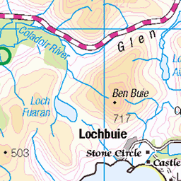
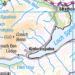
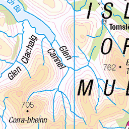
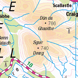
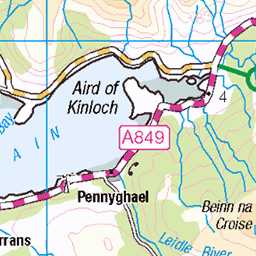
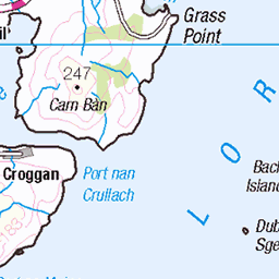
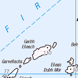
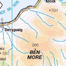
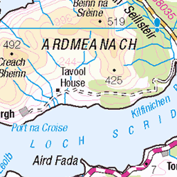
OS Map of Druim Fada
Height: 405m / 1329ft • Prominence: 390m / 1280ft • Summit : no feature: ground 10m W of trig point • Trip reports (hill-bagging)

1320 Druim Fada
A great walk for a bad weather day with Jim Bloomer. Name:Druim Fada Hill number:1320 Height:405m / 1329ft Area:17E: Mull and Nearby Islands Class:Ma,4 Grid ref: NM 64698 22554 Summit feature:no feature: ground 10m W of trig point Drop:390m Col:15m NM654256
02-May-13 • Dugswell2 • flickr
druimfada p390 mull marilyn vanessatrig isleofmull 12481774793

1320 Druim Fada a
A great walk for a bad weather day with Jim Bloomer. Name:Druim Fada Hill number:1320 Height:405m / 1329ft Area:17E: Mull and Nearby Islands Class:Ma,4 Grid ref: NM 64698 22554 Summit feature:no feature: ground 10m W of trig point Drop:390m Col:15m NM654256
02-May-13 • Dugswell2 • flickr
druimfada mull marilyn p390 vanessatrig isleofmull 12481643685

1320 Druim Fada 2
A great walk for a bad weather day with Jim Bloomer. Name:Druim Fada Hill number:1320 Height:405m / 1329ft Area:17E: Mull and Nearby Islands Class:Ma,4 Grid ref: NM 64698 22554 Summit feature:no feature: ground 10m W of trig point Drop:390m Col:15m NM654256
02-May-13 • Dugswell2 • flickr
druimfada mull p390 marilyn vanessatrig isleofmull 12481797503
OS Map
This is OS mapping. In some areas, OpenStreetMap shows more footpaths
Spatial NI has online OSNI mapping. Click "Basemap Gallery" (4 squares icon at the top).
Now would be a good time for a cup of tea.


GPX Editor
Record map clicks
Reload map
Photos
Please tag your photos and upload them to the British and Irish Mountains group on Flickr
The other photos have been geo-tagged as on or around the summit. For less busy mountains, it can be a little hit and miss.
1320 Druim Fada
A great walk for a bad weather day with Jim Bloomer. Name:Druim Fada Hill number:1320 Height:405m / 1329ft Area:17E: Mull and Nearby Islands Class:Ma,4 Grid ref: NM 64698 22554 Summit feature:no feature: ground 10m W of trig point Drop:390m Col:15m NM654256
02-May-13 • Dugswell2 • flickr
druimfada p390 mull marilyn vanessatrig isleofmull 12481774793
1320 Druim Fada a
A great walk for a bad weather day with Jim Bloomer. Name:Druim Fada Hill number:1320 Height:405m / 1329ft Area:17E: Mull and Nearby Islands Class:Ma,4 Grid ref: NM 64698 22554 Summit feature:no feature: ground 10m W of trig point Drop:390m Col:15m NM654256
02-May-13 • Dugswell2 • flickr
druimfada mull marilyn p390 vanessatrig isleofmull 12481643685
1320 Druim Fada 2
A great walk for a bad weather day with Jim Bloomer. Name:Druim Fada Hill number:1320 Height:405m / 1329ft Area:17E: Mull and Nearby Islands Class:Ma,4 Grid ref: NM 64698 22554 Summit feature:no feature: ground 10m W of trig point Drop:390m Col:15m NM654256
02-May-13 • Dugswell2 • flickr
druimfada mull p390 marilyn vanessatrig isleofmull 12481797503
Videos
None found
Notes
- Data: Database of British and Irish Hills v18.2
- Maps: We use OS mapping for England, Scotland, Wales, and the Isle of Man. Sadly, Channel Islands, Northern (OSNI) and Southern Ireland (OSI) mapping isn't available online, so we use Openstreetmap.