Hills of Britain and Ireland
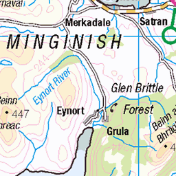
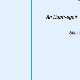
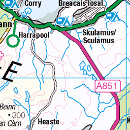
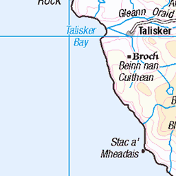
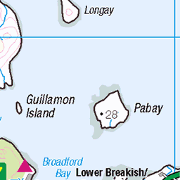
OS Map of Beinn Bhreac (Soay)
Height: 141m / 463ft • Prominence: 141m / 463ft • Summit : rock 4m N of trig point • Trip reports (hill-bagging)


1278 Beinn Bhreac (Soay) b
04-Jun-11 • Dugswell2 • flickr
trigpoint vanessatrig beinnbhreacsoay p141 submarilyn hump tump sib yeaman soayskye 50319481996

1278 Beinn Bhreac (Soay)
Second island of the day on a RIB from Elgol on day of Marhofn 2011 annual meeting in Portree organised by Alan Holmes. Did Wiah first,with Rob Woodall and Bob Taylor. This was Ann Bowker's last sub Marilyn so whisky to celebrate. Name:Beinn Bhreac (Soay) Date of ascent:04/06/2011 Hill number:1278 Height:141m / 463ft Parent (Ma):none RHB Section:17B: Minginish and the Cuillin Hills County/UA:Highland (UA) Island:Soay Maritime area:Skye & surrounding islands Class:Hump, Tump (100-199m), SIB, Submarilyn, Yeaman Grid ref:NG 46214 15484 Summit feature:rock 4m N of trig point Drop:141m Col:Sea Observations:<10cm higher than trig point base
04-Jun-11 • Dugswell2 • flickr
trigpoint vanessatrig beinnbhreacsoay p141 submarilyn hump tump sib yeaman soayskye 50318811003

1278 Beinn Bhreac (Soay) a
04-Jun-11 • Dugswell2 • flickr
trigpoint vanessatrig beinnbhreacsoay p141 submarilyn hump tump sib yeaman soayskye 50319658677

Soay_Harbour
Soay Harbour and Gavin Maxwells abandoned Shark oil Factory. The old locomotive was to render down shark meat into oil. Tex Geddes, the harpoonist, owned the island by then.
uk greatbritain travel skye industry island scotland shark fishing harbour small scottish inner gb ektachrome isles rendering hebrides soay gavinmaxwell texgeddes 3825794630
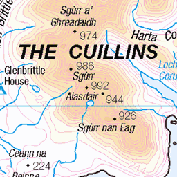
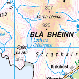
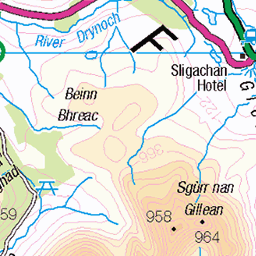
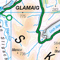
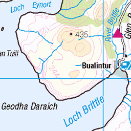
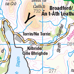
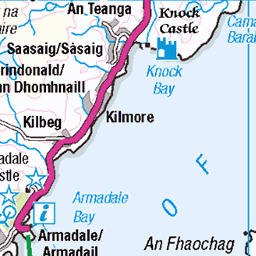
OS Map
This is OS mapping. In some areas, OpenStreetMap shows more footpaths
Spatial NI has online OSNI mapping. Click "Basemap Gallery" (4 squares icon at the top).
Now would be a good time for a cup of tea.

GPX Editor
Record map clicks
Reload map
Photos
Please tag your photos and upload them to the British and Irish Mountains group on Flickr
The other photos have been geo-tagged as on or around the summit. For less busy mountains, it can be a little hit and miss.
1278 Beinn Bhreac (Soay) b
04-Jun-11 • Dugswell2 • flickr
trigpoint vanessatrig beinnbhreacsoay p141 submarilyn hump tump sib yeaman soayskye 50319481996
1278 Beinn Bhreac (Soay)
Second island of the day on a RIB from Elgol on day of Marhofn 2011 annual meeting in Portree organised by Alan Holmes. Did Wiah first,with Rob Woodall and Bob Taylor. This was Ann Bowker's last sub Marilyn so whisky to celebrate. Name:Beinn Bhreac (Soay) Date of ascent:04/06/2011 Hill number:1278 Height:141m / 463ft Parent (Ma):none RHB Section:17B: Minginish and the Cuillin Hills County/UA:Highland (UA) Island:Soay Maritime area:Skye & surrounding islands Class:Hump, Tump (100-199m), SIB, Submarilyn, Yeaman Grid ref:NG 46214 15484 Summit feature:rock 4m N of trig point Drop:141m Col:Sea Observations:<10cm higher than trig point base
04-Jun-11 • Dugswell2 • flickr
trigpoint vanessatrig beinnbhreacsoay p141 submarilyn hump tump sib yeaman soayskye 50318811003
1278 Beinn Bhreac (Soay) a
04-Jun-11 • Dugswell2 • flickr
trigpoint vanessatrig beinnbhreacsoay p141 submarilyn hump tump sib yeaman soayskye 50319658677
Soay_Harbour
Soay Harbour and Gavin Maxwells abandoned Shark oil Factory. The old locomotive was to render down shark meat into oil. Tex Geddes, the harpoonist, owned the island by then.
uk greatbritain travel skye industry island scotland shark fishing harbour small scottish inner gb ektachrome isles rendering hebrides soay gavinmaxwell texgeddes 3825794630


Videos
None found
Notes
- Data: Database of British and Irish Hills v18.2
- Maps: We use OS mapping for England, Scotland, Wales, and the Isle of Man. Sadly, Channel Islands, Northern (OSNI) and Southern Ireland (OSI) mapping isn't available online, so we use Openstreetmap.