Hills of Britain and Ireland
OS Map of Craigeam

Islands
There were sheep kept on the foreground island, I just hope there was an easier landing stage on the other side. Hasselblad 903 swc Fuji Acros Big Stopper
07-Dec-19 • Mark Rowell • flickr
6x6 scotland lewis hasselblad hebrides swc 903 longexposure blackandwhite bw 120 film mediumformat le bigstopper 49281226747

Pot in Window
A pot in the window of a black house in Stornaway in the Outer Hebrides. Looks like the pot we used to use before toilets were invented. Otherwise known as a poe or guzunder (goes under bed) :-)
fineart blackandwhite bw pot window blackhouse outerhebrides monochrome stonehouse old ancient historic 34440977526

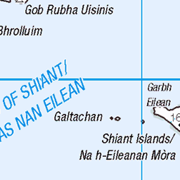
12745 Craigeam
Approaching Craigeam
14-Jun-16 • Dugswell2 • flickr
isleoflewis lochroag craigeam sib tump p40 28798728721

12745 Craigeam b
14-Jun-16 • Dugswell2 • flickr
isleoflewis lochroag craigeam sib tump p40 28259627633

12745 Craigeam c
14-Jun-16 • Dugswell2 • flickr
isleoflewis airdlaimisiadairbeacon lochroag craigeam sib tump p40 28769711162

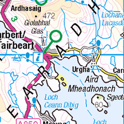
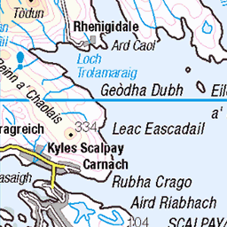
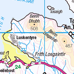
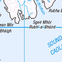
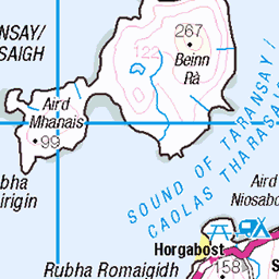
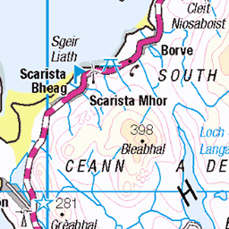
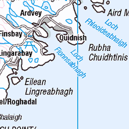
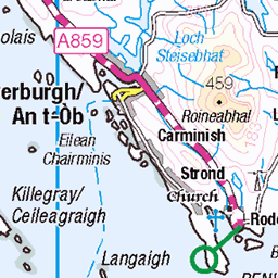
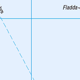
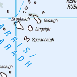
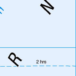
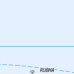
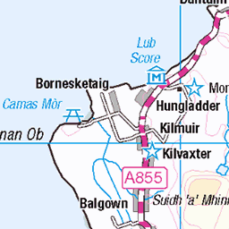
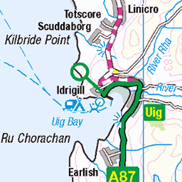
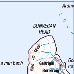
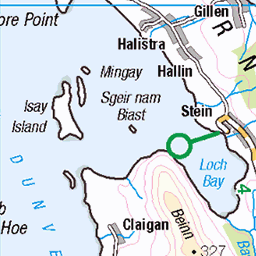
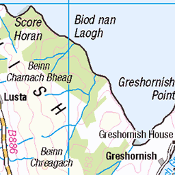
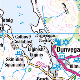
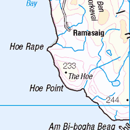
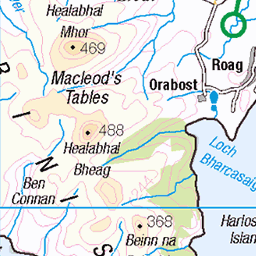
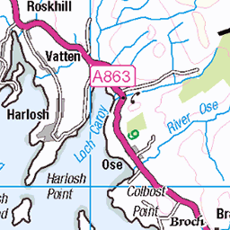
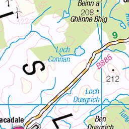
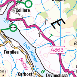
OS Map
This is OS mapping. In some areas, OpenStreetMap shows more footpaths
Spatial NI has online OSNI mapping. Click "Basemap Gallery" (4 squares icon at the top).
Now would be a good time for a cup of tea.


GPX Editor
Record map clicks
Reload map
Photos
Please tag your photos and upload them to the British and Irish Mountains group on Flickr
The other photos have been geo-tagged as on or around the summit. For less busy mountains, it can be a little hit and miss.
Islands
There were sheep kept on the foreground island, I just hope there was an easier landing stage on the other side. Hasselblad 903 swc Fuji Acros Big Stopper
07-Dec-19 • Mark Rowell • flickr
6x6 scotland lewis hasselblad hebrides swc 903 longexposure blackandwhite bw 120 film mediumformat le bigstopper 49281226747
Pot in Window
A pot in the window of a black house in Stornaway in the Outer Hebrides. Looks like the pot we used to use before toilets were invented. Otherwise known as a poe or guzunder (goes under bed) :-)
fineart blackandwhite bw pot window blackhouse outerhebrides monochrome stonehouse old ancient historic 34440977526
12745 Craigeam
Approaching Craigeam
14-Jun-16 • Dugswell2 • flickr
isleoflewis lochroag craigeam sib tump p40 28798728721
12745 Craigeam b
14-Jun-16 • Dugswell2 • flickr
isleoflewis lochroag craigeam sib tump p40 28259627633
12745 Craigeam c
14-Jun-16 • Dugswell2 • flickr
isleoflewis airdlaimisiadairbeacon lochroag craigeam sib tump p40 28769711162

2010-06-n5-6278
Image by Peter Asprey - DolphinPix. Captured 3.67 km from Carloway in Scotland United Kingdom. GPS Latitude/Longitude:58.280780/-6.806660. Copyright Peter Asprey.
06-Jun-10 • dolphinpix • flickr
scotland unitedkingdom carloway 4707307154

2010-06-n5-6279
Image by Peter Asprey - DolphinPix. Captured 3.67 km from Carloway in Scotland United Kingdom. GPS Latitude/Longitude:58.280780/-6.806680. Copyright Peter Asprey.
06-Jun-10 • dolphinpix • flickr
scotland unitedkingdom carloway 4707307818

2010-06-n5-6280
Image by Peter Asprey - DolphinPix. Captured 3.67 km from Carloway in Scotland United Kingdom. GPS Latitude/Longitude:58.280780/-6.806680. Copyright Peter Asprey.
06-Jun-10 • dolphinpix • flickr
scotland unitedkingdom carloway 4706666513

2010-06-n5-6281
Image by Peter Asprey - DolphinPix. Captured 3.67 km from Carloway in Scotland United Kingdom. GPS Latitude/Longitude:58.280780/-6.806680. Copyright Peter Asprey.
06-Jun-10 • dolphinpix • flickr
scotland unitedkingdom carloway 4706667119

2010-06-n5-6282
Image by Peter Asprey - DolphinPix. Captured 3.67 km from Carloway in Scotland United Kingdom. GPS Latitude/Longitude:58.280780/-6.806680. Copyright Peter Asprey.
06-Jun-10 • dolphinpix • flickr
scotland unitedkingdom carloway 4706667823

2010-06-n5-6284
Image by Peter Asprey - DolphinPix. Captured 3.64 km from Carloway in Scotland United Kingdom. GPS Latitude/Longitude:58.280780/-6.806230. Copyright Peter Asprey.
06-Jun-10 • dolphinpix • flickr
scotland unitedkingdom carloway 4706668195

Videos
Get your Merch: https://historywithkayleighshop.com/ Become a Channel member: ...
RIDE Cymru MCC charity motorcycle events. Five club members undertake the sub event 'Outer Hebrides Knievels' in aid of ...
Dun Carloway (Scottish Gaelic: Dùn Chàrlabhaigh) is a broch situated in the district of Carloway, on the west coast of the Isle of ...
Tour Scotland short travel video clip, with Scottish music, of traditional blackhouses on ancestry, genealogy, history visit to the ...
Notes
- Data: Database of British and Irish Hills v18.2
- Maps: We use OS mapping for England, Scotland, Wales, and the Isle of Man. Sadly, Channel Islands, Northern (OSNI) and Southern Ireland (OSI) mapping isn't available online, so we use Openstreetmap.