Hills of Britain and Ireland
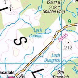
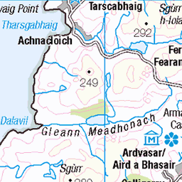
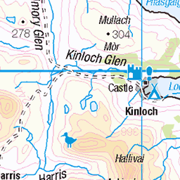
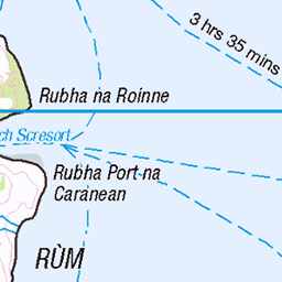
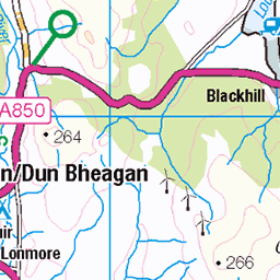
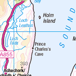
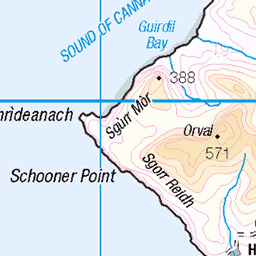
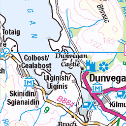
OS Map of Sgurr a' Mhadaidh

Edita on the trail into Coire a Greadaidh
Sgurr a Mhadaidh
22-May-23 • markhorrell • flickr
hillwalking britain scotland isleofskye balckcuillin sgurramhadaidh 52965461402

Ascending into Coire a Greadaidh
Sgurr a Mhadaidh
22-May-23 • markhorrell • flickr
hillwalking britain scotland isleofskye balckcuillin sgurramhadaidh 52966519423

Edita on the way to Sgurr a Mhadaidh
Sgurr a Mhadaidh
22-May-23 • markhorrell • flickr
hillwalking britain scotland isleofskye balckcuillin sgurramhadaidh 52966519443

On the rubble slopes to An Dorus
Sgurr a Mhadaidh
22-May-23 • markhorrell • flickr
hillwalking britain scotland isleofskye balckcuillin sgurramhadaidh 52966058181

View up to Sgurr a Greadaidh from the Sgurr a Mhadaidh side of An Dorus
Sgurr a Mhadaidh
22-May-23 • markhorrell • flickr
hillwalking britain scotland isleofskye balckcuillin sgurramhadaidh 52966436980

Me above An Dorus
Sgurr a Mhadaidh
22-May-23 • markhorrell • flickr
hillwalking britain scotland isleofskye balckcuillin sgurramhadaidh 52966202524
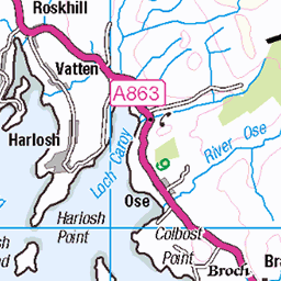
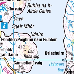
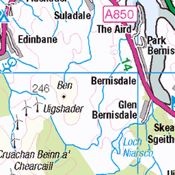
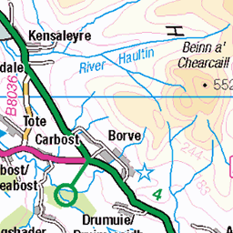
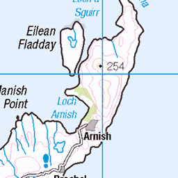
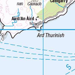
OS Map
This is OS mapping. In some areas, OpenStreetMap shows more footpaths
Spatial NI has online OSNI mapping. Click "Basemap Gallery" (4 squares icon at the top).
Now would be a good time for a cup of tea.

GPX Editor
Record map clicks
Reload map
Photos
Please tag your photos and upload them to the British and Irish Mountains group on Flickr
The other photos have been geo-tagged as on or around the summit. For less busy mountains, it can be a little hit and miss.
Edita on the trail into Coire a Greadaidh
Sgurr a Mhadaidh
22-May-23 • markhorrell • flickr
hillwalking britain scotland isleofskye balckcuillin sgurramhadaidh 52965461402
Ascending into Coire a Greadaidh
Sgurr a Mhadaidh
22-May-23 • markhorrell • flickr
hillwalking britain scotland isleofskye balckcuillin sgurramhadaidh 52966519423
Edita on the way to Sgurr a Mhadaidh
Sgurr a Mhadaidh
22-May-23 • markhorrell • flickr
hillwalking britain scotland isleofskye balckcuillin sgurramhadaidh 52966519443
On the rubble slopes to An Dorus
Sgurr a Mhadaidh
22-May-23 • markhorrell • flickr
hillwalking britain scotland isleofskye balckcuillin sgurramhadaidh 52966058181
View up to Sgurr a Greadaidh from the Sgurr a Mhadaidh side of An Dorus
Sgurr a Mhadaidh
22-May-23 • markhorrell • flickr
hillwalking britain scotland isleofskye balckcuillin sgurramhadaidh 52966436980
Me above An Dorus
Sgurr a Mhadaidh
22-May-23 • markhorrell • flickr
hillwalking britain scotland isleofskye balckcuillin sgurramhadaidh 52966202524

Edita with Loch Coruisk below
Sgurr a Mhadaidh
22-May-23 • markhorrell • flickr
hillwalking britain scotland isleofskye balckcuillin sgurramhadaidh 52966202389

Me on the main summit of Sgurr a Mhadaidh
Sgurr a Mhadaidh
22-May-23 • markhorrell • flickr
hillwalking britain scotland isleofskye balckcuillin sgurramhadaidh 52966202319

Edita, Dave and me on the summit of Sgurr a Ghreadaidh (Photo: Edita Horrell)
Sgurr na Banachdich a Sgurr a Ghreadaidh
17-Sep-20 • markhorrell • flickr
walking britain scotland blackcuillin isleofskye 53156224451

The Black Cuillin Ridge is rough, rocky and rugged but the views are simply magnificent. My fellow climber, Bob and I needed a breather on the peaks.
Commentary. Probably the finest ten-mile ridge of 1,000 metre plus mountain-climbing in the U.K. The Black Cuillin are the truncated base of a 20,000-foot plus Super-Volcano that blew its top over 60 million years ago. The force would have matched the Krakatoa explosion and sent lava over 40 miles in some directions. Today, this Gabbro igneous rock, with basalt intrusions and dykes, is a traverse, par excellence. What makes it outstanding is that it occurs on the Isle of Skye, one of the most outstanding islands in the world. Views take in expanses of over 100 miles from Sutherland to Mull, Rum and Eigg to the Outer Hebrides, Ben Nevis to Slioch and An Teallach. Bays, cliffs, beaches, headlands, peninsulas, islands mountains, glens, forests, lochs, rivers and coastline along a hundred-mile stretch of the North-West Highlands. Truly world-class, and totally awesome!
04-Aug-82 • Scotland by NJC. • flickr
54067758742
Videos
Sgùrr a' Mhadaidh and Sgùrr a' Ghreadaidh in the Black Cuillin on Skye. Solo Hike #hiking #skye #munro.
A fantastic hike of 2 Munros on the Skye Cuillins. Starting at the Youth Hostel on road to Glen Brittle, this is 9.5km hike and took ...
The Cuillin of Skye are Britain's most technically challenging mountains well known for their Alpine like majesty and their ...
Isle Of Skye,drone/cam footage if hike to Sgurr a Mhadaidh and Sgurr a Ghreadaidh Cuillin Ridge.
Sgurr Thuilm & Sgurr a Mhadaidh with Angus Macdonald,music Wild Mountain Thyme by the Silencers.
Notes
- Data: Database of British and Irish Hills v18.2
- Maps: We use OS mapping for England, Scotland, Wales, and the Isle of Man. Sadly, Channel Islands, Northern (OSNI) and Southern Ireland (OSI) mapping isn't available online, so we use Openstreetmap.